 |
| Calamity Jane at Skull Rock in the KofA National Wildlife Refuge |
Six years. It's been six years since I was in the KofA/Castle Dome Mountain area. Six years since I visited the Big Eye Mine with Bailey - and Paul! Yes - it was Paul and my second outing in April of 2014 - we had Duner and his family along, as well as Alex. But this time - it was just me and Paul - and Calamity Jane with her new shocks (Bilstein 5100) and lift (Toytec)! It was an AMAZING day!
 |
| Lewis & Clark, Calamity Jane, Alex's Jeep and Duner's FJ in April of 2014 at the entrance to the KofA |
This trip was planned sort of last minute - we had a number of destinations we were trying to go see, and had to make a choice as to where we were going to go. Because we decided to scuba dive on Saturday, we only had the one day - so we chose to go to the KofA, which is short for the King of Arizona - a group of mining claims south of Quartzite and north of Yuma on the 95. Paul and I had previously been to the Castle Dome Mountains (Big Eye Mine) in 2014, which is closer to Yuma than where we went this time - but I remember just loving the rugged looking mountains - they remind me somewhat of Red Rocks in Colorado - they jut up at odd angles, and just come rising up out of the desert like some underground hand just pushed them up and out of the Earth's crust. I love it out here. In addition - the KofA region of Arizona is one of the earliest mining areas in the entire state. It is bordered by the Colorado River, so back in the mid to late 1800's when the Colorado flowed of it's own accord and we had steamboats on the river, this area was a lucrative settlement for people. The KofA and Castle Dome Mountains are, in my opinion, some of the prettiest in the state - challenged only by the beauty of the Chiricahua's in the southeastern portion of Arizona.
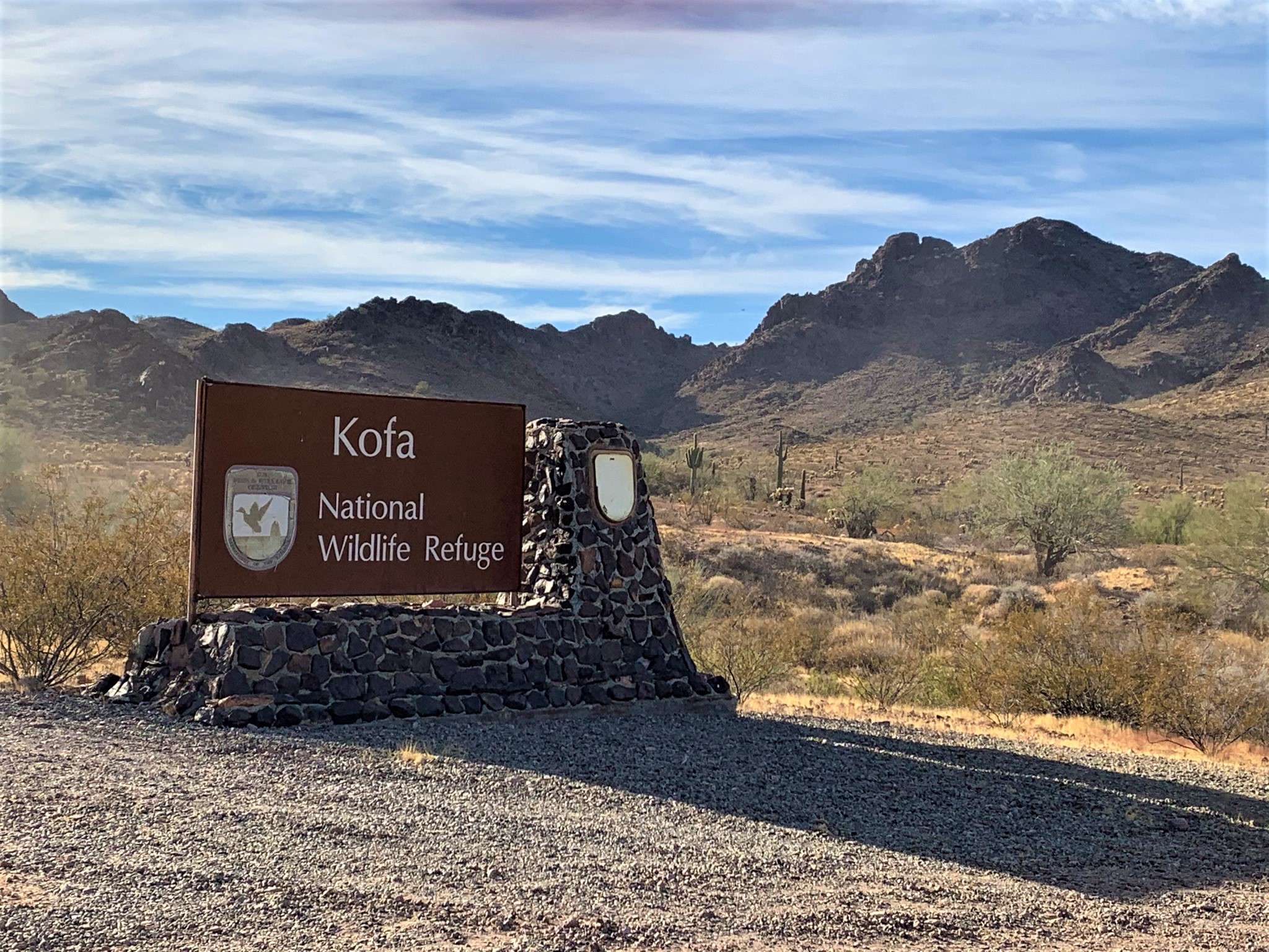 |
| KofA National Wildlife Refuge |
Our first stop was at a group of mining claims - some of which are on private property and are not accessible, some of which are on the KofA refuge. I will not be giving specifics on these mines because of the pristine condition in which a number of them remain. But wow - we started out our day strong - and it was by far one of the coolest stops we've ever made!
 |
| One of the Cabins at our first stop |
As we explored our first stop, we discovered several cabins, a workshop, a machine shop, and an amazing mill/processing building which was remarkably intact. Several engines which ran a number of different portions of the operation were found, and Paul was able to explain how almost everything worked. It was fascinating seeing how the different buildings were tied together with pulleys and following the lines we were able to figure out how things ran from the mill/processing building right down to the machine shop. We discovered a HUGE drill press, which Paul works in the below video - we were surprised that a) it was still there and b) it still worked quite well! This was also run by a belt (the belt is no longer there) powered by some of the engines in the mill/processing building.
 |
| Old flathead 6 Chrysler Industrial engine |
Paul loves to tinker - and he will dig around and explore even more than I will - he will go places I won't go - but he always knows when I'm going to regret not seeing something - so he climbed steep and rickety stairs, came back and got me, made sure I went up to see all the "things," and when we exited the main mill/processing building, he went up to look at another shed, and came back to get me because he knew I wasn't going to want to miss it - the actual mine adit. He was right - every single thing I saw just continued to amaze me! I don't think either Paul or I have been to a site so perfect since back in 2014 when we visited another amazing mining site in the middle of the state with Bailey and my brother. We spent several hours at this mining complex - and we plan to go back soon.
It always amuses me how interested Paul is in all these old workings. I'm fascinated just by the amount of stuff - but Paul is interested in how it works. When we got home from this particular trip, Paul must have spent 2 hours researching this Flathead 6 Chrysler Industrial engine - he found videos of what it would sound like, he found a marine version, and he played every single video (and made me listen to most of them! Ha). And then he spent hours researching a Servel gas refrigerator we saw up there.
 |
| O'Keefe Merritt Stove/Oven combo |
But - in true Paul and Bobbi Jo form, we had several other places to visit as well! Including the famous Skull Rock. So we left the mining district we were in, and headed back to the 95 to go up to the Queen Palm Canyon area to find Skull Rock.
 |
| Calamity Jane in front of Signal Peak |
Now Paul was the one that knew about Skull Rock - and we plan to go back. It's a VERY cool rock formation - it wasn't difficult to get to although you are in a wash for more than half the drive (so be careful if you go during a storm). Here, though, the scenery was amazing. Beyond amazing. Stunning is a better word for it. We kept stopping to take photos of the mountains. Well, and of my truck. Because hey - she has new shocks, a lift and new bump stops (all thanks to Paul). She didn't bottom out once - and the ride is so much smoother than it was. And hey - she looks awesome 3 inches taller! Paul and I both noticed a big difference in the comfort of the ride on washboard and just bouncing around. Best improvement in a long time!
 |
| Bobbi Jo at Skull Rock |
Skull Rock has been used as a camp site for years - and in fact, when you are standing inside the base of the rock itself, it smells heavily of fire - it does make some amazing photos when you have this ghostly skull with fire coming out of its mouth staring out of the dark desert at you - that will have to be another trip, however.
Behind Skull Rock is a very tall, vertical rock which is balanced on two smaller rocks - you can actually see through the area underneath that tall rock. Again - the rock formations here in KofA are just amazing! Paul and I poked around for a bit, but realizing we had other things to go see, we again headed out towards the 95 and went up to another trail...
 |
| Box Canyon on tbe way to De La Osa Well |
This next trail was a bit rougher in a few spots - but we never once hit my BudBuilt skid plates! And we bounced along for quite a long ways all while looking for the De La Osa Ranch cabin. Well - we were in for a surprise. Apparently, a watershed covering and a cabin look exactly the same to me on Google Earth. So I repeatedly said to Paul (who is driving) "who the heck puts a ranch cabin all the way out here and the road is so bad?"
Hmmm - well, we got out there and turns out it is the De La Osa WELL. Not cabin. Or ranch. Absolutely no idea how I came up with it being a ranch. Paul was mildly amused by my mistake. Mildly. But the windmill was in excellent condition, and we were originally going to go up to High Tank 8 to check out the watershed up there, but it was getting late and we had a VERY long drive out - and still more to see! So we started to head back to the 95, but then decided to change our route and head overland to the Kofa Cabin. We turned off back the road right outside the Box Canyon and headed northeast.
 |
| De La Osa Windmill |
This route was long, and while not terribly rough, there were a TON of washes as we crossed through the KofA Wildlife area on designated roads (you aren't allowed to be on roads that are not designated roads). The washes were generally the kind of washes that you "drop" down in to, and then climb out of on the other side. Lots of sand and dirt, and by this time, it is pushing 4 p.m. We wanted to be done looking at all of the "things" no later than 5, because we knew once we were done at the Kofa Cabin we had about an hour drive out, and we weren't sure the quality of the El Paso Natural Gas Company Access Road we were going to follow out.
 |
| Kofa Cabin |
The desert was beautiful, and just as we popped out of the last wash and I mentioned that GaiaGPS (our number one choice for off road mapping and navigation) showed us close, we could see the Kofa Cabin! Now the Kofa Cabin was built by the Civilian Conservation Corps ("CCC"). The CCC was made up primarily of young Native Americans from the Colorado Indian Tribes Reservation, and they built not only this cabin, but several earthen and rock reservoirs in the KofA area, including the Four Peaks Dam in the late 1930's. This cabin is exceptionally well constructed of basalt stone, and is open to the public for camping on a first come, first serve basis.
After a quick exploration of the Kofa Cabin, we head out on to the El Paso Natural Gas Company Access Road (longest road name ever) and start the long trek back out to the 95. Approximately a 25 mile drive on a graded dirt road with nothing much to see except tons and tons of gas pipeline signs, we finally exited the KofA National Wildlife Refuge, aired up Calamity Jane's tires, and headed back in to Quartzsite. It was time for some dinner, so we found a cute little cafe off the beaten path in Quartzsite - the Mountain Quail Cafe. Awesome burgers, and great service - if you get a chance - go there! Well worth it!!
We had full tummies, a full tank of gas, and a 2 hour drive home. It was dark, we were tired, but we were still so happy about our day, the findings at the mining complex, and just the fun of getting out while it's so nice in Arizona! The KofA didn't disappoint - it didn't in 2014, and it didn't in 2020. We look forward to coming back soon!
 |
| Desert Labyrinth on the way to Palm Canyon in the KofA |


