|
| Tower Mountain, Crown King, AZ |
Day 2 - SUNDAY
After a wonderful night's sleep, and being utterly lazy and laying around watching "Knowing" starring the always entertaining Nicolas Cage, we decided to go in to town for some breakfast at the Prospector Mall Smokehouse & Grill (amazing bacon, by the way! They cure it themselves and it was to die for...). We were reminded by one of the owners of the Smokehouse that the Memorial Day Parade was going to begin at noon, and, no offense to Crown King, we wanted to high tail it out of town...so around 11 a.m. we decided to head up to Tower Mountain to check out the old lookout tower. So we started climbing out of Crown King - windows down - amazing views - shelf road most of the way. Lots of side by sides and ATV's zipping down the roads at top speed - I have no idea how these people avoid accidents. It was crazy.
After a wonderful night's sleep, and being utterly lazy and laying around watching "Knowing" starring the always entertaining Nicolas Cage, we decided to go in to town for some breakfast at the Prospector Mall Smokehouse & Grill (amazing bacon, by the way! They cure it themselves and it was to die for...). We were reminded by one of the owners of the Smokehouse that the Memorial Day Parade was going to begin at noon, and, no offense to Crown King, we wanted to high tail it out of town...so around 11 a.m. we decided to head up to Tower Mountain to check out the old lookout tower. So we started climbing out of Crown King - windows down - amazing views - shelf road most of the way. Lots of side by sides and ATV's zipping down the roads at top speed - I have no idea how these people avoid accidents. It was crazy.
 |
| Collup Cemetery |
But as we turned off the shelf road and into the pines, it reminded me of Colorado driving - huge, tall pines on both sides of the road - so thick it was almost dark. As we were approaching the towers, there were plenty of "private property" and "no trespassing" signs, and then an huge field opened up to the North, and this lovely home, cabin and cemetery just appeared out of nowhere. There were clearly people home as the back door was open. The structure wasn't old - I don't know what the name of the ranch is, but I believe the Collup family owns it. Or did. But two of them appear to be buried here. It was such a peaceful and beautiful place.
 |
| Lookout Tower |
But onward we went until we drove up to the little cabin and all the towers. SO many towers, and then the tiny little lookout tower. Paul climbed the tower, but it was closed and locked. He took some photos from up top, although it was far from the tallest tower out there. But the views were magnificent - you felt like you were on top of the world! We spent a bit of time looking for a geocache that we never found, and then went down another short road towards another set of towers, but decided to turn around and head back - we had a very specific mine we were trying to get to!
 |
| Old school bus at Del Pasco |
As we drove through the pines again, and took the turn off at the Wild Flower Saddle, the road got a bit rougher - no longer an easy graded trail, but not a difficult trail either. We continued through the pine trees, ran into a few folks on their side by sides, dipped down into a wet little valley area, and came around to the turn off for the Del Pasco site. Paul and I were both really excited to see what was here. You can't see anything on Google Earth, but we've both seen pictures of the bus and other equipment left up here.
 |
| The dump truck - love those colors! Also - the clutch is still springy. Haha |
The Del Pasco did not disappoint! The bus is the first thing you see - but it's no longer yellow (which is why we can't see it clearly on Google Earth). The bus is also burned up inside. Just a shell remains. There's also an old dump truck, and a homemade trommel along with other miscellaneous old mining equipment. The old building with the boiler that was so beautifully tilting to one side has long since collapsed and is now just a pile of old wood. But this place is buried deep in pines and seems so out of place in what feels like the absolute middle of nowhere.
The Del Pasco was founded by Jackson McCrackin, James Fine, Charley Taylor and T.G. Hogle on July 4, 1970. It started as a placer mine but was further developed so as to access the 2-3 foot wide Del Pasco Vein. In the early 1870's, a 4 stamp mill was built and operated on sight by two men who acquired an interested from Hogle. The mill rarely ran at full capacity due to a lack of water, but averaged 40-50 ounces of gold every couple of days.
Jackson McCrackin was a member of the Walker Party and a member of the First Territorial Legislature. It is rumored he was not the most hygienic person, and that he was forcibly bathed and groomed by his political and mining colleagues so as to better fit the role of a proper Territorial Arizona Representative. McCrackin made his big money in later mining ventures, including the McCracken Silver Mine, a well known mine in Mojave County.
 |
| Homemade trommel at Del Pasco - and it still spins! |
By the 1880's, the Del Pasco Mine was overshadowed by the nearby Tiger Mines and Peck Mines. It continued to produce until the early 1940's when the mine owner was shipping 35 tons, or two cars, of high grade ore per month.
There has been additional testing done in the 1980's to see if there would be any value to heap-leaching, but nothing appears to have come from that.
 |
| Paul in the bus |
So there it sits - rotting away - trucks, equipment, beams, and a bus. But it's one of the oldest mines in the Bradshaw Mountains, and I was excited to have been able to see it! And in such a beautiful setting.
But on we went - to try to look at a few more mining claims, which all turned out to be gated and locked. So we slowly made our way down towards Crown King, passing tons of old mines, trucks, and some cool homes.
We pass by a cool old International Harvester work truck, and then as we get closer in to town, an old FJ40.
 |
| International Harvester Truck |
It's now roughly 1 p.m., and we had planned to take the Senator Highway up to Palace Station to stop and look around. Paul and I have both been to Palace Station a number of times, but neither of us have ever stopped to have a look. AND - the topo maps show a cemetery! We LOVE cemeteries!!!
So we arrive back in Crown King and we don't even stop - we head right out to the Senator Highway, and off we go. About 30 minutes into the trek, I offer to drive, and to my utter disbelief, Paul said yes. So he pulls over, I adjust the rear view mirror and the seat, and off we go. I'm not used to driving an automatic, so Paul walks me through how to put it in 2, 3 and 4 while in 4L. I only try to punch in the clutch once - luckily I missed the brake!
I'm getting the hang of it - and then we're driving on shelf roads. Ugh.
I'm getting the hang of it - and then we're driving on shelf roads. Ugh.
 |
| Palace Station |
Paul finds an old album in his mp3's that I used to listen to as a kid (Funnybone Favorites) - I'm absolutely shocked that he knows this album - and the other one too! We sing along to all the goofy songs having a grand old time. "I don't like spiders and snakes, and that ain't what it takes to love me, like I wanna be loved by you." Fun music, and it lightens my mood and keeps my mind off shelf roads...
Eventually we pull in to Palace Station, and we get out to look at the old cabin, which is closed. There's an old outhouse, and a new bathroom (locked), and as we wander around, Paul notices a little path heading in the direction that we think the cemetery is in.
 |
| Sign at the Palace Station Cemetery |
So we take off on foot to see what we can find. And sure enough, there is a darling little cemetery tucked away in the pines. Someone has taken great care to line the path with rocks, and to fence in the cemetery. We spent some time in the cemetery, although there are only two headstones that have writing, there is an informational sign - with far less people on it than there are crosses in the cemetery. The sign also indicates there are likely graves outside of the fence as well. Several of the known graves are of young children - as I've said before, always sad - but a grim reminder of how hard life was back then.
Palace Station was build in 1875 and was a stagecoach station and is listed on the National Register of Historic Places. In 1873, Alfred B. Spence and his wife and father-in-law left Missouri to settle here on Groom Creek. At first, they built a sawmill, but two years later decided to build the log cabin/structure that we see today. In 1877, a wagon road was surveyed into the canyon to the Senator Mine, and the Prescott to Phoenix stage line was built to carry passengers to Palace Station and then on to the Peck Mine. Travelers could stop at Palace Station, water and rest their horses, and enjoy a meal prepared by Mrs. Spence. There was one other stop on the way from Prescott to Peck Mine - and that was at the Bully Bueno, and due to this stage line, the trip from Prescott to the Peck Mine could be completed in a single day.
 |
| Palace Station Cemetery |
In 1905, Mr. Spence retired and then passed away in 1908. Mrs. Spence attempted to sell the station, but was unable to and she abandoned it and moved to Prescott, where she passed away in 1929. By 1915, newspapers were referring the Palace Station as range headquarters, and to this day it is owned and managed by the Forest Service. It has had many uses over the years, including as a place of residence for Forest Service Rangers. There is some hope that they will turn Palace Station in to one of the rental cabins that the Forest Service provides.
After walking around and enjoying the Palace Station property, Paul and I had a decision to make. Do we continue on into Prescott? Should we go try to check out the Eloise Mine and the Bodie Mine? Do we head back to Crown King where there is a live band playing at the bar?
We decide to head down the road to the Bodie Mine in hopes that we can see the Eloise Mine structures. We walk back to the truck and I start to hand Paul the keys, and he jumps in the passenger side. I guess I'm driving again - and now down a road I've never been on. This guy has WAY more faith in me than I do. We head out on what is a lovely road through a huge meadow, and then it all closes in. A little two rut road that has clearly had tons of trees fall across it, and whoever is cutting these tree trunks is cutting them JUST enough to squeeze the truck through. Then we come to it. A steep little jaunt with a rock that drops a foot or more. I just stop. Paul looks at me and says "Breathe baby, breathe - and just go." (That's our new thing - if I'm getting a little nervous, it's always "Breathe baby, breathe.") I let the truck do it's thing, and we slowly go over the little rock obstacle, pop through the small stream, and start climbing up the other side. The FJ just went - I didn't even have to do anything - except give it some gas going up the hill. It was awesome.
We get up over the hill, and the trail gets even tighter, and turns into a shelf road. But I'm okay - I have some confidence now, except that the trail keeps getting tighter and tighter. I try to avoid a big boulder - and I'm successful with the front tires, but I catch it with the back. And then we approach the turn off to the Eloise Mine, and of course, it's gated and chained. This is getting crazy - everything we want to see is gated and chained. Because I happen to know there isn't anything at the Bodie Mine except a big hole in the ground, we decide we are going to head back. But I can't turn around. So we keep going down the trail looking for a turn around point, knowing that when we finally hit the turn off for Bodie - we have a guaranteed turn around point. The trail is tight and overgrown. I'm pinstriping the heck out of the truck and I'm waiting for Paul to tell me he's driving. But he doesn't. He just keeps telling me I'm doing great. We get to a place where I can turn around, but I have to make a left turn while going down a steep embankment, straighten out, then back up over that same embankment. But hey - you know what? I did it!
 |
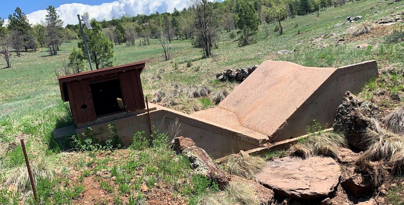
| Senator/Maxton Mill Ruins |
We head out - I didn't even flinch going over the rock obstacle. It was like I'd been doing it all my life. We get back to Palace Station, and we decide we're heading in to Prescott for dinner - I promise Paul an amazing steak and off we go. There were more buildings to see, but of course they were gated and chained. Until we got to the Senator/Maxton Mine.
 |
| Senator/Maxton Mill Ruins - Note the "open" window |
Now I've been here a bunch of times to view the Mill, and even over to the old mining ruins and to the adit (which was previously closed with a large metal door). I love this structure. It's a graffiti mess, but all the steel beams and concrete - so industrial right in the middle of this gorgeous canyon. I really wanted to get below it for photos, but that's a bit of a hike down into the creek bed, and there were already people down there, and we needed to get to Murphy's and then to Home Depot before heading back. Both Murphy's and Home Depot close at 8, and it's pushing 5 p.m. So we look around for a bit, Paul climbs up one of the posts (crazy boy), and we head back to the truck. Which I'm still driving. Shocking!
We head in to Prescott and over to Murphy's, where we are seated immediately in a cozy little booth, we order drinks, and then I ask Paul if he wants to try escargot. He's game, so I order some - and of course, it's divine - all that garlicky butter. And Paul liked it too! We both get filets, potatoes and veggies - and we eat with the appetite of people who haven't eaten in forever - until we're both stuffed and feel like we need to roll ourselves out of Murphy's. We had wonderful service and wonderful food, as always.
I drive us to Home Depot, we get the drawer latch we need for the truck, and I ask Paul if I'm driving back - he says sure. And we're going back on the Senator Highway. NOT the 89A! It's getting dark, but Paul has awesome lights on his truck, so we turn them all on while Paul watches for Sasquatch, and I watch the road. At one point we are quietly driving along and I gasp and shout "bunnies!!" at a pair of rabbits that ran across the road. I thought Paul was going to have a heart attack. Ha.
And guess what - I drove ALL THE WAY BACK TO CROWN KING. IN THE DARK. ON THE SENATOR HIGHWAY (which is not a highway, fyi - it's a back way from Prescott to Crown King on an old, rutted dirt road - which doesn't really require any off road abilities - except it was dark).
I know. I'm shocked too. Only once did I freak Paul out. I'm always the one to get nervous on shelf roads, but apparently I got a bit close and Paul got a bit nervous.
So Paul --
I know. I'm shocked too. Only once did I freak Paul out. I'm always the one to get nervous on shelf roads, but apparently I got a bit close and Paul got a bit nervous.
So Paul --
Breathe Baby, Breathe!
 |
| Senator/Maxton Mill |