My adventures on the backroads of Arizona - visiting ghosttowns, mines, cemeteries, and any other areas of interest in remote areas of Arizona and the surrounding states. In addition, we are underwater explorers, so you may occasionally see underwater explorations being posted as well! Welcome to my fantastic life! My name is Bobbi Jo Claywell, and exploring is our thing!
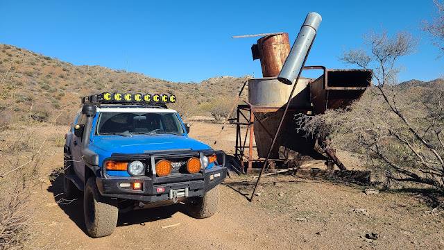
The Lewis & Clark at an unnamed mining site with the concrete pool
Neither Paul nor myself are football people. I mean, I like the commercials during the Superbowl, and sometimes that half-time shows are awesome (this one ranked high - I liked it, and I don't even like rap music), but generally speaking, there isn't much that will draw me to watching the Superbowl unless the Denver Broncos are playing (you can take the girl out of Bronco country, but you can't take the Bronco love out of the girl).
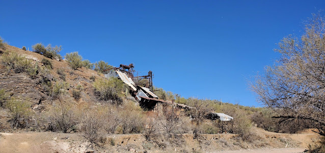
Anderson Mill from the truck
Anyway - I digress. Paul and I had a rare weekend without much to do, and decided to go up and explore the area around Anderson Mill - a place we've been to before, but we've always stopped at the Anderson Mill and have never gone further. So we got up, went to First Watch for breakfast and had amazing omelets, then we grabbed some gatorade, a few granola bars, and off we went!
The Underwood Family memorial area with one of the wells off to the right
The drive out to the trail was uneventful. The day was absolutely beautiful. I started out wearing a sweatshirt because it was 44 degrees outside in the morning, but brought a t-shirt to change in to. We turned on my bluegrass playlist and drove out to the Wickenburg Mountains at the base of the Bradshaws.
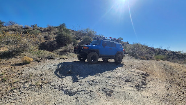
Lewis & Clark below the Climax Mine
As we turned on Castle Hot Springs Road to go north to Anderson Mill, we noted there were several dirt bikes and side by sides out and about, but not as many as one might expect on a Sunday. So we knew we would mostly have the trail to ourselves, and could enjoy exploring without being in someone else's way, or they in ours.
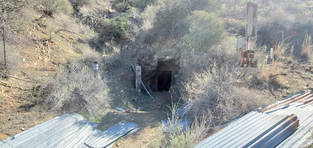
Climax Mine Adit
We turned off the Castle Hot Springs Road onto the North Mine Road. As we headed up the North Mine Road (which I didn't realize was a named road), we saw that someone had been placing "street signs" on poles with solar lights on the top along the route almost all the way up to Anderson Mill. We are thinking perhaps it was one of the mining clubs that mines in the area - there were lots of signs for a mining club and directions to their dig sites, as well as reminders that they are private property. So we drove by, enjoying the beautiful weather, windows down because there was no dust and it was a whopping 73 degrees outside - absolutely perfect outdoor weather!
Looking up at the Climax mine
We didn't get out to explore at Anderson Mill because we had planned to come back this way so I would take more pictures then, as well as find a geocache in the area. But plans don't always work out, do they? Off we went to head up the wash to find the old miner's homestead and Underwood grave/memorials.
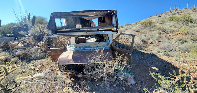
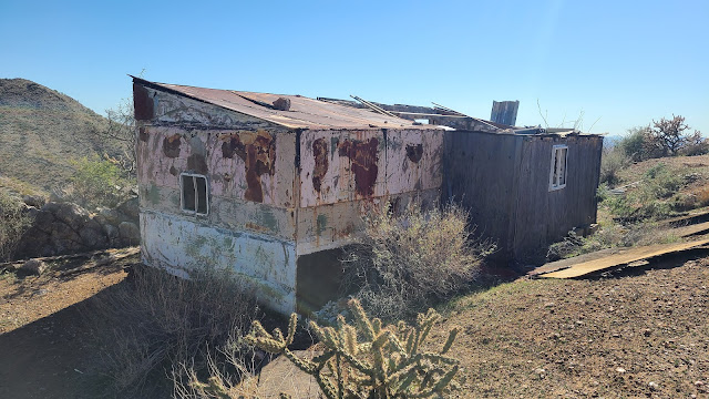
Old mobile home that has been pushed down the mountain
As we drove slowly through the San Domino Wash up towards Eddie Wash and turned the corner, the graves were very obvious. We parked the truck and walked around for a bit. There are three "graves" of people, and a fourth of a dog. According to a family friend of the Underwoods, they used to hunt deer and javelina out in the area for 50 or more years. The area where the graves of JR (Johnny Lee Roy), BJ (Bill) and JP (June Patricia) is located at their original camp site, however at some point an old miner took it over and built himself a little home there, and then the Underwood family moved up Eddie Wash to camp. This family friend states that nobody is actually buried there except the dog - they are memorials that indicate where ashes were scattered...
Front of the mobile home
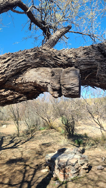
There are at least two wells - one capped, one is not and is 30+ feet deep - you wouldn't want to fall down in there - no way to get out. The old miner's cabin is up on top of the little clearing where the graves are. It appears to me that there may have been a swing on a branch here - something was tied around this branch down by one of the wells. It is very shaded here and would be a great place to have a little get away, although I'm not sure I'd want to be there during a flood.
I wonder what was tied onto this tree...a swing maybe?
After exploring the area, and still intending to come back out the way we went in, we pushed onward to look at another mine/cabin area I had found on Google Earth. I have absolutely no information about the mine we were headed to, except that when we drove up the steep ridge, we came to a nasty little washed off area that washed off down both sides into canyons on either side. Paul, in an effort to save my sanity, said we could make it, but did I really want to see this random no-name mine? I said nope. So we backed down the very steep side of the mountain back down into the wash, and went up to the next turn off to the Climax mine.
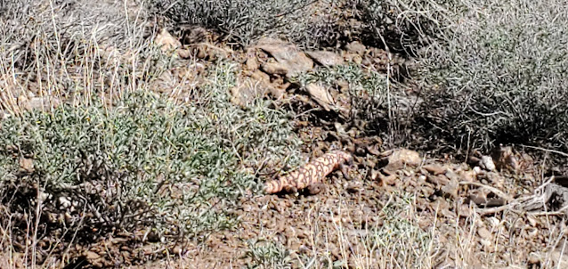
Fat Gila Monster meandering down the side of the mountain. Didn't even care about us.
The Climax mine is an old tungsten mine that doesn't appear to be worked any longer. I know that in 1942 it was being mined for Tungsten and other minerals, and in 1953, a James Kaler owned it. Mr. Kaler still owned it in 1958, but officed in Colorado. The Climax claims were also referred to as the Patchen claims, which may be a reference to the Patchin Camp that is nearby on the topographical maps (but has nothing at the site). As we pulled up to the Climax mine, we parked down in the canyon where 4 roads came together, and looked up the steep hill to where there was a toppled out-building and a TON of junk. Metal and wood and old conveyor belts lying around everywhere. As Paul hiked up the steep trail, I took pictures of the canyon and junk and then then started hollering up at the out-building at Paul so I could take pictures of him. Nothing. No sound at all. Finally, Paul pops his head out and says he had gone into the mine a few feet. I start heading back to the truck and I hear Paul talking to someone...so I haul my butt up the side of the mountain, where Paul and I met the nicest couple - Rick and Sharon. They were parked up top in their jeep and spoke to us about other mines and things to see while tootling around the Wickenburg mountains.
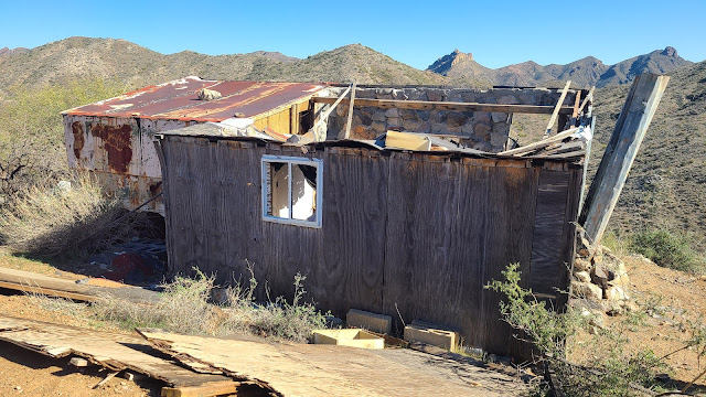
Old miner's cabin
Miner's Cabin
Our new trail friends were kind enough to offer to take us over to the no-name mine I had seen on Google Earth from a different trail, so we all piled in our vehicles and headed out to the no-name mine. On the way, the Jeep suddenly stopped when a destroyed old mobile home on the side of the mountain came in to view. We assumed he had stopped to take pictures, so we stopped to take them as well. As I finally got out of my side (Paul had parked me on the side of the mountain so I couldn't really get out of the passenger door very well), Sharon hollered "it's a gila monster." So we rushed up and caught some not-so-great pictures of our second ever gila monster in the wild. He was pretty big and very fat, and he moved slowly (as they usually do). So we watched him meander down the side of the mountain and talked about how rare it is to see one, then we climbed back in our trucks and drove the couple of hundred feet to the old miner's cabin and parking area that looked over San Domingo Wash. The miner's cabin apparently used to be in quite good shape. He had some kind of electrical hookups as he had an air conditioner, a microwave, a can opener, and other electrical items up there. The roof fell in over the last couple of years, and the old mobile home has been moved from where we parked and pushed over the side of the mountain.
Inside the miner's cabin
As we poked around, we got to talking to Rick and Sharon, and I asked about the "concrete swimming hole" I had seen just over the mountains, and they said it was very easy to get to, that the road was very good, and that we could follow the Trilby Wash out from there to the Castle Hot Springs Road. They were going to go down by the Anderson Mill, down the nasty ridge we chose not to go up, so Paul and I had to make a decision. Go back the way we came? Go down the nasty ridge? Or head out towards the "concrete swimming hole" and see what we can see.
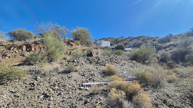
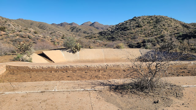
Concrete Swimming Hole - probably actually an evap pond or water source for the mine
Paul and I decided to try the concrete swimming hole and the Trilby Wash. Our new friends then told us about a cool old International Harvester TD25 that was on top of a mountain over in that area. So now we had to go!!
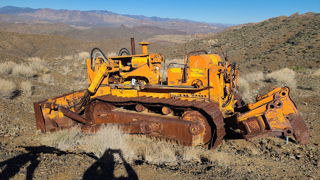
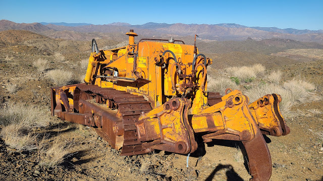
International Harvester TD-25 Crawler with ripper and blade - 48,000 pounds of iron right there!
The concrete swimming hole wasn't actually a swimming hole or pool - it appeared to be some kind of evap pond or water retention pool for the mining operation. There were other concrete pads, but clearly not building pads. There was also a hopper at the site. Not much else interesting to see there, but now I could say I've been! Then we were off to see the old crawler on the top of the mountain. We had good directions regarding heading that way, and we found it without any trouble, and I just fell in love with it! Paul bought me an old TD24 Crawler for my office some time ago, and this is a TD25 - a crawler with a ripper on the back and a dozer blade on the front. It's been up there for some time as it has been pillaged and plundered by all the idiots that like to steal stuff and shoot at things, but it was really cool to see up close how big they really are. I believe Paul said after the fact that they weight close to 48,000 pounds!!
International Harvester TD-25 with an ATECO ripper
The trek out Trilby Wash was uneventful but beautiful. We went past several springs and seeps that were flowing, and the canyons were green and beautiful. It was a gorgeous day with the perfect temperature, new friends, and of course, me and my guy out bouncing around on old mining roads trying to discover what there is to discover...in Arizona!
Road to Dupont Cabin - the clouds were perfect today - and made for gorgeous pictures
Summer is almost over, I've taken my daughter back for her freshman year at college, and I'm a bit stir crazy. So Paul and I decide to take the Lewis & Clark and head out for a two night camping trip. It took us about a week to finally decide on where to go - but we chose an area of the State that I have not been to much, and two cabins that Paul had visited, and a third that we almost didn't go to - but were glad when we did (and neither of us had been to it before).
PB Cabin in the Sierra Ancha/Tonto National Forest
So off we head towards the Sierra Ancha Wilderness for some "in the pines" tent camping (no Expedition Trailer this time) and some rest and relaxation (read here - no phones, no internet, nothing but nature). I left work early, got home, and we tied down the boxes to the top of the Lewis & Clark, and we headed out towards Globe.
Meadow at the PB Cabin where the original cabin used to be
The Sierra Ancha Wilderness was first established in 1933 as a "primitive area" with gorgeous box canyons, high cliffs, pine covered mountains, and some stunning cliff dwellings if one is fit enough to scramble up to them (which we currently are not). We planned our first night stay at the PB Cabin (info to follow) and had no set plans for the second night.
PB Creek
As we meandered up and through Superior to Globe, AZ, we decided to make one last stop for food, and stopped at the Burger House, which was extremely busy with a boy scout troop heading somewhere, and a number of locals just coming in for the good food. We got our burgers, ate, and then jumped back in the truck to top off and get on our way. We headed North on the 188, and just before we hit Roosevelt Lake, we headed northeast on the 288 towards Young, AZ. The 288 Globe/Young Road is sometimes paved, and sometimes just graded dirt - but it is a small highway - and as it was already dark, we carefully wound our way up almost to Young, but turned off onto the Cherry Creek Road. The Cherry Creek Road is a 40 mile dirt road which is now mostly only passable to 4 wheel drive, high clearance vehicles. It has been rumored as of late that the road will not be fixed going forward - and therefore, will no longer be considered a scenic road. For the short 4 miles we drove on it, it was definitely high clearance, although 4 wheel drive was probably not necessary if you stayed on the road. Once we turned off to PB Cabin, however, 4 wheel drive, locking diff and a-trac were a must if you wanted to drive all the way to the cabin (the PB Creek is heavily eroded from all the flooding and unstable at the crossing).
It's always fun to drive down roads that I've never been on, and Paul doesn't remember well, while in the dark. Especially while looking for a cabin turn off that we did not have marked correctly. Crossing the PB Creek was scary - so much so that I got out of the truck - I was sure it was going to roll - but Paul let it slowly sink down (very, VERY loose dirt, poorly stacked rocks, and a HUGE mess of erosion). BUT - we made it! We made a note to ourselves to record our treks the following day so we had appropriate GaiaGPS routes for the future, and we quickly set up our tent and went to bed. I wasn't feeling 100% after the long drive, and slept poorly, although the sound of the PB Creek next to us along with the rustling of the pines above us was relaxing, and I did finally fall asleep close to morning. One of the wonderful things about this particular trip - because it wasn't freezing cold outside, and because it wasn't raining, or snowing, we left the fly off the Marmot tent - we could see the stars and the moon, and it was nice and cool all evening as though we were sleeping outside - but without any bug problems (lots of bugs this time of year - particularly mosquitos - so we didn't want to just sleep in the open air).
View from the tent
Paul let me sleep for a bit - but we were still up early, wandering around, exploring the area. There is obvious flood damage in the area from, I assume, the massive monsoons we have had this past summer - the flooding of the PB Creek went up and under the cabin itself-the foundational blocks are covered in branches and other flooded river debris - there are HUGE trees that were downed, ripped downriver, and are wrapped around other still-standing massive hulking trees! We were surprised that the outhouse wasn't destroyed as the floodwaters reached up as high (and higher) than the outhouse as well. But the cabin itself looked to be in very good shape. It was clean with a few canned goods on the shelves, a propane stove which was usable last time that Paul was here (May of 2020) although it was missing the hoses. We signed the log book, and made our way over to the meadow which was covered in wild grasses at least 3 foot tall. You could barely make out the original Cabin structure.
Breakfast on the front porch of the PB Cabin
My information on the history of the PB Cabin was extremely limited, but there was a sign inside the cabin with a bit of history. There were apparently two "old timers" named Pendleton and Barkley (ie - "PB"). They ran 200 head of cattle in a partnership and built the original cabin (not the one in these pictures) around 1898. In 1910, Pendleton and Barkley sold out to a neighboring ranch called the Cherry Creek Ranch. The old cabin was then used as a line cabin until 1950 when the current cabin was built by miners who were mining down on the creek. The Cherry Creek Ranch (still in operation today) still uses the cabin, but they allow USFS personnel, nature enthusiasts, hikers, hunters, etc to use the cabin. People have taken remarkably good care of the PB Cabin - and in case anyone is wondering, they do state that they don't mind if you carve your name or initials on the cabin porch, as they feel it is tradition, but they ask that you not carve anything into the surrounding trees.
PB Cabin History
Inside the PB Cabin - the old propane run stove, a telephone and years of log books
We made our usual eggs and bacon breakfast (which I've recently started topping with avocado - which makes it even more delicious - well, for me anyway - Paul doesn't like avocados. He's weird), took down the tent, packed everything up, and decided to head out. By this time it was after 9 a.m. as we'd been lazing around all morning - but not a soul was in sight, and the creek was babbling away and there was a slight breeze in the trees. The PB Cabin was a magical place, and I cannot wait to go again!
PB Cabin and Lewis & Clark
Lewis & Clark getting ready to cross the gnarly PB Creek
I'm still not feeling 100%, although I didn't know why - but we decided to head over to the Dupont Cabin anyway. We weren't sure where we would end up for the night, but Paul had mentioned that he knew of a beautiful overlook that we could camp at if we wanted to, so that was the vague plan depending on how things went at the Dupont Cabin. The day was beautiful - light clouds, but sunny and not too terribly hot. So off we went back up out of the canyon and back up to the 288 road, where we would catch a forest road to head over to the Dupont Cabin.
Along the way, we stopped to check out some construction equipment - Paul has always loved construction equipment, and I have a newfound appreciation and interest in it as I'm now the office manager for a local construction company. So it's always fun to find old equipment and be able to recognize some of it!
Dupont Cabin
A Caterpillar D4D Dozer left in the middle of a field on the way to Dupont
The trek down to Dupont Cabin was uneventful, and the Cabin was interesting, but not as exciting as the PB Cabin was. I have found little to no information about the Dupont Cabin except that it was built some 100 or so years ago by some old miner (Dupont?) and for as far back as the Tonto National Forest knows, it has been an emergency shelter. We didn't stay long - we had thought about taking the old Dupont Tank road and jeep trail around buck peak and over to the JR Ranch, but we quickly decided not to as we were clearly driving down an old jeep road that had been rutted out and was now filled with very loose "baby heads" - round rocks about 5-10 inches round that make everything unstable. I still wasn't feeling great, so we chose to go back the way we came out and go find a camping spot and literally do nothing for the afternoon.
Stunning views overlooking Cherry Creek Road
We drove back up to FR609 and headed back to the 288, then went down to Reynolds Creek, where we drove down the road for a bit, then turned off and headed in on another old forest road. We passed an older gentleman in another FJ Cruiser - he seemed shocked to see us out there, but we waved and went on - and then we came to the end. A glorious and stunning overlook into the Devil's Chasm area of Cherry Creek Road and canyon. Luckily, while the canyon wall was steep and not one I'd like to accidentally fall over, there were several "steps" of rocks which allowed me to get close without feeling any sort of fear of the height.
My view from my chair - relaxing
We decided to set up camp right there - sure that others would be coming along soon because it was one of the best and most beautiful camp sites I had ever seen. But nobody - not one single soul - came along that road all afternoon, evening, night or the next morning. We set up our reclining chairs, our tent (with the fly off again - it was just so gorgeous out), and I climbed in the tent to lay down for a few minutes. Those few minutes turned into a couple hour nap - which I needed.
Early morning sunrise view from the tent
As the air cooled down and the sunset turned the canyon gorgeous colors, we made our usual dinner of steak and stuffed mushrooms (always so amazing while out camping!), and then we just sat by our small fire enjoying the cool air. All afternoon it was dead silent at the camp ground, which was a bit creepy, but after the sun went down, the insects started making noise and we watched as the bats flew around clicking with their echo location and swooping down to grab a bug.
The Sunrise over the Cherry Creek Road and Canyon
We went to bed in the nice and cool weather and woke up refreshed the next morning to an absolutely stunning sunrise over the cliffs of Cherry Creek Canyon. I finally felt much better and was ready for a little exploring on Sunday morning. I made a wonderful breakfast for us, and we packed up camp. We explored a few little areas here and there, and we discussed whether or not we wanted to try to go to the old Asbestos Mine (last we had heard, the trail was extremely rough), but we agreed we didn't want to do any rock crawling today and wanted to take it easy.
Early morning views
Right...our curiosity had other plans...
The "Angel's Wings" - the tailing piles from the asbestos mine - the "Wings" can be seen for miles and miles
The last place I had wanted to explore was an old cabin tucked up in the Sierra Ancha, but only accessible via 4x4 from the South or hiking in from the northeast. When we first turned off to head to the Boyer Cabin, we didn't know what to expect, but the road was long, straight and while it was somewhat washboard, it wasn't horrible. We aired down the tires and off we went.
Tucker Box Canyon at the bottom
Then came the Tucker Box. I was absolutely not prepared for the Tucker Box, and when we first rounded the corner to start descending the loose, steep trail into the box canyon and up the other side, I told Paul we hadn't signed on for this today and we could turn around. I'm telling him all this, but he's still moving forward. Now we are half way down and I'm holding on for dear life and hyperventilating. We are sliding all over the place and I'm just hoping we don't slide over the edge of the canyon. Paul is just crawling along like nothing is going on. I keep telling him we won't be able to get back up the other side, or even out of the box canyon once we are at the bottom. He told me we HAD to get out, and to just trust the truck and trust him (okay Paul...okay...maybe).
Our first glimpse of Boyer Cabin
So we descended a couple hundred feet in one small switchback and a very steep, very loose slate road, and made it to the bottom. Which was absolutely gorgeous. But then we had to go back up the other side with a similar road taking us up and out of the box canyon. With our rear diff and a-trac on, we slipped and slid up the other side, both of us leaning forward to compensate for the steep incline. We couldn't see the road in front of us for the first 10 feet or so, so we were both semi-hanging out of the windows and I was praying really hard...praying that we would be able to get back out.
Inside the main house at Boyer Cabin
The rest of the road was really rough - but only because it was all rocks and stair stepping. For the first time in either me or Paul's life, we saw two cattle guards that actually had ramps attached due to the erosion that has clearly happened over the years. These old roads are still used...there are cattle tanks everywhere, and miles and miles of beautiful grazing land. The grass was tall due to all the rain, and there were flowers everywhere. There were roads on the map that we could see no trails for - but we could see gates - that's how overgrown the grass is out there. But it was beautiful. We continued to bounce along, getting closer and closer - Paul with a very determined "we've gone this far - we aren't turning back now" look on his face. Despite the scary shelf road (which was thankfully short) and the constant jolting from the rough road, I was enjoying today and the scenery.
Boyer Cabin Complex
And then we pulled up to the Boyer Cabin. What an amazing gem in the middle of nowhere. A cabin, an open barn, an old generator shanty and an old workshop/bunkhouse. All in amazing shape, and all clearly still being used on occasion. The history that I have on the Boyer Cabin begins in 1891 which is when Joseph Boyer registered his official cattle brand in Globe. The Boyer Cabin Complex as it was known then was the site of the Boyer Ranch - a large working ranch. The cabin has a stove/oven, old beds (in a separate bedroom no less!), and at one time had some kind of electricity, which Paul surmised was powered by a generator as there is no sign of any electric coming in from anywhere. Apparently the history of the cabin may go back even earlies to 1886 as it is said that old Joseph Boyer was around when the Pleasant Valley War begin (cattlemen vs sheepherders - also known as the Graham-Tewksbury Feud).
Inside the bunkhouse/shop
The Boyer Cabin is in amazing condition - and I hope it stays that way. I found the Boyer Cabin on Google Earth from sheer determination and research after seeing pictures of it that some folks on a side by side took. If you want to go and you have the equipment, it's not hard to find. I do not recommend attempting to make this trip if you don't have lockers, traction control, really good off-road tires, skid plates and high clearance. It is worth the trip, but will jar the heck out of you, and will damage your undercarriage if you aren't careful and are not equipped. Do not go alone, and take LOTS of water. It's a VERY long walk to get out if you break down. It was a beautiful setting, however, and even though we had agreed not to rock crawl on that day, we also agreed it was worth the challenge.
The road goes on past Boyer, but quickly becomes a hiking or horse trail.
And then - we had to leave. And go through the Tucker Box again. I knew we would make it out - so this time I video'd the little excursion. The video doesn't do the steepness justice. But it gives you an idea of what you are facing if you choose to head that way.
So out we went, successfully I might add (thank you Paul - and Lewis & Clark). I wanted to show Paul the Roosevelt Dam, which he found fascinating, and then back in to Globe we went to fuel up and head home after a long day on the trail. Construction on the Roosevelt Dam was started in 1903 and finished in 1911. At the time, it was the world's highest masonry dam at 280 feet with a length of 723 feet. It cost $10 million at the time to build. In 1989 they decided to renovate the dam to keep it safe - the renovations cost $430 million. The Roosevelt Dam is considered to have contributed more to the the settlement of Arizona than any other Dam in or around Arizona.
Theodore Roosevelt Dam - I was privileged enough to see it before the concrete covering was put on in the early 90's
There is so much to still explore in the Sierra Ancha Wilderness. It is wild and rugged terrain - and an area of Arizona I've not frequented in the past - I foresee many more camping/exploring trips that way as there is still much to see! But this weekend - we saw 3 historic cabins, and had a most spectacular view over the canyons! What a beautiful way to spend a weekend...just me, my best guy, and one of our trucks. Hardly another soul in sight.
A picture Paul snuck on my phone at Boyer Cabin...there's even love out there in them 'thar hills.
Lewis & Clark and Calamity Jane at the Frey Marcos de Niza Monument Outside Lochiel, AZ
Well we have the itch to go camping - to get out of the house, away from people, the tv, the computers and phones - but it's still summer here in Arizona - which means hot. And it's August - which means hot AND humid! But the annual Monsoon Duner Memorial Border Run was happening the first weekend of August, and I had never been, so as a tribute to Paul's best friend and someone I highly respected, Duner (Mike Schuette), we decided to go and hoped for the best with regards to comfortable sleeping. We took both trucks this time because it was an AZFJ gathering, and we towed the camping trailer to sleep in.
The AZFJ group heading out from camp at Gardner's Canyon
We had been planning to take both trucks, hit up Nogales to pick up medications for my daughter before she heads to college, then head back up towards Sonoita near where our campsite was. But at the last minute, due to what we perceived would be parking issues with a trailer, we chose to head to the campsite first, dropped off the Lewis & Clark and the Expedition (the trailer) and we took Calamity Jane to Nogales.
A row of FJ booty...totally hawt! You KNOW there's junk in those trunks!
As we pulled in to Gardner Canyon dispersed campsite number 5, we met Jimbolio, who was our trail run leader. Also at the campsite already was CrazyJohn, who we met for the first time - he was our camp host - he had a huge RV and an ATV, but he did not go on the run with us. He hung around camp and watched everyone's stuff while we galivanted around southern Arizona for an entire day. CrazyJohn is also the gentleman who fabricated my friend VaderGirl's current mods on Vader.
Some of the FJ's (and a 4Runner) at the border
We quickly found a great camp location under a huge tree, and we dropped off Lewis & Clark and the Expedition and off we went to Mexico. The weather was VERY nice, and it appeared we were going to get some rain. And of course we did. Just as we parked Calamity Jane and headed to walk across the border. Thankfully, it was quick and easy as there are pharmacies right inside the gates, and the place I usually go was open and we were in and out with an entire years worth of meds for $200 (I would have paid $3,480.00 if I had used my insurance in Phoenix). Meanwhile, its pouring rain, and I kept warning Paul that the sewer system on the Mexico side of Nogales is seriously lacking and to watch out for puddles, and we needed to get back across the border to higher ground before we had a flash flood that washed through Nogales/Mexico. As we head back out to get in line to cross back to the USA, Paul noticed the water bubbling up and out of the sewer covers. The flooding was starting and having been in Nogales/Mexico after a big monsoon, the last thing I wanted to do was get hit with a deep water trudge back across the border. So we rushed to the border crossing, and for the first time in my entire 30+ years of going to Nogales, there was NO WAIT to cross back over. The border patrol agents were hilarious and were extremely pleasant to deal with, and just like that, we were in and out of Mexico in less than 30 minutes, WITH our purchases!
Paul at the Patagonia Marshall's Office - which is closed.
We quickly made our way back up to where we parked Calamity Jane and we took off to head back to the campsite. We noted all the canals and gullies were quickly filling up with water, and the Santa Cruz river was flowing/flooding. As we headed North back towards camp, the rain let up, and we were left with a warm, sticky and humid evening. If any rain had hit the campsite, you couldn't tell. Dry as a bone. But we got back before dark, and we made dinner (nachos!), and chatted with the other campers as they showed up. Then it was movie night! Jimbolio brings a computer, a projector, a "screen" and a little generator and we all gather around and watch a movie. Dust to Glory was the movie about the Baja 1000. It was interesting, but I got chilled towards the end and was tired. So after it was over, we headed back to our little camp spot and crawled in the Expedition to get some sleep. Now, it's still warmish and muggy - and then throw me AND Paul into a twin size sleeping arrangement, and it's not the most comfortable of evenings. There were a TON of bugs out, so we closed up all the windows that did not have screens, but that left for poor air circulation, even with the fan, so towards morning, we opened it all up and blew the fan across the back of the trailer, which kept out the bugs, and let the cool air in. Slept like babies for a few hours after that...
Calamity Jane and Lewis & Clark in Patagonia
We woke up on Saturday morning, not quite refreshed, but somewhat refreshed. I made bacon, eggs, and pancakes. Mr. Spock, Jimbolio's fun little pup came over to investigate. He will do tricks for bacon, so he got some really tasty applewood smoked thick cut bacon for doing tricks. We were instant friends after that.
And we took over part of the parking area in Patagonia.
We then cleaned up camp, and then the rest of the FJs started showing up for the Border Run. We had 14 trucks, I believe, on this run. 10 of which were FJ Cruisers! We also had a Jeep, a F-150, a 4 Runner and of course Jimbolio's Lexus GX470, also known as The Phoenix (it rose from the ashes of Precious, his FJ, whose bumper and roof rack are now on Calamity Jane). And off we were to explore southern Arizona and go see if we could get close to the border!
More of the trucks going on the run at Gardner Canyon
Our first stop was in Patagonia - I understand this is a normal stop for the AZFJ group - there is a bathroom there and ample space to park on an early Saturday morning. This is also the turn off on to the Harshaw Road. So we lined up the trucks all along the main drag in Patagonia for the obligatory pictures and bathroom breaks - then off we went down the Harshaw Road. After a short drive, we left the main Harshaw Road and headed up Harshaw Creek Road (which is a shorter bypass to the Harshaw Road). It was a stunning day for driving through the old Ghosttown trails of Patagonia - several small and muddy water crossings - and EVERYTHING was green! SO GREEN!!We stopped several times for bathroom breaks and to take pictures - and to let everyone catch up. It was so incredibly beautiful and green that everyone kept stopping to take pictures so our little group got very spread out...
First stop along Harshaw Road - so green!
Guajolote Flats - we went from the top to the bottom in just over a mile.
Guajolote Flats - looking back up the mountain
We stopped for lunch on the Guajolote Flat Road before the big "downhill on the switchbacks in 4L" portion of Guajolote Flats. This portion of the trail gave me some anxiety - steep shelf road which required both high clearance AND 4L in my manual (otherwise I'll burn up the clutch and brakes riding riding them). I'm driving alone in Calamity Jane with Paul and the Lewis & Clark in front of me. Paul keeps reassuring me over the HAM radio, but I can't talk back with I need both hands to drive and shift. About 1/3 of the way down I get the hang of using 1st gear (which is a granny gear in 4L for Calamity Jane) to engine brake and got more confident about what I was doing. Was I slower than Paul? Sure - but I made it, and by myself without anything except Paul telling me over the radio that I was doing awesome. As I pull up to the group at the bottom and look back up at what I had just come down, I spotted a truck that had gone over the edge. Couldn't even get a very good picture of it.
The Sonoran Desert at its finest - the Octotillo were full and green, and the wildflowers were awesome!
After we all got down off of the Guajolote Flat Road switchbacks, we started heading towards the border. First stop - about 700 feet from the border, Jimbolio had found this cool little watering hole and cabin. I know absolutely nothing about this cabin and watering hole except it is a named place on the topographical maps. I can find no history whatsoever on the internet. Sierra Tordilla Well. It was a beautiful little area - the perfect place for a little cabin. I suspect the cabin is being used as a shelter for border crossers as there is a confirmed water source and there is no real fence at the US/Mexico border just 700 feet away (possibly a small barbed wire farm fence...but nothing discernable on Google Earth.
Wall building resources - note the small wire fence where they tore up the other fence
Me and Paul - at the wall's end...
Paul and the Lewis & Clark at the border
Bobbi and Calamity Jane at the border
We poked around this area for a bit, then headed back up to the road that we would take to the border. We drove around Piedragosa Tanks and went straight down to the place they quit working on "The Wall." The Wall was stopped at the Grant Boundary just south of Kino Springs. It was clear they intended on continuing, but it was stopped on at the Private Property line, and then the building of the wall was ended by our current administration. The old steel criss-cross border wall had been yanked up for some length and nothing was left but a wire fence. Not even barbed wire. And lots of supplies to continue building the wall.
The old fence iron piled up...
No real fence/wall, so to speak, for as far as the eye can see.
It was an interesting stop, and we had officially made it to the border. Lots of pictures were taken, lots of investigating of the parts of the wall, and lots of jokes were made...but - we still had a long drive ahead of us to get to Sierra Vista for dinner. We left the border and headed back up to Duquesne Rd. We flew past Washington Camp and then past Duquesne. I've been to both places, as well as Harshaw, many times - and we didn't have time to stop so it's good that both Paul and I had been before.
Paul leaving the border fence - look at the wildflower bloom!
We hit Lochiel for some pictures - Lochiel is the place that it is said that Fray Marcos de Niza first came west of the Rocky Mountains on April 12, 1539. The town itself is private property, and the border crossing has been closed since, I believe, 1983. In my previous visits to Lochiel, you could go up to the gate, but a fence has been put across the road going in to town - now that there is no border crossing, there is no reason to let outsiders into the town...
San Rafael Ranch - barn buildings
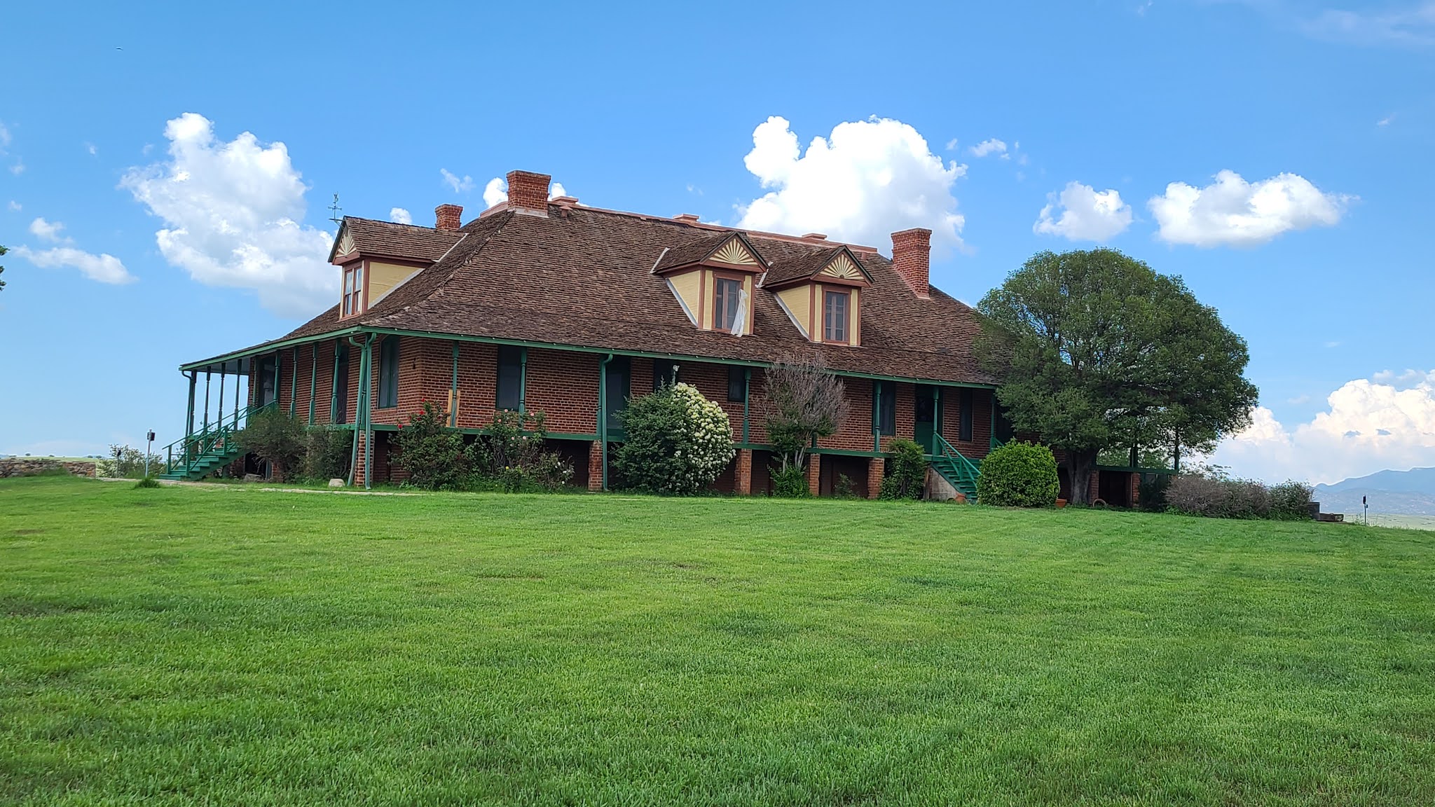
The Greene Ranch House - as seen in the opening scenes of McLintock
Storm blowing in over Mexico and a line of gorgeous FJ's!
And then we were off again - there had been some discussions about the "John Wayne Ranch" - also known as the San Rafael Ranch (fka the Greene Ranch). Once can see from the main road that the house is a stunning two story large farm house, with several barns and other outbuildings. The road going up to the Ranch has always been closed and locked each time I've gone through here, as well as others from our group. But today it was open! So up we went.
The storm over Mexico - looking southwest on Montezuma Pass
It was absolutely stunning with the green grass which had been freshly cut and storms brewing south of us in Mexico. The ranch was never actually owned by John Wayne, but part of the movie McLintock, which John Wayne starred in. In addition, scenes for Oklahoma! were filmed there (this tied in to a later trip we took across the US - blog on that to come later). The gorgeous ranch house was built in 1900 by the Greene family, who were a ranching dynasty in their own right - see The Greene Cattle Company Collection for more information. It is now part of the San Rafael State Natural Area, and has a local caretaker. The property is being meticulously managed and cared for, and it like stepping back in time.
Our babies at Montezuma Pass - spattered with dust and mud and looking truly bad ass!
By this time, everyone is getting a bit tired and we still have to go up and over Montezuma Pass to get to Sierra Vista. So we head off towards the Huachuca Mountains and up to Montezuma Pass. There is a big nasty storm brewing to the South in Mexico, but it missed us completely - when we stopped at Montezuma Pass to regroup, it was nice and cool. One of our group (@airconditionednightmare) was having some issues and had to limp down the other side into Sierra Vista. Paul and I took off to follow everyone down in a massive hurry to make it to the German restaurant - but I was tired and the switchbacks and steep drop offs got the better of me. There was two way traffic, so I took it very slow - and it took a bit longer to get to the bottom for me, so Paul and I decided to head back to Sonoita and have a steak at the steakhouse there. We finished our delicious mesquite grilled steaks and went back to camp, where we zonked out.
Calamity Jane in her element!
All in all, it was a successful Border Run. Lots to see, and of course the desert bloom this year was amazing! All the crazy clouds made for some beautiful pictures and now I can say that I've done one of the AZFJ border runs! There is more that we did on Sunday on our way out, but I will save that for another blog entry!