 |
| The Lewis & Clark at an unnamed mining site with the concrete pool |
Neither Paul nor myself are football people. I mean, I like the commercials during the Superbowl, and sometimes that half-time shows are awesome (this one ranked high - I liked it, and I don't even like rap music), but generally speaking, there isn't much that will draw me to watching the Superbowl unless the Denver Broncos are playing (you can take the girl out of Bronco country, but you can't take the Bronco love out of the girl).
 |
| Anderson Mill from the truck |
Anyway - I digress. Paul and I had a rare weekend without much to do, and decided to go up and explore the area around Anderson Mill - a place we've been to before, but we've always stopped at the Anderson Mill and have never gone further. So we got up, went to First Watch for breakfast and had amazing omelets, then we grabbed some gatorade, a few granola bars, and off we went!
 |
| The Underwood Family memorial area with one of the wells off to the right |
The drive out to the trail was uneventful. The day was absolutely beautiful. I started out wearing a sweatshirt because it was 44 degrees outside in the morning, but brought a t-shirt to change in to. We turned on my bluegrass playlist and drove out to the Wickenburg Mountains at the base of the Bradshaws.
 |
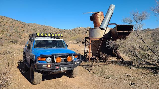
| Lewis & Clark below the Climax Mine |
As we turned on Castle Hot Springs Road to go north to Anderson Mill, we noted there were several dirt bikes and side by sides out and about, but not as many as one might expect on a Sunday. So we knew we would mostly have the trail to ourselves, and could enjoy exploring without being in someone else's way, or they in ours.
 |
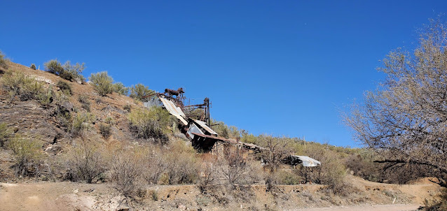
| Climax Mine Adit |
We turned off the Castle Hot Springs Road onto the North Mine Road. As we headed up the North Mine Road (which I didn't realize was a named road), we saw that someone had been placing "street signs" on poles with solar lights on the top along the route almost all the way up to Anderson Mill. We are thinking perhaps it was one of the mining clubs that mines in the area - there were lots of signs for a mining club and directions to their dig sites, as well as reminders that they are private property. So we drove by, enjoying the beautiful weather, windows down because there was no dust and it was a whopping 73 degrees outside - absolutely perfect outdoor weather!
 |
| Looking up at the Climax mine |
We didn't get out to explore at Anderson Mill because we had planned to come back this way so I would take more pictures then, as well as find a geocache in the area. But plans don't always work out, do they? Off we went to head up the wash to find the old miner's homestead and Underwood grave/memorials.
 |
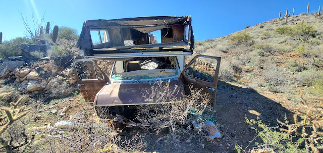
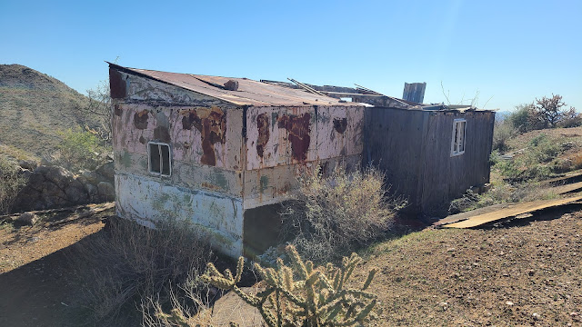
| Old mobile home that has been pushed down the mountain |
As we drove slowly through the San Domino Wash up towards Eddie Wash and turned the corner, the graves were very obvious. We parked the truck and walked around for a bit. There are three "graves" of people, and a fourth of a dog. According to a family friend of the Underwoods, they used to hunt deer and javelina out in the area for 50 or more years. The area where the graves of JR (Johnny Lee Roy), BJ (Bill) and JP (June Patricia) is located at their original camp site, however at some point an old miner took it over and built himself a little home there, and then the Underwood family moved up Eddie Wash to camp. This family friend states that nobody is actually buried there except the dog - they are memorials that indicate where ashes were scattered...
 |
| Front of the mobile home |
There are at least two wells - one capped, one is not and is 30+ feet deep - you wouldn't want to fall down in there - no way to get out. The old miner's cabin is up on top of the little clearing where the graves are. It appears to me that there may have been a swing on a branch here - something was tied around this branch down by one of the wells. It is very shaded here and would be a great place to have a little get away, although I'm not sure I'd want to be there during a flood.
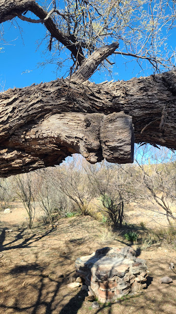 |
| I wonder what was tied onto this tree...a swing maybe? |
After exploring the area, and still intending to come back out the way we went in, we pushed onward to look at another mine/cabin area I had found on Google Earth. I have absolutely no information about the mine we were headed to, except that when we drove up the steep ridge, we came to a nasty little washed off area that washed off down both sides into canyons on either side. Paul, in an effort to save my sanity, said we could make it, but did I really want to see this random no-name mine? I said nope. So we backed down the very steep side of the mountain back down into the wash, and went up to the next turn off to the Climax mine.
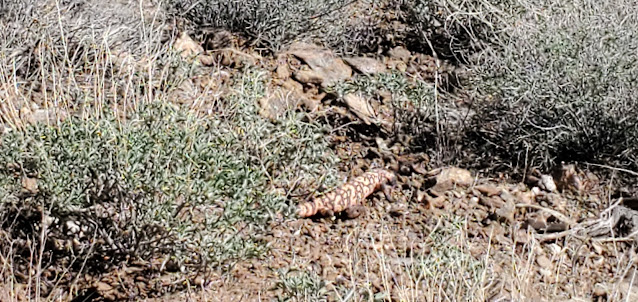 |
| Fat Gila Monster meandering down the side of the mountain. Didn't even care about us. |
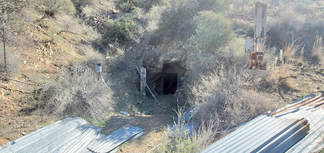
The Climax mine is an old tungsten mine that doesn't appear to be worked any longer. I know that in 1942 it was being mined for Tungsten and other minerals, and in 1953, a James Kaler owned it. Mr. Kaler still owned it in 1958, but officed in Colorado. The Climax claims were also referred to as the Patchen claims, which may be a reference to the Patchin Camp that is nearby on the topographical maps (but has nothing at the site). As we pulled up to the Climax mine, we parked down in the canyon where 4 roads came together, and looked up the steep hill to where there was a toppled out-building and a TON of junk. Metal and wood and old conveyor belts lying around everywhere. As Paul hiked up the steep trail, I took pictures of the canyon and junk and then then started hollering up at the out-building at Paul so I could take pictures of him. Nothing. No sound at all. Finally, Paul pops his head out and says he had gone into the mine a few feet. I start heading back to the truck and I hear Paul talking to someone...so I haul my butt up the side of the mountain, where Paul and I met the nicest couple - Rick and Sharon. They were parked up top in their jeep and spoke to us about other mines and things to see while tootling around the Wickenburg mountains.
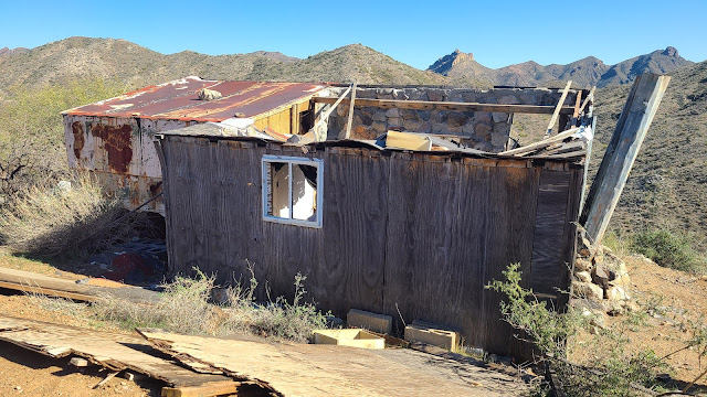 |
| Old miner's cabin |
 |
| Miner's Cabin |
Our new trail friends were kind enough to offer to take us over to the no-name mine I had seen on Google Earth from a different trail, so we all piled in our vehicles and headed out to the no-name mine. On the way, the Jeep suddenly stopped when a destroyed old mobile home on the side of the mountain came in to view. We assumed he had stopped to take pictures, so we stopped to take them as well. As I finally got out of my side (Paul had parked me on the side of the mountain so I couldn't really get out of the passenger door very well), Sharon hollered "it's a gila monster." So we rushed up and caught some not-so-great pictures of our second ever gila monster in the wild. He was pretty big and very fat, and he moved slowly (as they usually do). So we watched him meander down the side of the mountain and talked about how rare it is to see one, then we climbed back in our trucks and drove the couple of hundred feet to the old miner's cabin and parking area that looked over San Domingo Wash. The miner's cabin apparently used to be in quite good shape. He had some kind of electrical hookups as he had an air conditioner, a microwave, a can opener, and other electrical items up there. The roof fell in over the last couple of years, and the old mobile home has been moved from where we parked and pushed over the side of the mountain.
 |
| Inside the miner's cabin |
As we poked around, we got to talking to Rick and Sharon, and I asked about the "concrete swimming hole" I had seen just over the mountains, and they said it was very easy to get to, that the road was very good, and that we could follow the Trilby Wash out from there to the Castle Hot Springs Road. They were going to go down by the Anderson Mill, down the nasty ridge we chose not to go up, so Paul and I had to make a decision. Go back the way we came? Go down the nasty ridge? Or head out towards the "concrete swimming hole" and see what we can see.
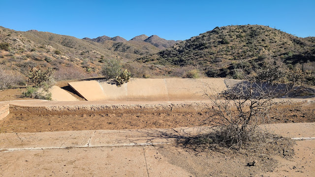 |
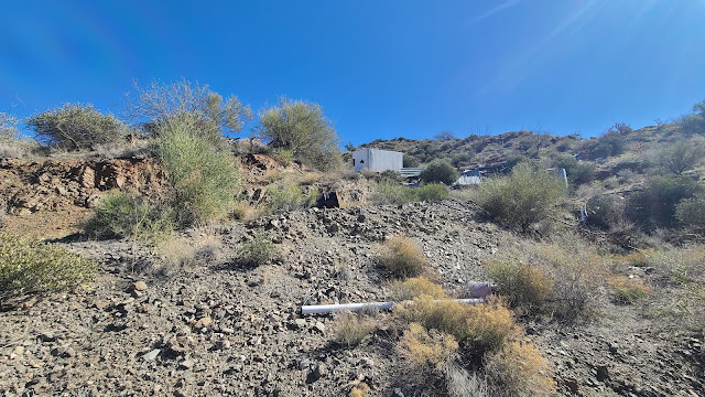
| Concrete Swimming Hole - probably actually an evap pond or water source for the mine |
Paul and I decided to try the concrete swimming hole and the Trilby Wash. Our new friends then told us about a cool old International Harvester TD25 that was on top of a mountain over in that area. So now we had to go!!
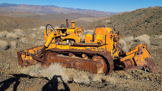 |
| International Harvester TD-25 Crawler with ripper and blade - 48,000 pounds of iron right there! |
The concrete swimming hole wasn't actually a swimming hole or pool - it appeared to be some kind of evap pond or water retention pool for the mining operation. There were other concrete pads, but clearly not building pads. There was also a hopper at the site. Not much else interesting to see there, but now I could say I've been! Then we were off to see the old crawler on the top of the mountain. We had good directions regarding heading that way, and we found it without any trouble, and I just fell in love with it! Paul bought me an old TD24 Crawler for my office some time ago, and this is a TD25 - a crawler with a ripper on the back and a dozer blade on the front. It's been up there for some time as it has been pillaged and plundered by all the idiots that like to steal stuff and shoot at things, but it was really cool to see up close how big they really are. I believe Paul said after the fact that they weight close to 48,000 pounds!!
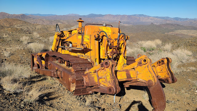 |
| International Harvester TD-25 with an ATECO ripper |
The trek out Trilby Wash was uneventful but beautiful. We went past several springs and seeps that were flowing, and the canyons were green and beautiful. It was a gorgeous day with the perfect temperature, new friends, and of course, me and my guy out bouncing around on old mining roads trying to discover what there is to discover...in Arizona!
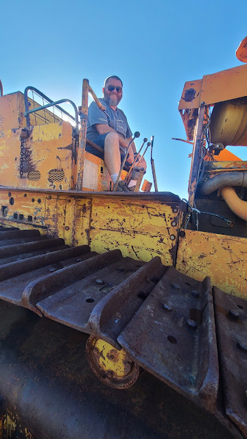 |
| Paul on the International Harvester TD25 |
No comments:
Post a Comment