My adventures on the backroads of Arizona - visiting ghosttowns, mines, cemeteries, and any other areas of interest in remote areas of Arizona and the surrounding states. In addition, we are underwater explorers, so you may occasionally see underwater explorations being posted as well! Welcome to my fantastic life! My name is Bobbi Jo Claywell, and exploring is our thing!
Showing posts with label FJ Lewis & Clark. Show all posts
Showing posts with label FJ Lewis & Clark. Show all posts
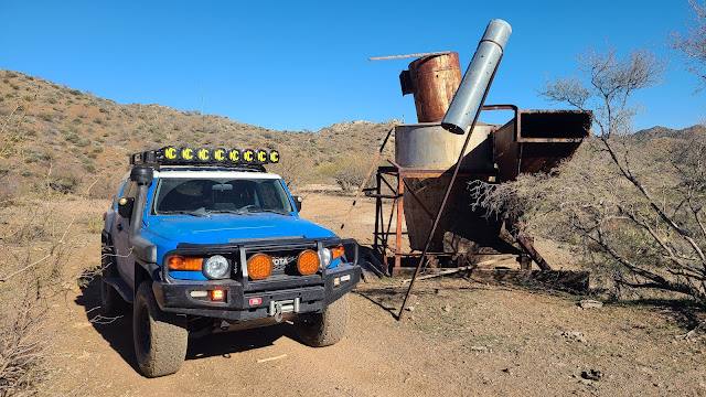
The Lewis & Clark at an unnamed mining site with the concrete pool
Neither Paul nor myself are football people. I mean, I like the commercials during the Superbowl, and sometimes that half-time shows are awesome (this one ranked high - I liked it, and I don't even like rap music), but generally speaking, there isn't much that will draw me to watching the Superbowl unless the Denver Broncos are playing (you can take the girl out of Bronco country, but you can't take the Bronco love out of the girl).
Anderson Mill from the truck
Anyway - I digress. Paul and I had a rare weekend without much to do, and decided to go up and explore the area around Anderson Mill - a place we've been to before, but we've always stopped at the Anderson Mill and have never gone further. So we got up, went to First Watch for breakfast and had amazing omelets, then we grabbed some gatorade, a few granola bars, and off we went!
The Underwood Family memorial area with one of the wells off to the right
The drive out to the trail was uneventful. The day was absolutely beautiful. I started out wearing a sweatshirt because it was 44 degrees outside in the morning, but brought a t-shirt to change in to. We turned on my bluegrass playlist and drove out to the Wickenburg Mountains at the base of the Bradshaws.
Lewis & Clark below the Climax Mine
As we turned on Castle Hot Springs Road to go north to Anderson Mill, we noted there were several dirt bikes and side by sides out and about, but not as many as one might expect on a Sunday. So we knew we would mostly have the trail to ourselves, and could enjoy exploring without being in someone else's way, or they in ours.
Climax Mine Adit
We turned off the Castle Hot Springs Road onto the North Mine Road. As we headed up the North Mine Road (which I didn't realize was a named road), we saw that someone had been placing "street signs" on poles with solar lights on the top along the route almost all the way up to Anderson Mill. We are thinking perhaps it was one of the mining clubs that mines in the area - there were lots of signs for a mining club and directions to their dig sites, as well as reminders that they are private property. So we drove by, enjoying the beautiful weather, windows down because there was no dust and it was a whopping 73 degrees outside - absolutely perfect outdoor weather!
Looking up at the Climax mine
We didn't get out to explore at Anderson Mill because we had planned to come back this way so I would take more pictures then, as well as find a geocache in the area. But plans don't always work out, do they? Off we went to head up the wash to find the old miner's homestead and Underwood grave/memorials.
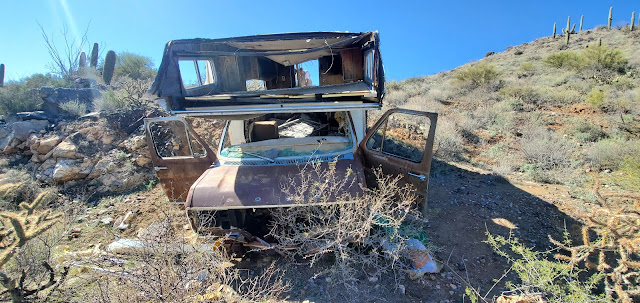
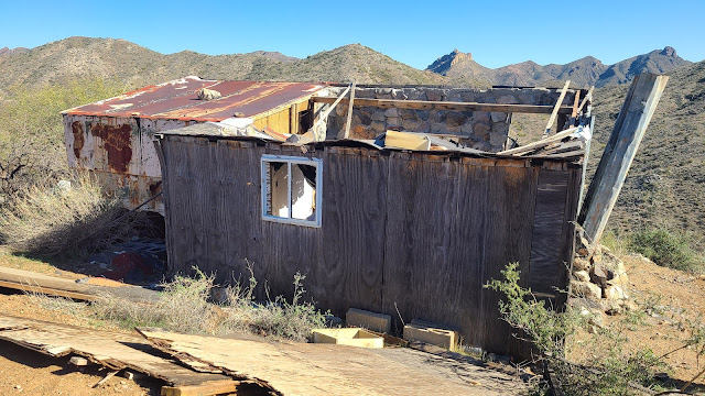
Old mobile home that has been pushed down the mountain
As we drove slowly through the San Domino Wash up towards Eddie Wash and turned the corner, the graves were very obvious. We parked the truck and walked around for a bit. There are three "graves" of people, and a fourth of a dog. According to a family friend of the Underwoods, they used to hunt deer and javelina out in the area for 50 or more years. The area where the graves of JR (Johnny Lee Roy), BJ (Bill) and JP (June Patricia) is located at their original camp site, however at some point an old miner took it over and built himself a little home there, and then the Underwood family moved up Eddie Wash to camp. This family friend states that nobody is actually buried there except the dog - they are memorials that indicate where ashes were scattered...
Front of the mobile home
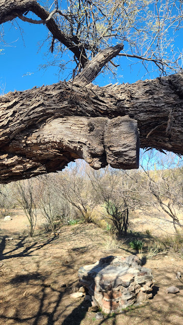
There are at least two wells - one capped, one is not and is 30+ feet deep - you wouldn't want to fall down in there - no way to get out. The old miner's cabin is up on top of the little clearing where the graves are. It appears to me that there may have been a swing on a branch here - something was tied around this branch down by one of the wells. It is very shaded here and would be a great place to have a little get away, although I'm not sure I'd want to be there during a flood.
I wonder what was tied onto this tree...a swing maybe?
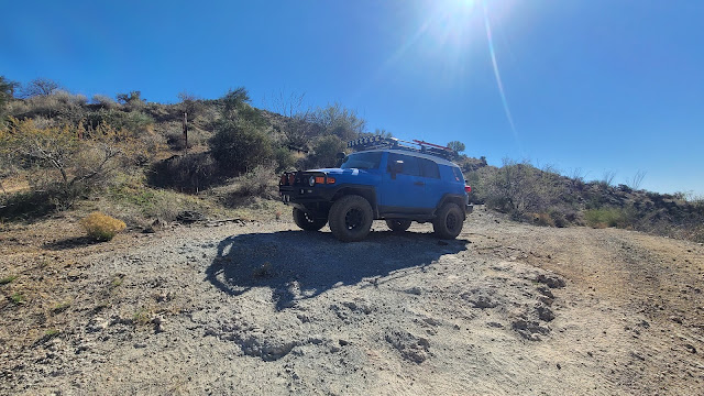
After exploring the area, and still intending to come back out the way we went in, we pushed onward to look at another mine/cabin area I had found on Google Earth. I have absolutely no information about the mine we were headed to, except that when we drove up the steep ridge, we came to a nasty little washed off area that washed off down both sides into canyons on either side. Paul, in an effort to save my sanity, said we could make it, but did I really want to see this random no-name mine? I said nope. So we backed down the very steep side of the mountain back down into the wash, and went up to the next turn off to the Climax mine.
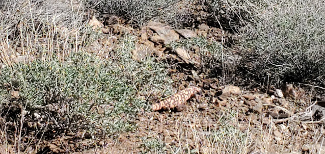
Fat Gila Monster meandering down the side of the mountain. Didn't even care about us.
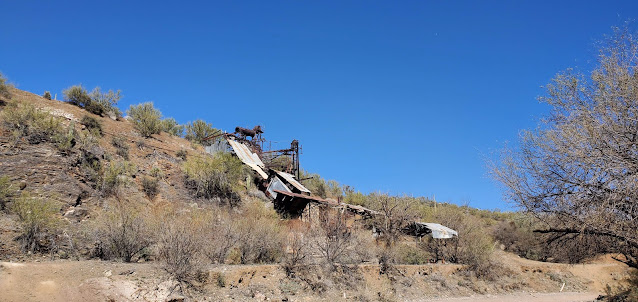
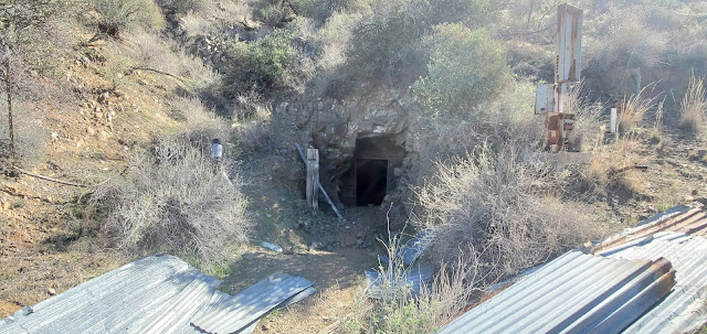
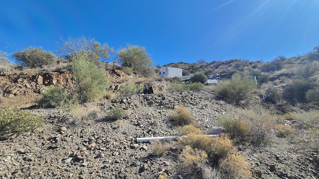
The Climax mine is an old tungsten mine that doesn't appear to be worked any longer. I know that in 1942 it was being mined for Tungsten and other minerals, and in 1953, a James Kaler owned it. Mr. Kaler still owned it in 1958, but officed in Colorado. The Climax claims were also referred to as the Patchen claims, which may be a reference to the Patchin Camp that is nearby on the topographical maps (but has nothing at the site). As we pulled up to the Climax mine, we parked down in the canyon where 4 roads came together, and looked up the steep hill to where there was a toppled out-building and a TON of junk. Metal and wood and old conveyor belts lying around everywhere. As Paul hiked up the steep trail, I took pictures of the canyon and junk and then then started hollering up at the out-building at Paul so I could take pictures of him. Nothing. No sound at all. Finally, Paul pops his head out and says he had gone into the mine a few feet. I start heading back to the truck and I hear Paul talking to someone...so I haul my butt up the side of the mountain, where Paul and I met the nicest couple - Rick and Sharon. They were parked up top in their jeep and spoke to us about other mines and things to see while tootling around the Wickenburg mountains.
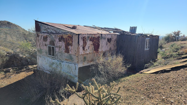
Old miner's cabin
Miner's Cabin
Our new trail friends were kind enough to offer to take us over to the no-name mine I had seen on Google Earth from a different trail, so we all piled in our vehicles and headed out to the no-name mine. On the way, the Jeep suddenly stopped when a destroyed old mobile home on the side of the mountain came in to view. We assumed he had stopped to take pictures, so we stopped to take them as well. As I finally got out of my side (Paul had parked me on the side of the mountain so I couldn't really get out of the passenger door very well), Sharon hollered "it's a gila monster." So we rushed up and caught some not-so-great pictures of our second ever gila monster in the wild. He was pretty big and very fat, and he moved slowly (as they usually do). So we watched him meander down the side of the mountain and talked about how rare it is to see one, then we climbed back in our trucks and drove the couple of hundred feet to the old miner's cabin and parking area that looked over San Domingo Wash. The miner's cabin apparently used to be in quite good shape. He had some kind of electrical hookups as he had an air conditioner, a microwave, a can opener, and other electrical items up there. The roof fell in over the last couple of years, and the old mobile home has been moved from where we parked and pushed over the side of the mountain.
Inside the miner's cabin
As we poked around, we got to talking to Rick and Sharon, and I asked about the "concrete swimming hole" I had seen just over the mountains, and they said it was very easy to get to, that the road was very good, and that we could follow the Trilby Wash out from there to the Castle Hot Springs Road. They were going to go down by the Anderson Mill, down the nasty ridge we chose not to go up, so Paul and I had to make a decision. Go back the way we came? Go down the nasty ridge? Or head out towards the "concrete swimming hole" and see what we can see.
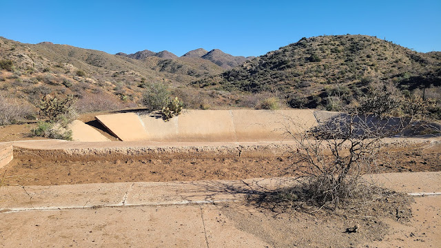
Concrete Swimming Hole - probably actually an evap pond or water source for the mine
Paul and I decided to try the concrete swimming hole and the Trilby Wash. Our new friends then told us about a cool old International Harvester TD25 that was on top of a mountain over in that area. So now we had to go!!
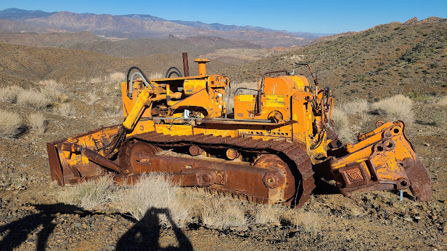
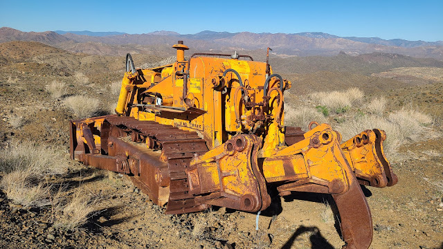
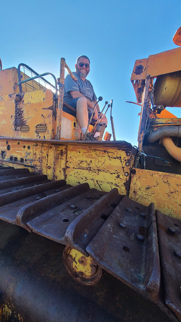
International Harvester TD-25 Crawler with ripper and blade - 48,000 pounds of iron right there!
The concrete swimming hole wasn't actually a swimming hole or pool - it appeared to be some kind of evap pond or water retention pool for the mining operation. There were other concrete pads, but clearly not building pads. There was also a hopper at the site. Not much else interesting to see there, but now I could say I've been! Then we were off to see the old crawler on the top of the mountain. We had good directions regarding heading that way, and we found it without any trouble, and I just fell in love with it! Paul bought me an old TD24 Crawler for my office some time ago, and this is a TD25 - a crawler with a ripper on the back and a dozer blade on the front. It's been up there for some time as it has been pillaged and plundered by all the idiots that like to steal stuff and shoot at things, but it was really cool to see up close how big they really are. I believe Paul said after the fact that they weight close to 48,000 pounds!!
International Harvester TD-25 with an ATECO ripper
The trek out Trilby Wash was uneventful but beautiful. We went past several springs and seeps that were flowing, and the canyons were green and beautiful. It was a gorgeous day with the perfect temperature, new friends, and of course, me and my guy out bouncing around on old mining roads trying to discover what there is to discover...in Arizona!
Lewis & Clark and Calamity Jane at the Frey Marcos de Niza Monument Outside Lochiel, AZ
Well we have the itch to go camping - to get out of the house, away from people, the tv, the computers and phones - but it's still summer here in Arizona - which means hot. And it's August - which means hot AND humid! But the annual Monsoon Duner Memorial Border Run was happening the first weekend of August, and I had never been, so as a tribute to Paul's best friend and someone I highly respected, Duner (Mike Schuette), we decided to go and hoped for the best with regards to comfortable sleeping. We took both trucks this time because it was an AZFJ gathering, and we towed the camping trailer to sleep in.
The AZFJ group heading out from camp at Gardner's Canyon
We had been planning to take both trucks, hit up Nogales to pick up medications for my daughter before she heads to college, then head back up towards Sonoita near where our campsite was. But at the last minute, due to what we perceived would be parking issues with a trailer, we chose to head to the campsite first, dropped off the Lewis & Clark and the Expedition (the trailer) and we took Calamity Jane to Nogales.
A row of FJ booty...totally hawt! You KNOW there's junk in those trunks!
As we pulled in to Gardner Canyon dispersed campsite number 5, we met Jimbolio, who was our trail run leader. Also at the campsite already was CrazyJohn, who we met for the first time - he was our camp host - he had a huge RV and an ATV, but he did not go on the run with us. He hung around camp and watched everyone's stuff while we galivanted around southern Arizona for an entire day. CrazyJohn is also the gentleman who fabricated my friend VaderGirl's current mods on Vader.
Some of the FJ's (and a 4Runner) at the border
We quickly found a great camp location under a huge tree, and we dropped off Lewis & Clark and the Expedition and off we went to Mexico. The weather was VERY nice, and it appeared we were going to get some rain. And of course we did. Just as we parked Calamity Jane and headed to walk across the border. Thankfully, it was quick and easy as there are pharmacies right inside the gates, and the place I usually go was open and we were in and out with an entire years worth of meds for $200 (I would have paid $3,480.00 if I had used my insurance in Phoenix). Meanwhile, its pouring rain, and I kept warning Paul that the sewer system on the Mexico side of Nogales is seriously lacking and to watch out for puddles, and we needed to get back across the border to higher ground before we had a flash flood that washed through Nogales/Mexico. As we head back out to get in line to cross back to the USA, Paul noticed the water bubbling up and out of the sewer covers. The flooding was starting and having been in Nogales/Mexico after a big monsoon, the last thing I wanted to do was get hit with a deep water trudge back across the border. So we rushed to the border crossing, and for the first time in my entire 30+ years of going to Nogales, there was NO WAIT to cross back over. The border patrol agents were hilarious and were extremely pleasant to deal with, and just like that, we were in and out of Mexico in less than 30 minutes, WITH our purchases!
Paul at the Patagonia Marshall's Office - which is closed.
We quickly made our way back up to where we parked Calamity Jane and we took off to head back to the campsite. We noted all the canals and gullies were quickly filling up with water, and the Santa Cruz river was flowing/flooding. As we headed North back towards camp, the rain let up, and we were left with a warm, sticky and humid evening. If any rain had hit the campsite, you couldn't tell. Dry as a bone. But we got back before dark, and we made dinner (nachos!), and chatted with the other campers as they showed up. Then it was movie night! Jimbolio brings a computer, a projector, a "screen" and a little generator and we all gather around and watch a movie. Dust to Glory was the movie about the Baja 1000. It was interesting, but I got chilled towards the end and was tired. So after it was over, we headed back to our little camp spot and crawled in the Expedition to get some sleep. Now, it's still warmish and muggy - and then throw me AND Paul into a twin size sleeping arrangement, and it's not the most comfortable of evenings. There were a TON of bugs out, so we closed up all the windows that did not have screens, but that left for poor air circulation, even with the fan, so towards morning, we opened it all up and blew the fan across the back of the trailer, which kept out the bugs, and let the cool air in. Slept like babies for a few hours after that...
Calamity Jane and Lewis & Clark in Patagonia
We woke up on Saturday morning, not quite refreshed, but somewhat refreshed. I made bacon, eggs, and pancakes. Mr. Spock, Jimbolio's fun little pup came over to investigate. He will do tricks for bacon, so he got some really tasty applewood smoked thick cut bacon for doing tricks. We were instant friends after that.
And we took over part of the parking area in Patagonia.
We then cleaned up camp, and then the rest of the FJs started showing up for the Border Run. We had 14 trucks, I believe, on this run. 10 of which were FJ Cruisers! We also had a Jeep, a F-150, a 4 Runner and of course Jimbolio's Lexus GX470, also known as The Phoenix (it rose from the ashes of Precious, his FJ, whose bumper and roof rack are now on Calamity Jane). And off we were to explore southern Arizona and go see if we could get close to the border!
More of the trucks going on the run at Gardner Canyon
Our first stop was in Patagonia - I understand this is a normal stop for the AZFJ group - there is a bathroom there and ample space to park on an early Saturday morning. This is also the turn off on to the Harshaw Road. So we lined up the trucks all along the main drag in Patagonia for the obligatory pictures and bathroom breaks - then off we went down the Harshaw Road. After a short drive, we left the main Harshaw Road and headed up Harshaw Creek Road (which is a shorter bypass to the Harshaw Road). It was a stunning day for driving through the old Ghosttown trails of Patagonia - several small and muddy water crossings - and EVERYTHING was green! SO GREEN!!We stopped several times for bathroom breaks and to take pictures - and to let everyone catch up. It was so incredibly beautiful and green that everyone kept stopping to take pictures so our little group got very spread out...
First stop along Harshaw Road - so green!
Guajolote Flats - we went from the top to the bottom in just over a mile.
Guajolote Flats - looking back up the mountain
We stopped for lunch on the Guajolote Flat Road before the big "downhill on the switchbacks in 4L" portion of Guajolote Flats. This portion of the trail gave me some anxiety - steep shelf road which required both high clearance AND 4L in my manual (otherwise I'll burn up the clutch and brakes riding riding them). I'm driving alone in Calamity Jane with Paul and the Lewis & Clark in front of me. Paul keeps reassuring me over the HAM radio, but I can't talk back with I need both hands to drive and shift. About 1/3 of the way down I get the hang of using 1st gear (which is a granny gear in 4L for Calamity Jane) to engine brake and got more confident about what I was doing. Was I slower than Paul? Sure - but I made it, and by myself without anything except Paul telling me over the radio that I was doing awesome. As I pull up to the group at the bottom and look back up at what I had just come down, I spotted a truck that had gone over the edge. Couldn't even get a very good picture of it.
The Sonoran Desert at its finest - the Octotillo were full and green, and the wildflowers were awesome!
After we all got down off of the Guajolote Flat Road switchbacks, we started heading towards the border. First stop - about 700 feet from the border, Jimbolio had found this cool little watering hole and cabin. I know absolutely nothing about this cabin and watering hole except it is a named place on the topographical maps. I can find no history whatsoever on the internet. Sierra Tordilla Well. It was a beautiful little area - the perfect place for a little cabin. I suspect the cabin is being used as a shelter for border crossers as there is a confirmed water source and there is no real fence at the US/Mexico border just 700 feet away (possibly a small barbed wire farm fence...but nothing discernable on Google Earth.
Wall building resources - note the small wire fence where they tore up the other fence
Me and Paul - at the wall's end...
Paul and the Lewis & Clark at the border
Bobbi and Calamity Jane at the border
We poked around this area for a bit, then headed back up to the road that we would take to the border. We drove around Piedragosa Tanks and went straight down to the place they quit working on "The Wall." The Wall was stopped at the Grant Boundary just south of Kino Springs. It was clear they intended on continuing, but it was stopped on at the Private Property line, and then the building of the wall was ended by our current administration. The old steel criss-cross border wall had been yanked up for some length and nothing was left but a wire fence. Not even barbed wire. And lots of supplies to continue building the wall.
The old fence iron piled up...
No real fence/wall, so to speak, for as far as the eye can see.
It was an interesting stop, and we had officially made it to the border. Lots of pictures were taken, lots of investigating of the parts of the wall, and lots of jokes were made...but - we still had a long drive ahead of us to get to Sierra Vista for dinner. We left the border and headed back up to Duquesne Rd. We flew past Washington Camp and then past Duquesne. I've been to both places, as well as Harshaw, many times - and we didn't have time to stop so it's good that both Paul and I had been before.
Paul leaving the border fence - look at the wildflower bloom!
We hit Lochiel for some pictures - Lochiel is the place that it is said that Fray Marcos de Niza first came west of the Rocky Mountains on April 12, 1539. The town itself is private property, and the border crossing has been closed since, I believe, 1983. In my previous visits to Lochiel, you could go up to the gate, but a fence has been put across the road going in to town - now that there is no border crossing, there is no reason to let outsiders into the town...
San Rafael Ranch - barn buildings
The Greene Ranch House - as seen in the opening scenes of McLintock
Storm blowing in over Mexico and a line of gorgeous FJ's!
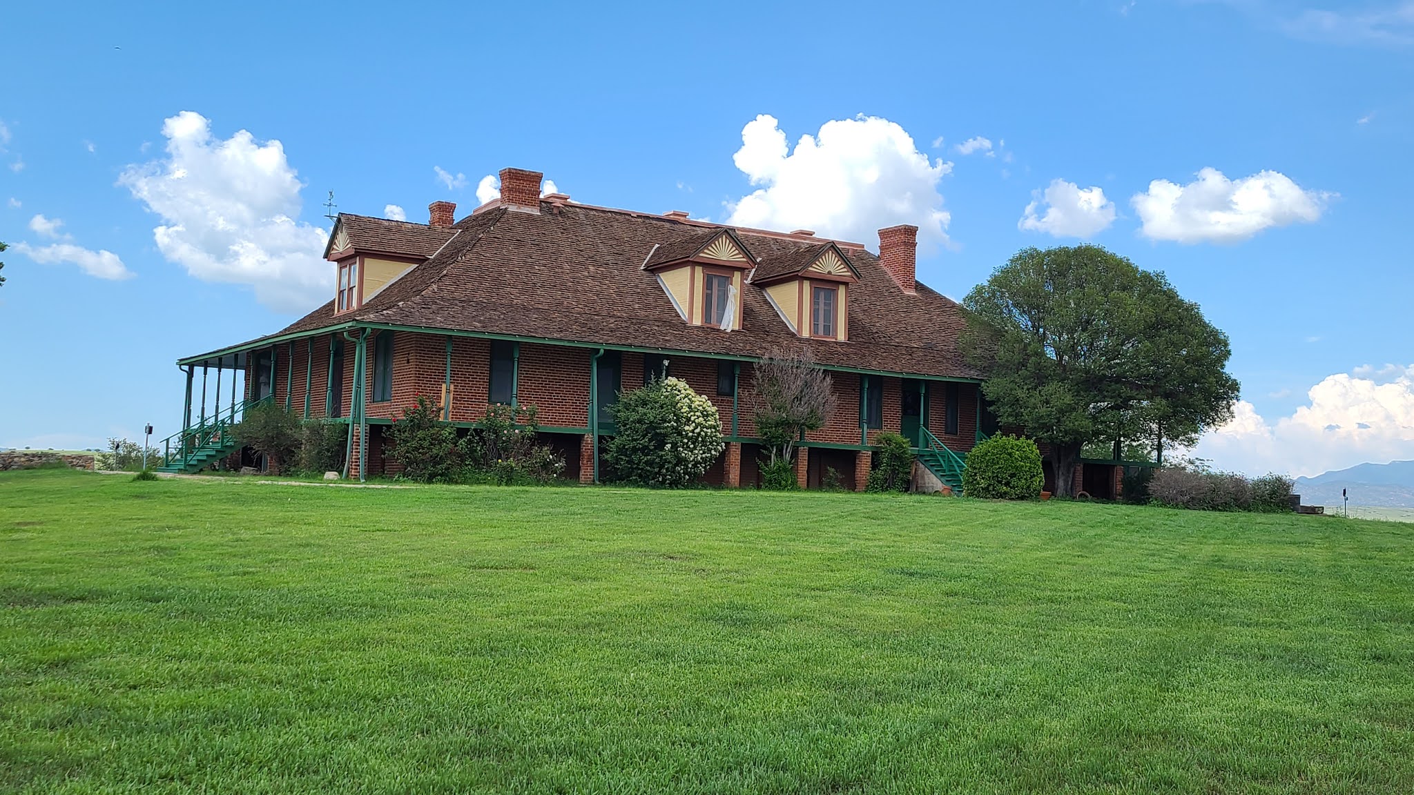
And then we were off again - there had been some discussions about the "John Wayne Ranch" - also known as the San Rafael Ranch (fka the Greene Ranch). Once can see from the main road that the house is a stunning two story large farm house, with several barns and other outbuildings. The road going up to the Ranch has always been closed and locked each time I've gone through here, as well as others from our group. But today it was open! So up we went.
The storm over Mexico - looking southwest on Montezuma Pass
It was absolutely stunning with the green grass which had been freshly cut and storms brewing south of us in Mexico. The ranch was never actually owned by John Wayne, but part of the movie McLintock, which John Wayne starred in. In addition, scenes for Oklahoma! were filmed there (this tied in to a later trip we took across the US - blog on that to come later). The gorgeous ranch house was built in 1900 by the Greene family, who were a ranching dynasty in their own right - see The Greene Cattle Company Collection for more information. It is now part of the San Rafael State Natural Area, and has a local caretaker. The property is being meticulously managed and cared for, and it like stepping back in time.
Our babies at Montezuma Pass - spattered with dust and mud and looking truly bad ass!
By this time, everyone is getting a bit tired and we still have to go up and over Montezuma Pass to get to Sierra Vista. So we head off towards the Huachuca Mountains and up to Montezuma Pass. There is a big nasty storm brewing to the South in Mexico, but it missed us completely - when we stopped at Montezuma Pass to regroup, it was nice and cool. One of our group (@airconditionednightmare) was having some issues and had to limp down the other side into Sierra Vista. Paul and I took off to follow everyone down in a massive hurry to make it to the German restaurant - but I was tired and the switchbacks and steep drop offs got the better of me. There was two way traffic, so I took it very slow - and it took a bit longer to get to the bottom for me, so Paul and I decided to head back to Sonoita and have a steak at the steakhouse there. We finished our delicious mesquite grilled steaks and went back to camp, where we zonked out.
Calamity Jane in her element!
All in all, it was a successful Border Run. Lots to see, and of course the desert bloom this year was amazing! All the crazy clouds made for some beautiful pictures and now I can say that I've done one of the AZFJ border runs! There is more that we did on Sunday on our way out, but I will save that for another blog entry!
Lewis & Clark at Chicken Point on the Broken Arrow Trail outside of Sedona
It has been a crazy May and June! Bailey graduated high school (which at XCP entails almost non-stop activities all week and every weekend for a month), and she graduated with TWO associates degrees from Rio Salado Community College! It was an amazing and emotional time for me - my trail buddy and off road companion has grown up, has her own 4x4, and is heading to college in a couple of months. I'm not crying. Nope. No tears. Just allergies...
On top of the rocks Paul and I were crawling around on!
But then...Paul and I were super excited to hear that his eldest son, Brandon, and Brandon's significant other, Julia, were coming to town! They were headed to Sedona for some much needed relaxation since having their adorable son, Luke (I might be a bit biased...but I think he's the cutest little dude out there!).
It's practically impossible to take a bad photo in Sedona - look at all that beauty! (and Brandon too)
So on Sunday, we met them for breakfast before their long drive to Sedona. We took Oskar and got a picture of Paul with his two boys. We had a great time, and gave them some ideas for stuff to do before their check-in time. They had rented a Jeep (we know, we know, but the rental places don't rent Toyota 4x4's), so Paul and I planned on heading up the next morning to do a couple trails with them!
The Bat Cave on the Broken Arrow trail
So off they went to their super-awesome looking spa/resort place to stay, and we went home to prepare for an all day outing on Monday. As usual, we were up and at 'em early on Monday, we grabbed the usual Starbucks, and off we went to Sedona. We had decided we wanted to do Broken Arrow, a trail that is listed as moderately difficult. I wanted to drive some of it, and Paul had agreed...so we met up with Brandon and Julia in their Jeep, and off we went, with me navigating all the side streets of Sedona. When did Sedona get so big and crazy? I remember in the 80's...........I digress...
Lewis and Clark at Submarine Rock
We pulled into a small parking area to air down the tires, and then turned onto the trail. I took video of the introductory "ledge" that is supposed to tell you if you can or cannot make the trail. It was a piece of cake...both trucks went right up. Well, the Jeep took a bit more coaxing, but it finally did it. We got a bit of a headstart on the Pink Jeeps, but there were a few ahead of us already - man, they are EVERYWHERE. But we made pretty good time, and it was beautiful outside, as well as beautiful in Sedona. Our first stop was at the Bat Cave where we took a few pictures, looked into the big hole, and then decided to move on.
On top of Submarine Rock with Lewis & Clark parked down below
We were then off to Submarine Rock. Submarine Rock is HUGE. And has two "peaks" to the rock. On one side was a geocache. Brandon and Julia hadn't geocached before, so Paul showed them what it was about, and they found the geocache! Meanwhile, I walked to the other "peak" and ended up talking to a really nice guy from Colorado, near where I grew up. He was on a mountain bike and riding Broken Arrow - we saw a number of folks on mountain bikes - impressive!!!
Okay - we'll allow a picture of the Jeep here...because it's Sedona and SO BEAUTIFUL!
After hiking around Submarine Rock for a little bit, we were back in the trucks - and this time I was driving! I went down the steep rock entrance to Submarine Rock like a pro - Brandon and Julia behind us in the jeep. We turned off to head towards the overlook at Chicken Point and then the Devil's Staircase. As we bounce around, Paul has jumped out to spot Brandon, and I had to move forward a bit, and of course, immediately whack Paul's new wheels on a rock and scratch them up. I felt terrible...but Paul kept encouraging me to drive on. We bounced along - nothing hard or difficult. In fact, it was all quite mild...Chicken Point overlook was STUNNING and we again saw the guy on the mountain bike walking along "the white line" up on one of the mountain sides...it looked terrifying to someone who isn't good with heights.
AZBackRoadsGirl driving down the rocks
But then we head out and towards Devil's Staircase. At the "point of no return" before the staircase is a big area with large red rocks that you can drive up. And when I mean up, I mean UP! Like - you're in the truck and all you can see is the sky...The first attempt I made I got stuck half way up and the tires just spun. So I backed back down and moved over a couple of feet, and the Lewis & Clark popped right up over those rocks. Then Paul had me turn the truck around and go DOWN the nasty part I got stuck on. Did that like a champ.
Paul showing off...
Then of course, Paul had to do it to show everyone that he could. He almost ran Brandon over, but you know, it's all in the name of good off-road run, right? We played around going up and down the rocks for a few minutes. We noticed the pink jeeps would go DOWN the rocks, but not up. We did both. Multiple times. And then - we were off to Devil's Staircase.
Brandon coming down Devil's Staircase
Devil's Staircase has a reputation as being a horrible section of the trail. I guess it technically is, but it's just really bumpy...I didn't hit bottom even once. It was worse for Brandon and Julia because 1) they were in a Jeep and 2) it was stock - but both trucks made it just fine. It was a little tippy, but I handled it with ease...I had a worse time trying to go up the rocks before the point of no return...
Bobbi playing on the rocks in the FJ Cruiser
The Jeep just had to watch...it couldn't play...
Bobbi playing on the rocks
After the Devil's Staircase, we went back to play around on the rocks by the Devil's Dining Room (topo map feature). I went up and down and up and down, climbed all the rocks while Paul guided me to get me comfortable. At this point, I was just playing. Because these were little climbs. Nothing like what I had done earlier.
The "Portal" at Bradshaw Ranch. Supposedly this can open up into an alternate universe or reality or something...
And then we decided it was time to be done. We were in search of a bathroom, a cold drink, and off to our next adventure - the Bradshaw Ranch. This time, we were looking for the portal and the rest of the old buildings at the ranch.
The northern portion of the Bradshaw Ranch properties
We drove over to Bradshaw Ranch - a long drive past some of Sedona's most popular hiking areas - where people park and walk a mile or more just to get to the trail head...then on to a dirt road, cross a huge wash, and there we were...at the mystical Bradshaw Ranch. Paul briefed Brandon and Julia on the paranormal significance of Bradshaw Ranch, and I told them about the history of the ranch as a filming location, as well as a place for the stars to stay (like Elvis!).
The house on the northern portion of the Bradshaw Ranch
We decided to walk around the NAU fenced area and over to the area designated as a portal. We all took our photos standing "in" the portal - thankful that nothing weird popped out of a portal opening while we were there - and then we bushwhacked over to the North end of the property to investigate the old barn/shop and the old house.
Eerie old gate at the Bradshaw Ranch
As we were walking back through the corral, the old wooden fence was creaking in a most creepy way...so I stopped to take some video of it. With the odd clouds overhead and the wind that would occasionally moan through the canyon, it was a very weird feeling being there. We headed on down to the ranch proper, and investigated the VERY large ranch house and smaller historical adobe home. The entire complex was fascinating, and fairly creepy...but I'm glad we went back and saw the entire thing. Last time Paul and I were here, he missed the entire North end of the property (and I didn't go in at all).
The Bradshaw Ranch - the Big House
The Bradshaw Ranch House
Panoramic View of The Bradshaw Ranch, including the old historic adobe ranch house
We then did a quick geocache that was on the outskirts of the Bradshaw Ranch property, and then headed back towards the main dirt road to head over to our last stop of the day - the oh-so-secret cliff house. This is another one of those places I won't give any specific directions to - it's such a cool place, and part of the trek there is on private property if you don't pay attention to where you are headed.
The Cliff House
I have found some sparse history on the builder of the "cliff house," as we call it. But nothing certain and nothing I can fully verify. But it's cool...and in excellent shape because the internet is keeping its location very secret. The cliff house is a multi-level home built into the side of a cliff. It is surrounded by private property as best I can tell, and may be on private property or may be on National Forest land - the line is different depending on what software and map you are looking at. Either way - it is a cool place to visit. And no, Elvis did NOT live here, nor did he visit this cliff house. But it's a good story...
The hike to the Cliff House - gorgeous!!!
After our hike in, up, and back out of the cliff house, we decided it was time for some dinner. We went to the Golden Goose American Grill and had an amazing dinner - filet mignons - and a couple drinks - then it was time to head home. We said goodbye to Brandon and Julia, who got to head back to their gorgeous room and relax in a hot tub while Paul and I made our way back down to Phoenix and the heat.
The astounding beauty that is Arizona and her extreme weather changes...
It was another beautiful day in gorgeous Sedona - and we went during the week so that we missed most of the people - although Sedona was still packed, and by the time we left Broken Arrow, there were tons of vehicles. But the views were perfect, the rain trying to blow in made for some gorgeous photo moments and kept the air cool! I hope, with all the fires burning up there, that all these amazing places are kept safe!


