Tuesday, June 9, 2020

Wickenburg Mountain Exploration

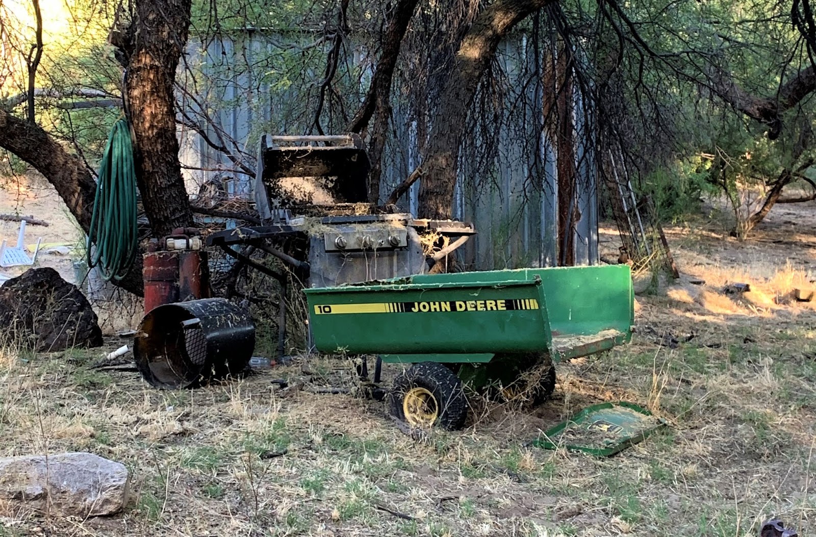
John Deere trailer and Shack
This week has been a whirlwind of excitement and new things!  First off, we started Paul's confined water dives (towards his Open Water Diver certification) - put an entirely new meaning on "Breathe Baby, Breathe."  I sometimes forget how stressful it can be to put on a mask and regulator and breathe underwater - but Paul took to it like a fish - and in short order was removing and replacing his mask, clearing his mask, and swimming around with all the gear on and making it look easy!  

Saturday and Sunday I had two full Open Water Diver classes at Lake Pleasant.  They started at 7 a.m., but in order to secure a parking spot at Vista Point, I arrived at 5:45 a.m.  I got home each day around 2, and was pretty tired out.  

Saturday morning Paul installed my new Kenwood stereo in Calamity Jane, and Sunday he installed the backup camera!  Calamity Jane is in the new millennium!  Then Saturday we spent the remainder of the afternoon in the pool working on confined water skills, then Sunday, Paul picked out a place to go off-roading - some place we had both seen on Google Earth, but neither of us had gone.  This place is on a long road off of a familiar trail in the Wickenburg Mountains - but that's all I'm going to say about the location.  It was one of the rougher roads I've been on - especially towards the end.  I was amazed at the rock crawling we did - and how little jarring I felt while climbing over boulders, etc.  And many of these were more than "baby heads."  Paul said my truck could have done it with some careful tire placement, but I'm not sure.  

And I'm getting ahead of myself again...

Fully functioning windmill and tank
with VERY cold water!
So I get home from the lake, I clean my scuba gear (with Paul's help - thank you!) - we empty out his truck (which I took to the lake while he finished my stereo/backup camera), I took a quick shower, and then we were off.  We had about a 1 hour drive to the start of the familiar trail head - so we put on the satellite radio 50's station, and bee-bopped down the road.  It was a beautiful day out - I don't think the temperature even broke 95 on Sunday.  We hit the trail and air'd down around 4 p.m., and off we went - another hour or so to the end of the familiar trail and the turn off to this new area we had never been...

We spent a few minutes finding the correct route at first - did a bit of rock crawling down a river bed while looking for it - but finally found a clearly marked trail, with gate, which we opened and closed, then we took off!  The trail was easy at first - but it was so beautiful and remote...from the point we air'd down the tires until we reached the main highway afterwards, we didn't see one single person or vehicle!  

As we drove through the beautiful Wickenburg Mountain desert, we laughed at all the quail, little bunnies, and jackrabbits.  We passed through several washes full of thick green growth, and the trail became slightly more eroded and rough.  We came upon a well maintained corral with a fully working windmill pumping really cold water into a tank - one of the very few windmills I've seen that is actually working and has all the blades in place.  It was a very peaceful and beautiful location.  

Hole in the ground
We continued down the road, and as we passed a corner, I shouted "I see things!" - Paul laughed at me - "things" was a hoist brace above a big hole in the ground.  HUGE timbers and a framework supporting them was over this hole - we couldn't see to the bottom - but it was the first sign of mining we had seen since we turned off the familiar trail.  I wouldn't get close enough to look down the hole - but Paul did...and took the picture!  This mine isn't on my GAIA app, nor is it listed in the USGS Mine overlays on my Google Earth.  I have no information about this hole, nor the mine we ultimately ended up at (which is a pit mine).  

We left the "hole in the ground" and continued on - the road getting rougher and rougher - thankfully Paul was driving - I was so exhausted that I wasn't sure I could even attempt a mild obstacle.  But as we neared our destination - I got excited about what we might see when we got there.  


Frog in the stream
We finally stopped and decided to hike the rest of the way in - we were about 1/4 of a mile away according to GAIA - but we didn't see a clear trail (this is important - because there was one...which I will explain later).

We parked the FJ and looked around - there was a big herd of cattle hanging around the area that we parked in.  As soon as we opened the doors, the cattle all went running over to one side and just stood there looking at us.  Tons of little babies and their mommas (with horns) staring at us, and occasionally making some noise...

Caterpillar Tractor
We hiked up the river bed, which was flowing (yay for our Merrell Moab hiking boots, which are waterproof, but light weight and super-comfortable!) We didn't even get our feet wet crossing in the low stream of water - and as we were walking up the North side of the stream, we started to see bits of yellow - meaning we were nearing all the equipment!  Paul spotted a little frog that looked just like a rock (see the picture above), he jumped once, then sat there for pictures.  

We crossed the stream again and there we were.  In the midst of a ton of old Caterpillar equipment just sitting there rotting.

**This particular open pit mine has equipment at it that has been moved from another mine much further away, which has led to some speculation online about the name - but the mine "name" that is marked on some old equipment throughout this mining site is NOT the actual name of this site - we have seen pictures of what is likely the same equipment at the other site South of this site.**

Fully stocked cupboard in the cabin
There is SO much old equipment up at this site - an old cabin, several old trailers, and spread out over almost 1/4 of a mile up and down the stream.  

I don't think the site is very old, and according to Google Earth, equipment was still being moved around as late as 2010 or so - but it all appears to be abandoned now.  Probably cheaper to leave all the old equipment and take a loss than to try and get it out of here.

As Paul and I walked around looking at all the stuff strewn about the site, we talked about how they got the equipment back here, and why they didn't take it all with them.  This is all professional mining equipment - none of it is homemade stuff - and they clearly spent a substantial amount of money on earth movers, tractors, an other equipment - Caterpillar and John Deere equipment - not cheap stuff!


Trommel and conveyor
As we are walking around, we noticed a road heading "out" of the area.  We decide to take the road and see where it leads us...well, it led us straight to the FJ.  But we didn't see the road because when we scared the cows and they all ran to one side, they were standing on the road.  We laughed about our trek up the stream bed when there was a perfectly serviceable road - but hey - it was nice to get out and walk around, and it was absolutely beautiful out!

As we walked towards the truck, the cows spooked and went running in two directions - one group towards the stream bed, the other up the road we had driven down.  There was a ton of loud commotion as they ran about - but we got in the truck and started heading back.  We wanted to get back to the familiar trail before dark.  

As we head out, the group of four cows and their babies that separated from the rest of the herd just kept running up the road.  We slowly followed them, hoping they would move off to the side and just let us pass - but they stayed on the road.  We followed them for what had to be a mile or so before they finally moved off to the side.  There was one little black cow that was sassy as could be, and would stop, and look the FJ square in the grill and bawl at us.  He was so cute - he's in the video above where he stops and looks at us!  We felt like we were on a cattle drive following these beasts.

The drive out was easy, relaxing and fun.  It was a great way to end a hectic and busy weekend - I slept like a baby on Sunday night after all my weekend activities!  And I look forward to more of these little Sunday afternoon jaunts in the future!  Big thanks to Paul for driving, and as always, keeping me calm on those shelf roads!

Breaker boxes at the pit mine

Wednesday, June 3, 2020

Crown King Adventures - Memorial Day - Day 3

Mystery Cabin
So today's final blog about the Memorial Day Weekend will be a tad bit different - today I'm going to talk about some cool stuff we saw over the weekend - but without divulging locations or "when" we saw it over the weekend.  There is too much destruction of these precious abandoned sites going on right now to give up locations of sites that Paul and/or I find through our hard work and efforts - and I would hate to see the amazing finds be totally destroyed in the next few years...

Mystery Cabin

The first site is the above cabin.  It was a little hike off the trail - and we weren't sure if it was abandoned or not.  So we parked the FJ, and slowly and carefully walked back in the direction we thought the cabin was - the trail was grown over, but we saw what appeared to be a road, so we were cautious.  We made noise as we approached, but the front door was open, and we didn't see anyone in or around the cabin site, so we continued to approach.  

It is clear after a bit of snooping around that the cabin is abandoned, but the cabin building itself is posted no trespassing, so we did not go in.  It's a beautifully constructed cabin - not sure of the age - but there was an outhouse out back - very cute with a half moon cut in the door and news clippings pasted all over the inside.  Also did not go in here...didn't really want to see if it was used (recently or not).  

As Paul continued around the side of the property, I heard him holler at me, so I turned around and he was pointing out the Scout II that was behind the cabin!  As we continued to look, I noticed another vehicle deeper in the weeds, and said "is that an 800A?"  Sure enough, it was!  What luck to find two International Harvesters while out and about - and then the truck we saw on Sunday as well!  Shows you how incredibly well made these trucks were to have withstood time and the elements to be out here!  The trucks are clearly not in working order - the 800A is pretty banged up and rusting, and while the Scout II doesn't look terrible, the windows have been left open and weeds are growing out from inside the truck!  But I was excited to see them nonetheless.  Paul said there were other Scout parts lying around the 800A...he knows my brother and I love International Scouts!  

Scout II Grill
There was a ton of trash lying around this cabin site, and as always, we poked through it.  Kerosene cans, old cookie tins (lots of them), old bottles and lots of broken glass.  A number of old beds and frames, and several pairs of pants with tags still on them.  Odd.  

We slowly walked back to the FJ, wondering who lived here, who owns the place now, and what are they doing with it.  I've since found out who owns the cabin and trucks through some detailed research, as well as the nearby mine that is associated with the cabin.  These kinds of finds are the finds that make my day!  Pristine cabins, beautiful in their settings, with lots of remnants of things from the past just waiting around it - they make my day!

A Random Mine

Inside the entrance to the mine
And now for something that makes Paul's day!  Mines - Paul LOVES abandoned mines.  I mean, I love finding them, learning about their history, poking around the remains ON THE OUTSIDE.  But Paul likes to explore them.  ON THE INSIDE.  I will rarely go in a mine.  Don't get me wrong - he's safe, and doesn't go in anything that looks remotely unsafe or unstable, but we've been out a number of times now where Paul has gone into a mine and I've waited outside.  Hoping he comes back out and I don't have to manage the FJ back to find help (although I suspect I could manage it just fine now if necessary).  He, of course, always comes back out - with awesome pictures, and then I wish I had the guts to go in - but I don't.  I likely never will, so I'll be the "look out" on the outside, waiting for safe return.  We plan to drag my brother along at some point as well - he's a little crazy like that too. 

Down the mine shaft
But at one point on this weekend, Paul found a mine that he went in to.  I'm not posting pictures of the outside so as to preserve the identity...and Paul did not descend the ladders at all - we need a second person on the inside with him, as well as me on the outside - but it looked promising!  I really like this picture on the right because if you zoom in to the bottom of the photo you can see another ladder at the bottom of this permanent ladder.  And it looks like the Upside Down from Stranger Things. 

We heard about this mine and decided to do some searching for it, and found it!  It was an interesting find, because the mine itself has been around since the 1920's, and was part of a group of claims - but was primarily an open pit mine until the 1980's, when a shaft was dug at the location of the original pit mine.  The pit area itself looks the same as it did decades ago - you have to look around for the entrance.  But it's there...Paul found it.  And after letting his eyes adjust to the lack of light, he was able to look around a bit.  Hopefully there will be more exploration to come...with my brother in tow.  Paul and Cabot can explore the mine - I'll do the research! 

Final Trek Down from Crown King

So our wonderful weekend had come to an end.  We took the front road down from Crown King - down the old train switchbacks where I showed Paul how the trains would go straight off the switchback, switch tracks, and go up (or down) the next switchback.  At one point we could see the cuts in the rock that allowed the train "switch" tracks. 

We stopped to look at the Swastika Mine, which is just below the Peck Mine (not abandoned, and the caretaker isn't one to mess with), and then we came around the corner to see the DeSoto Mine - it's a mine I've always wanted to see, but we need to plan that for another day - not sure how the road is, and there is plenty to see on the way up to the mine.  You can still see some of the tramway foundations, although I didn't see the wooden tramway structures - I haven't seen them in over 20 years, so I don't know if they still exist or not.  They did in the 1990's...but the rock foundations are still there.  You don't even realize what you are looking at unless you know. 
Maggie Mine Properties

We half-heartedly attempted to visit a few more places I had marked on my Gaia, but all were gated and locked, and we made no attempt to find alternate routes (although there are alternate routes to most).  We decided to take the Maggie Mine Trail back in to Black Canyon City to get just a tiny last bit of dirt fun - the trail was tame, but fun, and it's always exciting to see it in daytime (last time I ran the Maggie Mine I did it at night - by myself). 

And as per the usual, we ran in to traffic on the I-17 coming back in to Phoenix - but what a great weekend we had.  Relaxing, fun, I learned how to drive Paul's FJ, I learned some about what the FJ could do - and am now excited to take Calamity Jane out and try her out on a few obstacles!  Good food, cool mountain air, and wonderful company! 

Welcome to my amazing, awesome and fun life! 

Scout 800A at the Mysery Cabin


Friday, May 29, 2020

Crown King Adventures - Memorial Day Weekend - Day 2

Tower Mountain, Crown King, AZ

Day 2 - SUNDAY

After a wonderful night's sleep, and being utterly lazy and laying around watching "Knowing" starring the always entertaining Nicolas Cage, we decided to go in to town for some breakfast at the Prospector Mall Smokehouse & Grill (amazing bacon, by the way!  They cure it themselves and it was to die for...).  We were reminded by one of the owners of the Smokehouse that the Memorial Day Parade was going to begin at noon, and, no offense to Crown King, we wanted to high tail it out of town...so around 11 a.m. we decided to head up to Tower Mountain to check out the old lookout tower.  So we started climbing out of Crown King - windows down - amazing views - shelf road most of the way.   Lots of side by sides and ATV's zipping down the roads at top speed - I have no idea how these people avoid accidents.  It was crazy.  

Collup Cemetery
 But as we turned off the shelf road and into the pines, it reminded me of Colorado driving - huge, tall pines on both sides of the road - so thick it was almost dark.  As we were approaching the towers, there were plenty of "private property" and "no trespassing" signs, and then an huge field opened up to the North, and this lovely home, cabin and cemetery just appeared out of nowhere.  There were clearly people home as the back door was open.  The structure wasn't old - I don't know what the name of the ranch is, but I believe the Collup family owns it.  Or did.  But two of them appear to be buried here.  It was such a peaceful and beautiful place.  

Lookout Tower
But onward we went until we drove up to the little cabin and all the towers.  SO many towers, and then the tiny little lookout tower.  Paul climbed the tower, but it was closed and locked.  He took some photos from up top, although it was far from the tallest tower out there.  But the views were magnificent - you felt like you were on top of the world!  We spent a bit of time looking for a geocache that we never found, and then went down another short road towards another set of towers, but decided to turn around and head back - we had a very specific mine we were trying to get to!  


Old school bus at Del Pasco
As we drove through the pines again, and took the turn off at the Wild Flower Saddle, the road got a bit rougher - no longer an easy graded trail, but not a difficult trail either.  We continued through the pine trees, ran into a few folks on their side by sides, dipped down into a wet little valley area, and came around to the turn off for the Del Pasco site.  Paul and I were both really excited to see what was here.  You can't see anything on Google Earth, but we've both seen pictures of the bus and other equipment left up here.  


The dump truck - love those colors!
Also - the clutch is still springy.  Haha
The Del Pasco did not disappoint!  The bus is the first thing you see - but it's no longer yellow (which is why we can't see it clearly on Google Earth).  The bus is also burned up inside.  Just a shell remains.  There's also an old dump truck, and a homemade trommel along with other miscellaneous old mining equipment.  The old building with the boiler that was so beautifully tilting to one side has long since collapsed and is now just a pile of old wood.  But this place is buried deep in pines and seems so out of place in what feels like the absolute middle of nowhere.  

The Del Pasco was founded by Jackson McCrackin, James Fine, Charley Taylor and T.G. Hogle on July 4, 1970.  It started as a placer mine but was further developed so as to access the 2-3 foot wide Del Pasco Vein.  In the early 1870's, a 4 stamp mill was built and operated on sight by two men who acquired an interested from Hogle.  The mill rarely ran at full capacity due to a lack of water, but averaged 40-50 ounces of gold every couple of days.  

Jackson McCrackin was a member of the Walker Party and a member of the First Territorial Legislature.  It is rumored he was not the most hygienic person, and that he was forcibly bathed and groomed by his political and mining colleagues so as to better fit the role of a proper Territorial Arizona Representative.  McCrackin made his big money in later mining ventures, including the McCracken Silver Mine, a well known mine in Mojave County.  

Homemade trommel at Del Pasco - and it still spins!
By the 1880's, the Del Pasco Mine was overshadowed by the nearby Tiger Mines and Peck Mines.  It continued to produce until the early 1940's when the mine owner was shipping 35 tons, or two cars, of high grade ore per month.  

There has been additional testing done in the 1980's to see if there would be any value to heap-leaching, but nothing appears to have come from that.  

Paul in the bus


So there it sits - rotting away - trucks, equipment, beams, and a bus.  But it's one of the oldest mines in the Bradshaw Mountains, and I was excited to have been able to see it!  And in such a beautiful setting.  

But on we went - to try to look at a few more mining claims, which all turned out to be gated and locked.  So we slowly made our way down towards Crown King, passing tons of old mines, trucks, and some cool homes.  

We pass by a cool old International Harvester work truck, and then as we get closer in to town, an old FJ40.  


International Harvester Truck
It's now roughly 1 p.m., and we had planned to take the Senator Highway up to Palace Station to stop and look around.  Paul and I have both been to Palace Station a number of times, but neither of us have ever stopped to have a look.  AND - the topo maps show a cemetery!  We LOVE cemeteries!!!

So we arrive back in Crown King and we don't even stop - we head right out to the Senator Highway, and off we go.  About 30 minutes into the trek, I offer to drive, and to my utter disbelief, Paul said yes.  So he pulls over, I adjust the rear view mirror and the seat, and off we go.  I'm not used to driving an automatic, so Paul walks me through how to put it in 2, 3 and 4 while in 4L.  I only try to punch in the clutch once - luckily I missed the brake!

I'm getting the hang of it - and then we're driving on shelf roads.  Ugh.  

Palace Station
Paul finds an old album in his mp3's that I used to listen to as a kid (Funnybone Favorites) - I'm absolutely shocked that he knows this album - and the other one too!  We sing along to all the goofy songs having a grand old time.  "I don't like spiders and snakes, and that ain't what it takes to love me, like I wanna be loved by you."  Fun music, and it lightens my mood and keeps my mind off shelf roads...

Eventually we pull in to Palace Station, and we get out to look at the old cabin, which is closed.  There's an old outhouse, and a new bathroom (locked), and as we wander around, Paul notices a little path heading in the direction that we think the cemetery is in.  

Sign at the Palace Station Cemetery
So we take off on foot to see what we can find.  And sure enough, there is a darling little cemetery tucked away in the pines.  Someone has taken great care to line the path with rocks, and to fence in the cemetery.  We spent some time in the cemetery, although there are only two headstones that have writing, there is an informational sign - with far less people on it than there are crosses in the cemetery.  The sign also indicates there are likely graves outside of the fence as well.  Several of the known graves are of young children - as I've said before, always sad - but a grim reminder of how hard life was back then.  

Palace Station was build in 1875 and was a stagecoach station and is listed on the National Register of Historic Places.  In 1873, Alfred B. Spence and his wife and father-in-law left Missouri to settle here on Groom Creek.  At first, they built a sawmill, but two years later decided to build the log cabin/structure that we see today.  In 1877, a wagon road was surveyed into the canyon to the Senator Mine, and the Prescott to Phoenix stage line was built to carry passengers to Palace Station and then on to the Peck Mine.  Travelers could stop at Palace Station, water and rest their horses, and enjoy a meal prepared by Mrs. Spence.  There was one other stop on the way from Prescott to Peck Mine - and that was at the Bully Bueno, and due to this stage line, the trip from Prescott to the Peck Mine could be completed in a single day.  

Palace Station Cemetery
In 1905, Mr. Spence retired and then passed away in 1908.  Mrs. Spence attempted to sell the station, but was unable to and she abandoned it and moved to Prescott, where she passed away in 1929.  By 1915, newspapers were referring the Palace Station as range headquarters, and to this day it is owned and managed by the Forest Service.  It has had many uses over the years, including as a place of residence for Forest Service Rangers.  There is some hope that they will turn Palace Station in to one of the rental cabins that the Forest Service provides.  

After walking around and enjoying the Palace Station property, Paul and I had a decision to make.  Do we continue on into Prescott?  Should we go try to check out the Eloise Mine and the Bodie Mine?  Do we head back to Crown King where there is a live band playing at the bar?  

We decide to head down the road to the Bodie Mine in hopes that we can see the Eloise Mine structures.  We walk back to the truck and I start to hand Paul the keys, and he jumps in the passenger side.  I guess I'm driving again - and now down a road I've never been on.  This guy has WAY more faith in me than I do.  We head out on what is a lovely road through a huge meadow, and then it all closes in.  A little two rut road that has clearly had tons of trees fall across it, and whoever is cutting these tree trunks is cutting them JUST enough to squeeze the truck through.  Then we come to it.  A steep little jaunt with a rock that drops a foot or more.  I just stop.  Paul looks at me and says "Breathe baby, breathe - and just go."  (That's our new thing - if I'm getting a little nervous, it's always "Breathe baby, breathe.")  I let the truck do it's thing, and we slowly go over the little rock obstacle, pop through the small stream, and start climbing up the other side.  The FJ just went - I didn't even have to do anything - except give it some gas going up the hill.  It was awesome.  

We get up over the hill, and the trail gets even tighter, and turns into a shelf road.  But I'm okay - I have some confidence now, except that the trail keeps getting tighter and tighter.  I try to avoid a big boulder - and I'm successful with the front tires, but I catch it with the back.  And then we approach the turn off to the Eloise Mine, and of course, it's gated and chained.  This is getting crazy - everything we want to see is gated and chained.  Because I happen to know there isn't anything at the Bodie Mine except a big hole in the ground, we decide we are going to head back.  But I can't turn around.  So we keep going down the trail looking for a turn around point, knowing that when we finally hit the turn off for Bodie - we have a guaranteed turn around point.  The trail is tight and overgrown.  I'm pinstriping the heck out of the truck and I'm waiting for Paul to tell me he's driving.  But he doesn't.  He just keeps telling me I'm doing great.  We get to a place where I can turn around, but I have to make a left turn while going down a steep embankment, straighten out, then back up over that same embankment.  But hey - you know what?  I did it!

Senator/Maxton Mill Ruins


We head out - I didn't even flinch going over the rock obstacle.  It was like I'd been doing it all my life.  We get back to Palace Station, and we decide we're heading in to Prescott for dinner - I promise Paul an amazing steak and off we go.  There were more buildings to see, but of course they were gated and chained.  Until we got to the Senator/Maxton Mine.  

Senator/Maxton Mill Ruins - Note the "open" window


Now I've been here a bunch of times to view the Mill, and even over to the old mining ruins and to the adit (which was previously closed with a large metal door).  I love this structure.  It's a graffiti mess, but all the steel beams and concrete - so industrial right in the middle of this gorgeous canyon.  I really wanted to get below it for photos, but that's a bit of a hike down into the creek bed, and there were already people down there, and we needed to get to Murphy's and then to Home Depot before heading back.  Both Murphy's and Home Depot close at 8, and it's pushing 5 p.m.  So we look around for a bit, Paul climbs up one of the posts (crazy boy), and we head back to the truck.  Which I'm still driving.  Shocking!

We head in to Prescott and over to Murphy's, where we are seated immediately in a cozy little booth, we order drinks, and then I ask Paul if he wants to try escargot.  He's game, so I order some - and of course, it's divine - all that garlicky butter.  And Paul liked it too!  We both get filets, potatoes and veggies - and we eat with the appetite of people who haven't eaten in forever - until we're both stuffed and feel like we need to roll ourselves out of Murphy's.  We had wonderful service and wonderful food, as always.  

I drive us to Home Depot, we get the drawer latch we need for the truck, and I ask Paul if I'm driving back - he says sure.  And we're going back on the Senator Highway.  NOT the 89A!  It's getting dark, but Paul has awesome lights on his truck, so we turn them all on while Paul watches for Sasquatch, and I watch the road.  At one point we are quietly driving along and I gasp and shout "bunnies!!" at a pair of rabbits that ran across the road.  I thought Paul was going to have a heart attack. Ha.

And guess what - I drove ALL THE WAY BACK TO CROWN KING.  IN THE DARK. ON THE SENATOR HIGHWAY (which is not a highway, fyi - it's a back way from Prescott to Crown King on an old, rutted dirt road - which doesn't really require any off road abilities - except it was dark).

I know.  I'm shocked too.  Only once did I freak Paul out.  I'm always the one to get nervous on shelf roads, but apparently I got a bit close and Paul got a bit nervous.

So Paul --

Breathe Baby, Breathe!

Senator/Maxton Mill


Tuesday, May 26, 2020

Crown King Adventures - Memorial Day Weekend - Day 1

Horsethief Lake, Horsethief Basin, AZ
Wow - what a weekend!  I don't even know where to begin - so much fun, so many off road miles - so many places to explore!  And Paul and I did it all!  Non-stop bouncing around in the Big Bad VooDoo FJ this weekend - and I even got to drive it!

Day 1 - SATURDAY

Paul and I decided to have a slightly later start than normal and to be lazy - so we didn't even really head out until around 9 a.m.  Stopped for fuel, stopped for socks (don't ask) and creamer.  Then we were on our way.

The road up the back way to Crown King starts at Lake Pleasant/Castle Hot Springs Road.  Right after we turned off on to Cow Creek Road, we saw a little gila monster.  Maybe a foot or foot and a half long - and we didn't get to the camera in time - but it was the first time I had ever seen a gila monster in the wild!  And apparently it was Paul's first time too!  He was faster than I thought he would be - and definitely cute!  I really wish I had grabbed a picture - but oh well.  Some things are better as memories anyway...

As Paul and I went up this very familiar stretch of road, having been up to Humbug and Columbia several times - individually and together - the road was mostly boring until we passed the little residential community where apparently spelling is not required.  

Redneck with a "Riffle"

Now - I don't know what a "Riffle" is - but I can guess.  And I've come upon some awesomely funny signs up here around Columbia and the likes - if you look back through my old posts you'll find the Mortar Bikers photo.  One of my favorites.  But now I have the Redneck With A Riffle too!  

We left the Redneck alone and went along, talking about how the CK rock is always further along than we think it is.  But eventually, we came to the rock - took the obligatory photo (the rock used to be incredibly colorful, but not anymore), and went
The infamous CK Rock
on our way.  During all of this, we were following behind a couple of side by sides.  Paul and I watched in horror as they threw beer cans out of their side by sides, and then came to a complete stop.  We though, because we were right behind them, that they were going to get out and pick it up - but no.  They just stopped to talk.  Bunch of idiots littering like that - and they were rude on the trail all day long.  This is why the North side of Lake Pleasant (the park portion anyway) is now closed for an undetermined amount of time.  Because people can't pick up after themselves, or - in this case - simply don't care.  A small group ruining it for those of us that play by the rules. As I'm writing this, I'm hearing of issues at the Hassayampa Box Canyon and threats to close it off as well...another of my favorite playgrounds - and every time I go up there, there is trash, fires left burning, you name it...

Anyway, we went around them (after I took a picture of their license plate) and onward we went.  We had stuff to see and explore!  As we are climbing up into the Bradshaws, we are behind a group of Jeeps and one 4 Runner.  All of the Jeeps are taking the obstacle bypasses, and the 4 Runner is occasionally taking the obstacles.  Paul takes the obstacles.  Well, most of them anyway.  No squeaks from me - I was having a grand old time bumping up these obstacles that I've been climbing with quads for years.  In fact, the first time I ever did the back road to Crown King was in the mid-1990's.  It wasn't as beat up as it is now - and I had heard that the road had been graded in 2013 or 2014 - but the road on this day was as rough - if not worse - than I remembered!  And SOOOOOO much fun!  The Jeeps finally have us pass them once we get past the worst of the lower obstacles - and then we come upon the new mining claim just before Ft. Misery.  


Looking up the creek at the unwelcoming bypass,
which Paul and the FJ traversed like a champ!
This mining claim is new to me.  It was not here the last time I went up the back road to CK (which was, I think, 2011).  The road isn't where it is supposed to be...this dredging operation is apparently somewhat famous due to Tony Beets of "Gold Rush" fame...but it has blocked off the regular road and you have to drive up the river bed (unfortunate) - high clearance and 4 wheel drive is definitely necessary here.  The operation's caretaker came down to talk to another Jeep, two motorcycle riders and us.  He told us we'd have no problem in the creek bottom - but the motorcycles might...and, we found out later, he let them bypass and go up the old road.  We had to go up the creek bed - with the Jeep following behind us.  But we made it - a few little squeezes between some boulders, but nothing major - just a bunch of "baby heads."  (That's what I call head-sized rocks - I know - weird and slightly demented)

Fort Misery Ruins
We continued up through Kentuck's Cabin area, and on to Fort Misery - periodically stopping to hike into the brush to look at some item or man-made thing I saw on Google Earth.  Thank goodness for GaiaGPS and the ease with which I can mark waypoints and routes - made it SO easy to find all the things I wanted to see!  

As we begin to climb up towards the FR711/FR192 merge, we come across the motorcycle riders - clearly one had fallen - one of his back taillights was broken.  Paul spoke to them for a bit - they seemed to be okay, and we talked them through how much further they had to go - and unfortunately, Paul and I thought the worst was behind us - and technically it probably was - but it was far from smooth sailing up the switchbacks past Orobelle - which used to be a breeze to drive - and was probably going to be an absolute bear for the two of them.  But we left them there and continued on with our trail climb.  

We turned onto the Orobelle Road - and we saw my old familiar friend - the "Rock Lobster."  There was a part of me that was SO happy it was still there - I have a love/hate relationship with this obstacle.  I've taken it a number of times on a quad - and the first time or two was a mess.  In fact, that's how it became known by me as the Rock Lobster - I was having trouble saying "rock obstacle" after one of these runs and out came Rock Lobster.  And it stuck.  

So as Paul and I were looking at this obstacle and trying to decide which would be best - straight on or to the right - I decided to get out and video Paul going up over this.  I'm so glad I did - look at those tires popping right up and off the road!  Front passenger, and then back passenger - Makes for one sexy truck, let me tell you!!  While my Calamity Jane could have done this obstacle with some careful guidance, she would not look quite this awesome!  


Orobelle Ruins
So over the Rock Lobster Paul went, and up to Orobelle we drove.  I'm always so disappointed in Orobelle - each time I go it looks less and less like Orobelle.  From the first time to Orobelle in the early 1990's (in a 2wd Toyota, no less) to now - it doesn't look anything like it used to.  There used to be recognizable buildings, windows, walls.  Now - you have to search for foundations and wood beams.  I know that time takes its toll on all, but Orobelle feels especially hard hit to me.  Nothing is recognizable except the old tank on the side of the mountain.  

Orobelle from above
We go through the creek bottom, mentioning again to each other how much rougher the road is than we remember it - and worrying a bit about our motorcycle trail buddies from earlier.  We haven't seen them again...did they make it?

We start bouncing up the switchbacks to head up and above Orobelle - beautiful views, and still lots of fun things we could go see.  We stop periodically to take in the views and to just enjoy our day - the weather was beautiful - high 60's, low 70's, and we were almost in the pines!  We continue on until we can see the Tunnel Mine - both of us have been there before so we didn't go again - but Paul took a photo from above.  We also decided not to head over to the Savoy Mine - another place I would love to explore some day, but it's private property, so there was no real reason to go...I've been over there a few times and the gate is never unlocked, but there is always activity down in the valley - so in case of "shoot first ask questions later" types of folks, I have just not tried...

The Tunnel Mine
As Paul and I finish up the Orobelle Road, and we exit onto the Senator Highway headed in to Crown King, we have the windows rolled down, the pine scented air and cool breeze blowing through the truck - what a glorious afternoon spent with my guy!  

As we pull in to Crown King, we stop at The Mill for some well deserved lunch!  Wonderful food - and fun objects to look at - I haven't been to The Mill since 1998 for the first Ghosttowns.com Rally.  The food was excellent, and Paul and I had a ton of fun looking at all the old gadgets - the old Wurlitzer Juke Box, an old radio, old fans, and a cool old F&E Check Protector (see HERE for information on what the Check Protectors did).  

Old Wurlitzer Jukebox
After lunch, Paul and I headed over to the cute little bed and breakfast we were staying at - The Cedar Roost Inn - a delightful little place off the main road, and far enough away from downtown to be quiet at night - but close enough to walk if you want (1/2 mile in to town).  Big shout out to this B&B - it was a lovely little place, and I will stay there again!  AND - they have a pet goat named Claire.  

We got ourselves settled and decided to walk in to town to go to the General Store (I forgot my phone charger) and then to the Crown King Historical Museum - which was super-interesting!  Lots of old maps, information on the old school, newspaper clippings, etc.  All the things that Paul and I adore about old mines and towns!  After the museum, we strolled back towards our B&B, stopping to read the building informational signs along the way - loving the cool weather!

The 10-stamp mill at The Mill Restaurant

Once back, we decided to go drive to Horsethief Lake.  It was a gorgeous drive - weather perfect - windows down - and headed deep into Horsethief Basin to see how the lake looked.  I always thought Horsethief Lake was a stunning little gem in the Bradshaw mountains.  And this trip did not disappoint.  Baby ducks greeted us when we arrived, along with some rather drunk but hilarious side by side folks who wanted their pictures taken.  Paul went out on the dam - I refused to go out there, swearing there was a 1000 foot drop off on one side (I'm not even sure it's actually 100 feet....but there's a drop).  I've walked the entire Horsethief Dam twice.  I have no need to put myself through that again.  

As we left, we poked around the Forest Service cabin that you can rent, but is currently closed due to the COVID-19 pandemic - I knew about the cabin, but had never stopped to look at it.  It's the same sort of system as the Apache Maid cabin from my Mother's Day post that you can rent - when the Forest Service is open.  

As we drove back in to Crown King, we decided to go have a drink or two at the old Saloon.  It had been quite some time since we had arrived in town the first time at roughly 1:00 pm - it's now almost 7 pm - and we ran into the poor motorcycle guys...apparently just past Orobelle, they had to leave one of the bikes - the dad, who apparently has hypoglycemia, was getting faint and was almost passed out when the Jeep crew came upon them.  They picked up the Dad, left his bike - and the son followed them in to town.  They had just called the Mom to come down from Prescott in their 4 wheel drive pickup so they could go down and get the other bike.  I felt terrible for them - but we sat with them for quite a bit of time, had a few drinks, and Paul and the guys talked about bikes, what had gone wrong, how to get them back up, etc.  Apparently they had planned to go up from Lake Pleasant to the Senator Highway, then cut over on the Senator to Prescott to join the wife and the other son.  The wife arrived, and they all headed back down towards Orobelle to pick up the other bike and then head out to Prescott.  What a day for them!

But our glorious day was ending - back to The Cedar Roost Inn for a wonderful night of sleep in the cold mountain air - and rejuvenating ourselves for Sunday - another amazing day - which will be discussed on the next post!

Timber ruins at the Orobelle Townsite


Monday, May 18, 2020

Mica, Mountains, and Murder - Big Reef Mill

Big Reef Mill Site
So Sunday late afternoon - I had to work until 4 - but Paul and I had plans to go check out the Big Reef Mill after work - a location I discovered on Google Earth and then considered checking out on my Easter drive on the Castle Hot Springs Road - but didn't.  The Big Reef Mill (also called the Green Dragon Mine) was a mica and beryllium mine.  Not mica like the lovely large slabs - but mica that could be crushed for commercial purposes.   They crushed it into mica dust and sold it for quite a bit of money.  This mine was prosperous - until misfortune befell the owner...

So Paul and I left the house - we were hungry and wanted to grab some In-n-Out before we did the Castle Hot Springs loop.  We left the house without my Nikon, without extra water, and without a gun.  Basically unprepared.  Not really like us, but oh well...  

We stopped at In-n-Out, had cheeseburgers while maintaining social distance from all the other patrons, jumped back in Calamity Jane and we were off! 

The trail to Castle Hot Springs was uneventful, except this picture, which struck me as incredibly funny.  I had to jump out to take a photo of it.  Note the sign, which reads:  

"No Fishing or Cliff Divin'"

Someone has a good sense of humor...
After having a good laugh the sign and the tiny little stream, we pressed onwards.  We passed Castle Hot Springs, the JL Bar Ranch and barn, and continued on through the roughly 15 miles or so of Castle Hot Springs road - it was beautiful - the canyon you drive through was absolutely stunning and it was tempting to stop and poke around a bit, but we were also chasing the sunset, and wanted to get to the Mill site.  

As we approached the first turn off from the East, I explained to Paul that I wasn't sure the road was passable because it didn't look so good on Google Earth - although it looked awesome from where we were sitting in the truck.  We drove down the road to the point where it turns to go down in to the river bed, and we stopped - Paul got out to see what the road looked like and he said it was about an 8 foot drop straight down (ie - Calamity Jane would be nose first in the river bed).  So, we backed out, retraced our steps to Castle Hot Springs Road, and turned into the river bed.  This route proved to be successful!  We put Calamity Jane in Low to get her up a little bit of an obstacle - spun the tires for a bit (found out later we were only on 3 tires!), caught hold, and up we bumped.  

Chute of some kind

We parked up by the large concrete pad in front of the Mill ruins, and both of us were exclaiming "look at that" or "look over there" - and we both took off.  In different directions!  Paul beelined for the old twisted, shot up, burned up car ruins, and I took off up the road to see where it went.  

Old Jeep


As Paul and I independently hiked around looking for things, and trying to shoo off the flies (they were horrible out there), Paul discovered that the vehicle was a Jeep - and it had been burned and shot all up.  I couldn't even recognize it for anything except some sort of vehicle - but Paul figured out relatively quickly that it was a Jeep.  


From the top of the chute, overlooking Big Reef Mill and the Bradshaw Foothills
The Crow
I ended up on the top of the Mill site overlooking the Bradshaw Mountain Foothills (yes, again...I know).  Stunning vistas, and the sun was starting to go down which made all the colors just pop.  Paul joined me up top and as we were taking picture and looking around at various roads and paths heading off into the mountains, a large crow came and landed on the tower.  The crow didn't move again the entire time we were there.  


Paul and I walked the road back down as the sun began to set, and as usual in the Bradshaws, all the colors began to change and turn to hues of purple and pink.  
Panoramic Shot from the Top of Big Reef Mill


As we walked back to Calamity Jane, we wondered about the history - as we always do - of this cool old site. Well, thanks to some early morning digging on Paul's part, and diligent reading on mine, we discovered some odd things about this awesome site just rusting away in the mountains.

The crow is still on the tower
In 1959, Doc M. ("Dee") Cantwell purchased 21 claims and the surrounding land and began to test the area for mica and beryl crystals.  By 1964, Cantwell is actively mining his claims, and is producing and selling plenty of mica and beryl.

In 1965, Cantwell starts considering selling or leasing his claims to anyone else...numerous other companies and people express interest, and in 1966, Cantwell has a mining examiner out to review the claims due to a potential lucrative deal with a California group. Cantwell continues to work the property until mid-1966, when the gates are locked and nothing appears to be going on any longer.  

At this point in the research, I can't figure out exactly what happened, except that in 1967, Joe Wong and some associates claim they have taken over the Big Reef Mill and begin to work it.  At this point, I have no idea what happened to Mr. Cantwell - there is no indication that he sold his rights - but now Wong Associated Enterprises appears to be mining the claims and building on the plant.    It is at this time that I find the small note at the bottom of one of the mining examiner's pages that Mr. Cantwell, manager and owner of Big Reef Mill, is in the County jail on three counts of attempted murder at Big Reef Mill.  This is in October of 1967.  

The mill changes hands a number of times, and as recently as 1988, mining was still consider to be a possible lucrative endeavor at Big Reef.  No other mention of Cantwell, and I can find absolutely nothing about him online anywhere.  I'm sure the public court records in Yavapai County don't go back that far, but I did look - nothing.  This will be an ongoing project for me - as I'd really like to know what happened to Mr. Cantwell.  He did not get put in the State Prison System, as those historical records came up with nothing.  


So with nothing else to think about except the beauty of the Bradshaws, Paul and I head back out towards Castle Hot Springs Road.  I took a video of the "rough" spot we hit going up.  Doesn't look so nasty coming back down (just let gravity bring you down....).  But its fun to see Calamity Jane doing her thing.  

So until next time, stay cool my Phoenix friends - it's hot out there!

Paul at the base of the Mill terraces