My adventures on the backroads of Arizona - visiting ghosttowns, mines, cemeteries, and any other areas of interest in remote areas of Arizona and the surrounding states. In addition, we are underwater explorers, so you may occasionally see underwater explorations being posted as well! Welcome to my fantastic life! My name is Bobbi Jo Claywell, and exploring is our thing!
Lewis & Clark at the Viking Mine Camp - Overlooking the Lower Centennial Flats
It's Wednesday morning - day three of overlanding - no shower for Bobbi and she's starting to feel a bit grimy. But we slept amazingly well at the Boxcar Cabin with the wood burning stove putting off lots of heat and then the Mr. Buddy Heater, which Paul set up in the middle of the night to make sure we stayed warm.
Paul and Bobbi Jo - up early at the Viking Mine Camp
We were lazy about waking up, and when we did get up, we were starving - our ever-favorite applewood smoked bacon and eggs for breakfast filled up our stomachs and then we decided to clean up and pack up so we could head out and explore! We weren't sure where we were planning on spending the next night, so we were free to end up where we ended up - no specific plans and we hoped to make it to our destination early enough to relax and maybe watch a movie tonight. Specifically we wanted to watch Helter Skelter as we knew we were headed to Barker Ranch on New Year's Eve. Paul hadn't seen Helter Skelter and I wanted him to watch it before we visited Barker.
Viking Mine Camp - note the Christmas wreath!
So we left Boxcar Cabin behind and decided to quickly check out the Viking Mine Camp - an abandoned talc mine camp. As it turned out, it wasn't a quick stop. You can see the Viking Mine Camp from the 190 - so we were really surprised about the condition it is in. I've since learned there are volunteers who are attempting to keep the Viking Mine in stable condition.
Viking Mine Camp - Large Building With Multiple Rooms - Wood Shingles for Siding
The Viking Mine Camp is on a small hill overlooking the Lower Centennial Flats. It was cold but sunny - and a stunning morning to overlook this wide expanse of nothingness. I have absolutely no history whatsoever on this camp - but there are multiple buildings, and a "fire pit" building with benches that I've since learned was a former garage that caved in.
Papa Smurf - I Mean Paul - At Viking Camp
We walked around the multiple buildings, and up towards one of the mines, however, we didn't see much up that way, so we turned around and decided to head in towards Panamint Springs again and over towards Ballarat. There was a cabin we wanted to see on the way...
Little Fixed Wing at Panamint Springs
Back on the 190, we went by a pit toilet maintained by the NPS overlooking Rainbow Canyon, so I begged Paul to stop, and we did. I mean, I'm doing pretty good with this overlanding thing - but a bathroom is a rare thing - so you must stop when you can! The NPS is doing a great job during the California shut down of maintaining these pit toilets - they even have lemon scented hand sanitizer in all of them!
We do one last stop at Panamint Springs, which we know will be the last stop with any semblance of groceries, etc. I was going to get more eggs, but the truck doesn't come until this afternoon - so no more eggs this trip. And we are off again...
Panamint Valley Road
We turn down Panamint Valley Road. This is one of those roads that "goes off into the sunset" - it traverses the Panamint Valley - a large dry lake with occasional salt marshes. I told Paul on this trip that when I first moved to Arizona from Colorado I thought Arizona was ugly - so brown and beige - nothing beautiful about it. I've now lived in Arizona for 34 years and I find immense beauty in the desert - and today was one of those days that I found an immense amount of beauty in the desolate desert. Here we are - just me and Paul - not another soul in sight - enjoying each other's company and the solitude of being offline, unwired and more connected to nature than usual. What a beautiful way to spend a vacation~~
Minnietta Cabin - note the flag - the cabin is taken
We decide to take a brief detour to check out a cabin we had seen on Google Earth - the Minnietta Cabin and Mine. As we drive down the 4WD road we pass the mine, and pull up to the Cabin. The flag is out and there is a truck there, so we know that the cabin is currently taken - the picture here is a good example of how you know if a National Park Service cabin is available for use. They are always first come, first served, and it is asked that you stay no more than 3 days. You have to put the flag out, or the cabin is not considered "yours" for the night. So we did not get to see the inside of Minnietta Cabin, but we did head back down to the Minnietta Mine/Little Mack Mine.
Minietta Mine/Little Mack Mine
The Minnietta Mine/Little Mack Mine is a lead and silver mine. It began operations in 1902, and then waqs on and off again until 1915. In 1924 the mine was reopened and a mill and much of the modern equipment we see today was installed. It appears the last bucket of ore was shipped out in 1952 - the Minnietta Mine produced roughly $1,000,000.00 in ore (per the National Park Service).
Paul Being a Kid and Climbing on Things at the Minnietta Mine - This Boy Never Grows Up!
There were plenty of things to see here - the mine shaft up at the top of the hill with cabling and tramways coming down to the chute (which of course, Paul had to climb on - because he's Paul and he can't resist), what looked like an adit that had been collapsed, old building frames, and interesting old machinery. There was even a geocache that I logged!
Panamint Valley Vistas! Gorgeous...
We knew we weren't staying here for the night, so we headed back towards Panamint Valley Road, and the views were stunning! We passed a number of Jeeps on the way who were likely trying to get to Lookout City - we had opted not to attempt that route this trip because we had the trailer and there isn't much to see except foundations. But Lookout City was the first mining district in the Panamint Valley area!
Ballarat - Note the Power Wagon on the Left - Supposedly Tex Watson's Escape Vehicle - More on That Later
We were now headed to the infamous Ballarat Ghosttown. On our way there, we heard a VERY loud fighter jet coming, so we stopped and I jumped out - apparently the nearby base does tons of flights and maneuvers through the Panamint Valley - this thing was SO low - and SOOOO loud! Any vehicles that were on the road stopped and jumped out. Lewis and Clark was shaking it was so loud! The jet buzzed us several more times - it was amazing! But onward we go...we can't watch fighter jets all day. (Well, I could...but we had places to go and things to see!!)
The J.B. Foote Foundry Co. Leader Automatic Block Machine
Ballarat is located at the base of the Panamint Mountain Range and began its long and storied existence in 1897 as a supply point for the many mines in the canyons of the Panamint Mountains. It was named after an Australian gold camp by one of the first residents - Australian immigrant George Riggins. Ballarat, Australia is where the largest gold nugget in the world was found - weighing in at a whopping 143 pounds. I guess they thought naming this little town in Panamint Valley Ballarat might bring them good luck...
A Catalog from the J.B. Foote Foundry showing the Block Machine at the Bottom!
Ballarat has had as many as 500 residence, although conditions were harsh - summer highs were often 120 degrees or more, and the winter was bitter cold. Everything needed for survival - water, timber, food - had to be brought in - but these pioneering residents persevered and Ballarat hung on.
It is said that Ballarat soon had seven saloons, three hotels, a Wells Fargo station, a post office, a school, a jail and a morgue. But no church. This seems to be a recurring theme in a lot of ghosttowns. Hmmm. Oh, and they apparently had a "red district" of some kind as well - gotta have those "soiled doves"!
Old Truck on the Way Up Pleasant Canyon to the Claire Camp
The primary draw for me and Paul was the power wagon that is at Ballarat. The current resident/owner of Ballarat states that the power wagon was the one that Tex Watson (of the Manson Family) drove out of Barker Ranch when he went on the lam. I wanted to see this power wagon, as I have read some very detailed and compelling information about it NOT being Tex Watson's power wagon. But we are now in the early afternoon and are wanting to find a place to rest and relax for the late afternoon, and we knew we would be coming back down this way tomorrow before we headed out to Barker Ranch. So after listening to the storekeeper tell us all about how Tex Watson left the power wagon there, we asked him if the cabins up at Claire Camp are available to staying in, and he said "they are private, but they don't care if you stay there." We then asked about Briggs Cabin, which we happened to know had hot running water, and he said that the group of Jeeps that had just left (there were about 12 of them) were headed there, and we weren't likely to get the Briggs Cabin or the Stone Cabin next to it.
Claire Camp Looking North - Cabin is No Trespassing
So off we went up Pleasant Canyon to go to Claire Camp. This was an interesting, and wet, trip up into the Panamint Mountain Range. We drove through lots of long grass and even some cattails while following a little stream up Pleasant Canyon. Then - all of the sudden - the stream was gone (we had passed the "spring" where it came out of the ground) and we were at Claire Camp.
Boilers at Claire Camp - Note the Two Crosses Up Top
We got very excited because there is a HUGE cabin at Claire Camp - but unfortunately, despite the size and obvious care taken of the cabin, there are No Trespassing signs on the cabin. Which means that they do NOT want us staying there. We decided to poke around the mine area for a few minutes - we knew there was another cabin a little further up and another one beyond that - so we had other options. But this cabin was nice and had multiple rooms. We were bummed.
A Piece of Cut Steel Cabling for a Winch or Tramway at Claire Camp
There was a ton to see - boilers, old winches, old buildings - tons to see. Again, we knew we were coming out this way and the sun was right in our photos, so we didn't spend a great deal of time as we planned to do so tomorrow morning.
The Radcliffe/Ratcliff Mine was up the hill to the right, but access was corded off - the trail looked nasty anyway. Henry Ratcliff began mining here in 1896 - his mine was called the Never Give Up Mine. By 1905, the Ratcliff Mine has suspended their operations. In 1930, W.D. Claire purchased the Ratcliff Mine and began to work the tailings - this is when it became Claire Camp. I've seen posts that there were people living there in 2015, so this area has been worked on and off regularly.
The Amazing World Beater Cabin - Note the Flag We Put Out
We decided to head out and up the canyon a bit further to find the next cabin - the World Beater Mine Cabin. It was worth the drive and the wait!
As we pulled around a small switchback, the Cabin came into view - it was a gorgeous looking cabin, and we looked around and didn't see a flag. Excited, we drove up to it, went inside, and put the flag out! It was ours for the evening! Easily the nicest cabin we had seen this trip (and ultimately the entire trip). There was an outhouse, and a HUGE steel drum stove inside. This cabin is privately owned, but the owners are gracious enough to allow visitors. By this time, we are getting chilly, so we start up a fire and begin to unload the truck.
Our Cots, Sleeping Bags and the Monster Stove at the World Beater Cabin!
Paul and I poked around the area a bit - we noted the rough looking road that leads up to the World Beater Mine (most of which burned down in the 1980's due to vandalism), and some remains from some hunters who had dressed their animals here (a pair of legs left out by the outside fire pit). There was a sink in the cabin (no running water) that drained to the outside, a lovely patio, and there were even curtains on the windows! The World Beater Mine shares a similar history with Claire Camp - the original owners worked together on the two mines, and abandoned them at the same time and went in together at the lucrative Skidoo Mine in northern Death Valley.
Patio at the World Beater Mine - and Paul Making Drinks
Happy in the wait to get to this cabin, I made fried kielbasa and potatoes for dinner - comfort food in our comfortable cabin - and we watch the first half of Helter Skelter (it's more than 3 hours long!) in our surround sound FJ Cruiser!
Bobbi Relaxing After a Long Day - World Beater Cabin
Tired with full bellies and a nice warm cabin, Paul and I tumbled into our cots late, and finished our day off. The stove worked a bit too well - we were insanely warm. But we learned quickly we had to keep a fire going because it was VERY windy and if we didn't keep the fire somewhat stoked, the wind would blow down the chimney and fill up the cabin with smoke. But it was nice to be overly warm - it was the first time in 4 days! We slept on and off while enjoying the sound of the wind - and the utter pitch black of the World Beater Mine Cabin at night!
Paul and Bobbi on the World Beater Cabin Patio During Sunset
As usual, Paul and I were wanting to get out of the house - work has been hectic, the temperatures were finally dropping (although as I type this, they are back up again). And Paul has convinced me to go camping again.
Now - I used to hike, backpack and camp all over. But not for a very long time have I done any of that regularly. I'm not a "pee in the woods" kinda gal. However, without getting into much detail - there are all kinds of things out there now to make life more comfortable for a girl while camping - as well as comfortable sleeping pads, etc. So I let Paul talk me into it. We had to take Calamity Jane because Lewis & Clark is in the body shop. I had no idea how much I would love it!
Boiler at the Logan Mine
I've recently been active with a group - Arizona Backcountry Explorers - who has a private group to which I belong. An overland trip up in the Prescott National Forest has been planned for a month or so, and Paul and I both had the weekend off - so we decided to go. Kevin from Arizona Backcountry Explorers was the only other person to go on this exploratory trip - and what a great couple of days it was! Paul knew Kevin from some previous outings, and he was just our type of person to overland with - an eat-on-the-road, push it until we're done kinda guy!
Saturday started out a bit of a mess. Kevin was running late and I forgot a sweatshirt - and we knew it was going to be cold. We were supposed to meet at Cordes Junction, but because Kevin was late, we stopped in Rocksprings to look for a sweatshirt. No go - so back to Anthem we went, where I got an awesome fleece lined flannel jacket and a long sleeve thermal top. Back in the truck we hop - and the north-bound traffic has hit.
Scenery and Building at Logan Mine
We finally make it to Cordes Junction - use the facilities, purchase some trash bags (because I forgot them), and as we were waiting for Kevin to arrive, we noticed another Black Cherry Pearl FJ Cruiser with an AZFJ sticker on it... Paul and I are not-so-subtly staring at it wondering who it belongs to. We are completely stumped, because the driver looks like Bryan Glider, but it isn't Bryan's ride. Well, as it turns out, it IS Bryan - and the FJ is his lady's FJ - Kelly. So as Kevin arrives and fixes his tire, we chat with Bryan and Kelly - laughing about what a small world it really is...
So after an almost 2 hour delayed start, we start heading up to the 169 off the I-17. I'm just chatting up a storm to Paul (who is driving) and I'm not paying attention to the fact that Kevin blew past the exit and just kept going. We get off on General Crook Trail and I realize what we've done, so back to the 169 we go. Just after we exit the 169, we turn off on a dirt trail that heads north - a road with no Forest Route designation - just a dirt road heading north. We air down, and head off. We bounce along on a heavily rutted road until we get to a spot with very, very deep ruts and a bunch of sand. And the truck slides. Into the ruts. And we are high centered and stuck. We radio to Kevin, who backs back down to assist in yanking us out. I hopped out to video it...
After getting yanked out by Kevin, we are off again, and Paul tells me what once I get the new shocks and lift on, that won't happen. We talk about how we don't really worry about that stuff when we take Lewis & Clark because she's all grown up and lifted...
Stunning Views at Logan Mine
Next up is the Logan Mine (Copper and Gold) - an underground mine with a single 600 foot shaft. The Logan Mine is about 2 miles southwest of Cherry, and was opened for the second time in 1922. By 1934, the Logan Mine was idle and has not been reopened since. The site had a small mill along with other buildings. We stopped to poke around - lots of brick, and old boiler completely encased in concrete, one old building, and tons of mining trash...and lots of nails!
We explored for a bit, had a brief snack, and decided to keep heading up the road. It was starting to get warm, but being completely buried in the mountains without another soul around except us was wonderful!
As we continued heading up the road towards Cherry, we came upon a gate - which was, of course, locked and said no trespassing. We could see the town of Cherry from here - and had less than a quarter mile until we were there, but we had to turn around, go back through the Logan Mine area, back through where we got stuck, and down to a more frequently used route that ended up on a paved road for a short time until we entered the town of Cherry from the paved route.
Old Building at Logan Mine
We drove into and around Cherry briefly, then found our route again and started to head north into the forest again - no more nasty rock climbing or rutted roads, now we just had absolutely stunning views and occasional stops to check out something I had found on Google Earth - like the Brindle Pup Mine.
At the Brindle Pup (Iron, Lead and Zinc), there was a gate, but it was open, so we went in, parked the trucks, and walked around. Lots of mining trash, and a cabin - with a toilet, beds, and a can of stewed tomatoes (eww). We never did find the mine proper, but based on the topographical maps that Kevin and I both had, we knew there was an adit, and at least two other possible pit mines on the side of the mountain that the Brindle Pup mine was on.
Trash at the Brindle Pup
Someone took a great deal of time around the Brindle Pup mine housing - there are rock lined pathways, benches, planted trees, and more. It was quite beautiful up there - and we all agreed it would be a beautiful place to live. AND - we all had service on top of that little mountain as well! We found an area where they were clearly processing ore as there was a water tank, and some other mining trash lying around.
But - it's already afternoon and we aren't even a third of the way into our route for the day, so we are off and headed up towards Mingus Mountain and the color changing trees! What a stunning afternoon of overland driving - all dirt, sometimes shelf roads, but all of it gorgeous.
We dropped down into Cottonwood and determined that the route originally plotted would not work, so we drove up through Jerome - which I haven't been to in at least 25 years - drove through Jerome, and then headed out Perkinsville Road - another long but wide shelf road. At this point, the sun is starting to go down, and we are all wanting to find a camp site. Kevin wanted to watch the sun set, and Paul and I wanted some daylight to set up the tent.
Moon over the Campsite at Sunset
After crossing the Verde, we drove north on FR354 until we found a high, flat place to set up camp, and within minutes, both trucks are parked, tent is up, and we are all sitting back in our chairs having some dinner (bourbon marinated burgers with sautéed mushrooms) and drinks (peanut butter whiskey anyone?), and just talking about trips, what we want to do in the future, and the next day's adventure.
We turn in relatively early - Kevin sleeping in his truck, Paul and I in the tent - the overnight temperature was in the high 40's, but we were toasty warm in the tent - and surprisingly comfortable on the pump up sleeping pads Paul had. Just as soon as we got settled in to go to sleep, we start hearing something around the tent - and I immediately think that the coyotes we'd been hearing all night calling to one another were around. It took a good 20 minutes before I realized it was the big miller bug (aka "Moth") that was flying around in the tent when we went to bed. He was flittering around the top of the tent trying to get out, but because it was so incredibly quiet, it sounded like something was walking around outside...
I slept incredibly well all snuggled down in the cold - and as usual, Paul and I both woke up around 4 am or so (our regular waking time) and just dozed on and off waiting for the sun to come up (at 6am or so). After the sun came up, Paul and I got up, made breakfast (biscuits and gravy for me!!!), and lazed around in the cool morning air. Once Kevin was up and we had all eaten, we decided to hit the trail, so we took down the tent, packed up the trucks, and we were off headed to Sycamore Point, which was our intended camp site - and was 14 miles away.
Paul drove in the morning, and while there were no obstacles, it was VERY rocky on the road to Sycamore Point. We passed some large quarries along the way, with some beautiful rocky areas - in fact the only area that I took a video of Calamity Jane doing even the smallest bit of climbing.
Once we arrived, the views were stunning overlooking Sycamore Canyon. Paul and I were amused by the fact that not very many weeks ago, we were on the other side of the canyon at Winter Cabin - less than 3 miles from where we were at Sycamore Point, and the Buck Ridge cabins were directly across from us!
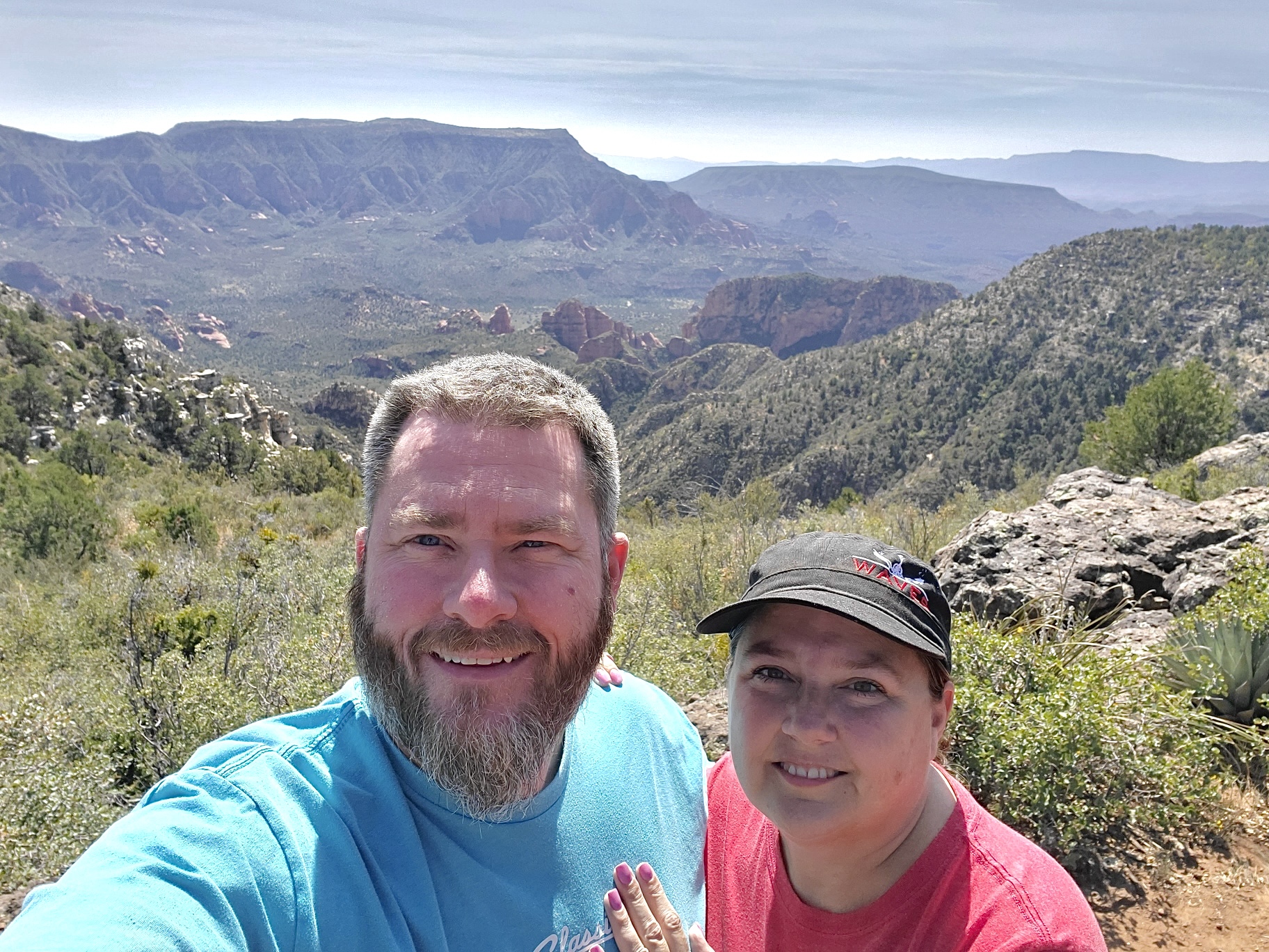
AZBackRoadsGirl and Paul at Sycamore Point
As we head out of Sycamore Point, I mentioned that I wanted to see the JD Cabin and grave at Sunflower Flats, so we make a small detour to this really cool cabin, owned by James Douglas (1820-1884). Also at the JD Cabin, which looks a bit newer than 1884, is an old bunkhouse which had several rooms (the floors are collapsing) and above the main cabin is a log cabin which has fallen down and is quickly becoming part of the forest again. As we explored this gorgeous old cabin and surroundings, I decide to head over to the grave - which we quickly found. James Douglas ("JD") has a headstone there, but I understand his wife is also buried here, without a headstone or memorial marker. These are the places I love to visit - old cabins, old graves, pioneer history in the middle of nowhere. The JD Cabin is in one of the most beautiful settings in Arizona - it overlooks a flowered meadow and is surrounded by huge pine trees - absolutely stunning - I could live there without any hesitation.
James "JD" Douglas Cabin/Homestead
As we leave JD Cabin, I take over the driving - I thought we were done with any crazy off road driving and that I wouldn't even have to be it in to low to do anything on the way out to Oak Creek. Boy was I wrong.
As we head South on FR527, everything seems nice and easy - wide graded roads...then we hit the 527A to the 236A. I'm pretty sure this is some torture route that is used to shake the truth out of people. The 527A was rough in that it was very heavily rutted, and because of this, we had to take it slow. As we headed around Casner Tank and down towards the 236A (which is a road Paul and I have been on before), Kevin radios that he would like to go to the overlooks near Kelsey Spring. Paul and I decide to forego the overlooks as we've already been to many of them in the Sycamore Canyon wilderness area, and we head out.
James "JD" Douglas' Grave Site
The road was long, and at times trying - but we made it. We stopped at Chileen's for dinner, and then headed home to unpack and get ready for work the next day. We had a wonderful time - Paul got to go camping, I realized that I still enjoy it, and we are making plans for more over night adventures!