Sunday, June 13, 2010

Agua Caliente, Hyder, Sundad, Dixie Mine, Arlington and the Gillespie Dam - June 13, 2010

Me and Bailey at the broken Gillespie Dam
So today we did a level 1 backroads trail to a couple places I've already been, and then expanded it to include a full trail I've never been on, as well as a dam and a corresponding bridge that is on the National Register of Historic Places.


Our day started out early - the weather was beautiful (it was a cool 91 degrees in Phoenix yesterday, with some light rain).  We took the old MC-85 (otherwise known as Buckeye Road) to Buckeye to grab the I-85 South to Gila Bend.  As we pulled into Buckeye, I decided to show the troops a neat, little known artifact in Buckeye. 

Hobo Joe - Downtown Buckeye
Hobo Joe.  A giant, fiberglass statue from the old Hobo Joe coffee shops here in Arizona.  It is on private property and stands in front of a meat packing plant, but is still a most interesting piece of history - and it is the only one in existence today...the Hobo Joe coffee shops have been closed since, I believe, the 1970's.  For more information on Hobo Joe, visit Buckeye, Arizona's Historical Places.


After leaving Buckeye, and driving the 30 minutes or so to Gila Bend, I kept reminding the girls to keep their eyes open for the spaceship.  They were glued to the windows of the truck looking for the spaceship in Gila Bend.  Apparently the Best Western Space Age Lodge wasn't as impressive to Bailey as it has always been to me.  Space Age Lodge  Bailey's comments were as follows:  1)  "Mommy, that was stupid"; 2) "Mommy, really - that didn't even look real"; 3)  "Mom, you wasted the whole day making me look for a spaceship that isn't a real spaceship.  Can we go home now?"  My child had no imagination this morning...I thought it was funny.  

We drove on down I-8 towards California, and got off the highway at Sentinel.  It used to be that Sentinel was just a small, dumpy stop on the freeway with an abandoned purple gas station.  Now there are a few mobile homes, and a gas station and store that are in business.  The old purple station still stands across the street, lonely and abandoned.  And very purple.

Pioneer Cemetery - Agua Caliente
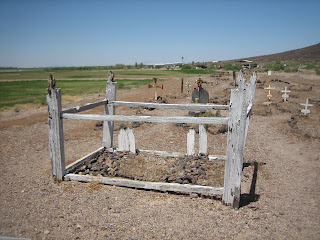
Our first official stop of the day was at the Agua Caliente Pioneer Cemetery.  It is a very well taken care of cemetery, with burials ranging from 1896 through 2007 (at least the ones we could read).  Interesting info on those two graves...same last name.  Possibly related?  Who knows...but interesting, nonetheless. 


There were lots of graves...many marked, and some were obvious, but not marked.  I would assume there are a number of non-obvious and unmarked graves as well.  It is a large cemetery, and is apparently still used today.  There were a number of flags on graves, obviously left over from memorial day.  One small "plot" area was interesting...small graves, and the headstones were wood.  No obvious markings on them at all - no idea who was buried here, but the graves are tiny, and there are two.  One can only imagine the sad possibilities.

Bailey and Quel at the old Agua Caliente Hot Springs Resort
After leave the cemetery, we venture over to the resort itself.  The hot springs, which have since dried up, were used for years and years by the Indian people and the Spaniards long before the white man came and "harnessed" the water.  In 1897, a 22 room hotel/resort was built.  During WWII, a large stone pool was built to help assist in the healing of soldiers.  It was shortly thereafter that the springs dried up due to the farming, irrigating, and other natural and human causes.  The pool is now empty, and is marked "No Trespassing" - the resort itself doesn't have any no-trespassing signs, however, there are "keep out" signs all over the buildings themselves.  We took our pictures of the out-buildings and the resort buildings themselves, and moved onward, as we were just at the start of our trail. 

Hyder, AZ
Hyder Cabins
A mile or two around the bend was Hyder.  Now, I've read that the little cabins out there are steambaths, however, I have no actual proof of this...just what I've read on the internet.  What I do know for a fact is that those buildings are the location of some of General Patton's exercises in the Arizona desert. 

General Patton used several locations in Arizona for training of his troops in WWII.  Again, these are on private property, and we were unable to go in and look at the cabins.  We were a little bummed, because last time I was here there were no mobile homes or other individuals living here and I had hoped to be able to walk around, but such is life...

We now have two girls who are disappointed because were didn't see a "real" spaceship, they couldn't go swimming at the hot springs (even though I told them that the hot springs don't exist anymore), and their slushies are melted.  Life is so hard when you're 7 and 10.  AND, most importantly, we still have several hours of driving to do before we are on the "road to home," as Bailey says. 

Remains of Sundad, AZ
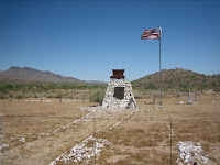
We continued on the graded dirt road (we are in the truck, by the way, not on the quads - it's just too hot for the quads right now) and found the old ghosttown of Sundad.  There is nothing there...just some rocks that outline the name "Sundad", some old foundations, and a number of mine shafts.  Not much is known about the ghosttown at Sundad...except that at one time, it was under consideration to be the location for the State's sanitorium (santitorium meaning tuberculosis hospital).  The girls found it to be very boring (of course), and were getting frustrated with Randy and I's attempts to find SOMETHING to explore.  Well, in all honesty, Randy and I were getting frustrated too...but we forged onward!
Dixie Mine


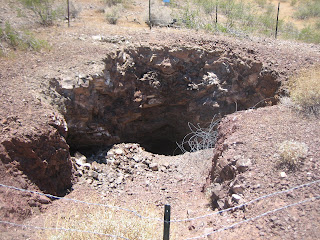
We drove on and on and on...the road was well graded, and we felt certain we would find something interesting.  We saw the 4th of July Butte (named by a group who picnic'd there on Independence Day in the late 1800's).  We saw the Dixie Mine and some foundations there.  We drove and drove.  On the most boring trail ever.  However, it WAS beautiful, and would be fun if we had the quads in order to explore some of the side trails.


Arlington, AZ
Eventually, however, we made it back to the Old Highway 80.  As we drove up to Old Highway 80 (considered a scenic route), we passed a large dairy ranch, recently abandoned.  However, it was green and lush in the valley, as the Gila river was flowing - very full, very wide, and making everything green!  As we turned onto the Old Highway 80, I realized we were in Arlington, an old farming community...there was lots of old, neat farming equipment, mills, and plants.  We enjoyed driving around the small community looking at the farms and old buildings.  It reminded me of driving around Wyoming.  Two story farm houses, barns, out buildings - it was lovely.

Bailey at the Gillespie Dam

I have, however, saved the best for last.  Even the girls would agree with me on this.  I had read somewhere about the breached Gillespie Dam...it was roughly 3 miles South of where we came off the Agua Caliente trail, so we decided to go see it.  As we rounded the corner, the huge Gila river loomed before us, with a gorgeous gravity fed spill dam strung across it, with a 150 foot break on the West side.  We went around the hill on the East side of the river, and as we came through the turn, a lovely old bridge appeared before us!  It was the Gillespie Dam Bridge. 


Steel Truss Bridge
The dam was built in 1921 by a local rancher to replace another structure.  It was built primarily for irrigation purposes.  Because the river crossing was also a major crossing over the Gila river, the predecessor to the Arizona Department of Transportation built a concrete "apron" on the South side of the dam (part of which can still be seen today) for vehicles to go across the river bed.  Then, in 1926 the Highway Department built a steel truss bridge over the river bed in anticipation of the US Highway System formation.  Upon completion, it became part of US 80, and at the time, was the longest highway bridge in the state of Arizona.  The highway was decommissioned in 1956, and then the bridge became a county bridge.  In 1981, the bridge was added to the National Register of Historic Places.  In 2007, it was named by the Arizona Preservation Foundation as one of the top 10 endangered historic places in Arizona.  Due to the deterioration of the bridge, and because it is still basically standing as it was built in 1926, it is in serious need of repair, and in danger of being destroyed in a flood.

Gillespie Dam
In 1993, a 65-year flood rushed through the Gila River bottom, and for unknown reasons, the Gillespie Dam broke - a 120 foot part of the dam fell into the river.  Due to this breach in the dam, and the resulting flood waters, 3 natural gas lines were exposed, and later were severed.  The bridge, however, survived, and was deemed safe for travel after.  There are dirt berms throughout the South portion of the river below the dam in order to assist in the diversion of waters to the canals.  It is possible to walk out there, although it is posted as belonging to a local ranch.  Fishing is discouraged due to the all the chemicals in the water that have washed down from all the farms. 


From across the concrete apron, we could see the mud-swallow nests, and watched the birds flying in and out of their nests that were hanging from the arches of the dam. 


We had a lovely time at the dam, walking around, watching the fish jumping (there are bass, trout and sunfish in the Gila River at this juncture).  The girls enjoyed it, the clouds were overhead keeping it cool, and it was a nice finish to what started out as a mostly boring day!

Mud-swallow nests at the Gillespie Dam

Monday, May 31, 2010

Harquahala Peak Observatory and Harrisburg Cemetery - May 31, 2010


Well, it is getting hot in Phoenix.  We've reached 100 degrees a few times, and Sunday was going to be hot.  But we wanted to get in one last ride before the scorching desert temperatures keep us from riding the quads for 5 months.  So we woke the girls up early, and went out to try a trail we had tried before - one that I hadn't been able to complete because of the steep and rocky terrain, and because I had been on the little quad.  We borrowed our friend Butch's quad again, and we were at the staging area by 9 a.m. or so (later than we wanted, but still early enough to be comfortable in temperature).  We knew it was a short trail (10 miles) but you also ascend roughly 5000 feet in elevation in that short 10 miles.  Up, up and away.


Harquahala Mountain Trail
The ride up was uneventful.  Towards the top, we reached the paved section that I had read about.  The road to the Observatory was washing out, so the BLM (Bureau of Land Management) paved a short section of eroded road that is steep.  I knew we were almost there, and looked up, and low and behold, we could just see the top of the structure over the little ridge.


We continued up to the established parking areas (there are three, with picnic tables, camping areas, and all).  The BLM has put up informational signs and a visitors booklet to sign.  The picture to the left is of the croquet court at the Observatory.
Picnic Area


I suppose I should give you a little history of the Observatory itself. Harquahala Peak Observatory was built in 1920 by the Smithsonian Astrophysical Observatory to measure and record solar activity.


Observatory building


Although deserted now, from 1920-1925 a group of scientists (and one of their wives) lived and worked atop the highest mountain in southwestern Arizona (5681 foot elevation). At the time, it was about an hour's drive from Wenden, Arizona, to the mountain, with a 3-hour hike to the top of the peak. Burros were used to pack building supplies, living supplies and equipment to the mountaintop. Most difficult of all to transport were the delicate recording machines and laboratory equipment. Even water had to be transported by burro until collection tanks could be built.  We read about the life of Chella Moore, the wife of Alfred Moore.  It is  because of Chella Moore that there is a croquet court, a well, a refrigerator, and even a telephone at the Observatory.

Harquahala Observatory in protective metal housing
The "tin shed" that you see now is just a cover to protect the original, two story building at the Observatory.  The original structure, which is, I believe, adobe, is too unstable to allow visitors inside, so the BLM has fenced it, covered the structure with a protective metal "outer" house, and locked it all up. 

We poked around for a bit, reading the informational signs, looking at the well and other items around the Observatory.  We rode up to the cellular towers and looked at the solar collectors, explaining to the girls what they were for.  Then we decided it was getting hot, even up at the top, and that we needed to head down soon.

Noisy rattlesnake

On our way down both Randy and I heard a very loud rattle over the sound of the quads.  We both slammed on our brakes, skidding to a halt.  Up on the ledge above us (but far enough away that we were still safe) was a 2-3 feet rattlesnake.  The girls could even hear him rattling above the engine noise of the quads and with their helmets on.  It was the only snake we saw all day, surprisingly enough. 


The views of the Harquahala Valley were beautiful, but again, we were all getting hot, so we hurried down to the truck.  We noticed that all the sahuaro cactus' were in bloom and looking particularly lovely. 

Then, at the bottom as we were preparing to load the quads onto the trailer, we noticed the flat tire on the trailer.  Not a little bit flat, but completely down.  So there in the hot desert dirt, Randy and I changed the tire on the trailer.  The girls sat in the truck, because of course there was a huge hornet nest by the staging area, and another bee hive over by the bathrooms.  There were stinging insects everywhere, as well as an unbelievable amount of gnats.  I have no idea where the gnats were coming from.  There was no water source...but they were seriously annoying. 
Randy changing the tire

After changing the tire and loading up the quads, we decided to drive into Salome and go look at a cemetery that I remembered from about 15 years ago.  We ate in the car, and asked someone at the Salome bar for directions.  Unfortunately, I didn't realize there were two pioneer cemeteries out there.  The one I remembered was on a well graded dirt road that led back to I-10.  The one we received directions to was, well, not the one I remembered.  

As we drove down Salome Road to what we now know is the Harrisburg Cemetery (we meant to go to the Harquahala Cemetery and mining ruins), I said to Randy "I don't think this is the right road...I don't remember it being this bad."  We came up to a wide river wash crossing.  It looked really sandy, but clearly people had been driving through it, as there were tracks everywhere.  SO - still pulling the quads in the trailer, Randy decides to go across it. 


Ooops.  It was really soft, and really deep.  The wash was maybe 50 feet across.  We made it almost all the way before we finally buried the back tires up to the axle.  We were stuck.  And hot.  Thankfully, we had TONS and TONS of water and snacks...leave it to Bobbi to make sure we have plenty of water and food!

Leaving the girls in the truck (with the air on, obviously), Randy and I unhooked the trailer (after digging out the trailer hitch) and with both quads, we pulled the trailer out of the wash and up to a staging area we had passed just before the wash.  We even tried to pull the truck out with the quad.  But we just dug it deeper and deeper.  We called some friends of Randy's to come pull us out, but it would be at least two hours before they got there.  Thankfully, we had cell service, and were only 5 or 6 miles from town.  I knew all would be okay, because worst case scenario, I would ride both girls into town on a quad and hang out at the bar until someone rescued Randy. 

As we sat waiting, some folks in a couple of UTVs came riding along.  They looked at the truck and laughed and said "are you stuck?"  As it turned out, they were all Salome firefighters who lived just around the corner.  One of them had a large Dodge 4-wheel drive, and went to get it to pull us out.  While we waited, one of the wives offered to take Bailey, Raquel and I up to the Harrisburg Cemetery so we could at least see the Harrisburg cemetery.  As it turned out, we were stuck less than a mile from the cemetery.  So while Randy was being pulled out, us girls went up to the cemetery, and Randy joined us shortly after. 

The cemetery was well taken care of, and at least one of the firefighters was part of the group that put the new monument up in 1985, after the original one had been stolen in the mid to late 70's.  They had lots of stories to tell us, and we enjoyed hearing all about them, and getting a tour of the cemetery.  The town of Harrisburg is no longer, and there do not appear to be any remains, but one of the firefighters said that when he was growing up, there were still covered wagons and buildings everywhere out there.  Now, there are tons of ranches...


On the way back, everyone was taking bets as to whether or not we'd make it across the wash again, but we made it across without even one slip of the tires (we didn't have the trailer or quads attached, which is why).  We loaded up the quads and the trailer, and Randy and I decided to head home...I still wanted to go see the other cemetery, but in light of the fact that we'd had a flat tire and gotten stuck already, we agreed it was best to head home.  On the way home, we got a great invitation to go jump in my mom's pool and have dinner.  What better way to clean up from a hot day riding the quads than to jump in a cold swimming pool?


So today's lesson...always have a spare tire for ALL vehicles, and never underestimate the weight of the trailer with quads.  It WILL drag you down.  Oh, and always carry plenty of water.  More than you need for just your ride - you never know when you might get stuck.  

Happy Memorial Day, and thank you to all who have served our country and keep us free!  America owes you!
Bobbi and Bales

Sunday, April 4, 2010

Battleaxe Trail - April 4, 2010

Battleaxe Staging Area

**UPDATE - 2020** - the Coke Ovens are closed to the public.  Do not trespass.  Do not open the fences.  View them from a distance.  Vandalism has caused the collapse of one.  Leave them for future generations.  

The BattleAxe Trail - sounds ominous, doesn't it?  Not sure you should even take the kids on the trail, right?  The books list it as a difficulty level number 5 (scale of 1 to 10), on the low end of difficult...  As we parked, some nice, older folks in a Jeep Rubicon said the trail is better than the Florence-Coke Ovens trail, but its not great.  "It gets a bit bumpy and rough towards the end" the gentleman said.  I asked if they were going all the way to the Coke Ovens.  "Oh no, we're just going down to the Gila River - the Coke Ovens trail is too rough and too long."


Ha - BattleAxe - Ha.  It didn't even live up to its name.  "Leisurely ride to the Coke Ovens" should be the trail name.  

So, 9:30 in the morning, we head out on the trail after a 2.5 hour drive to a turn off about 8 miles South of Superior.  I'm a little bit tentative about the trail - worried it will get too difficult for me, knowing my past reservations about rough trails.


Start of Battleaxe trail

I have the Garmin GPS out, with each and every waypoint pre-programmed in, and each waypoint name matches the pages I've both copied out of the book (book was too big to take with) and the Google Earth Map pictures I printed.  I'm checking each and every waypoint (remember the Tule Creek Homestead incident?).  After we make the turn into the wash going around the mountain, under Copper Butte, I realize the trail is fairly obvious.


Bailey and Quel looking downright cute as buttons


We splash through the creek bed a few times, and discover the little artisian well, and stop for a break.  Bailey, as usual, starts asking for food.  The child eats like a bird, except when we are out riding, when she gets the biggest, most voracious appetite in the world.  Wants to eat about every 10 minutes.  So we feed the bottomless pit and move on.  


More Bailey and Quel cuteness


We head around the mountain, and climb up to the shelf road.  I'm prepared for our first major obstacle - the "rock crawl" mentioned in several books.  Except this time, I have exact GPS coordinates.  I have the GPS turned on, and I'm watching us get closer and closer on this shelf road on the side of the mountain - deep canyon on the left...  .20 miles - .15 miles - 500 feet - 20 feet - 2 feet - 30 feet - 80 feet - wait - we passed it.  I actually stopped to look for it.  There was no rock in the middle of the road.  None.  Not even sure where it went.


We move on, down into the valley and wash.  This is where it is supposed to get a little tricky - lots of turns, easy to take the wrong one, according to the books.  Again - had no issue at all.  Starting to think maybe the trail is easier than we thought.  We're still cruising along at a pretty fast clip.  Except when we stop to feed Bailey.  LOL


As we climb back out of the wash and away from the Gila River, the trail gets a little more difficult.  What I mean by that is that there are a few more rocks to avoid, and the trail gets a bit more rutted.  In fact, there is one point where I chose to take the right-hand rut, and probably should have chosen the left hand rut.  The fact that I jack-knifed the quad trying to cross the rut (which was roughly 3 feet deep) and jammed the handlebar into my thigh, proved I didn't take the best route.  It's all good - Randy got the quad out of the rut (by brute force and lifting), and we went on. 


The coke ovens


As we got close enough to start seeing the other Coke Oven trail (which we meet up with approximately 1 mile before the Coke Ovens), the trail got really rough.  Four wheel drive and low, and we barreled up the side of the mountain.  I didn't even falter!  Woohoo!!!  My courage was in over drive, and I felt pretty good about my accomplishment.


The rest of the ride to the Coke Ovens and back was uneventful.  The wildflowers were in bloom, and the desert was absolutely gorgeous.  I was glad to know that my daughter was able to see the Coke Ovens.  I have a deep concern that in 10 or 15 years, they will be closed due to vandalism or because the trails will become completely impassable.  Showing young people the wonders of our past is important.  You need to explain where they came from, what their ancestors went through to give them the kind of life they have today.

Bailey in the North Coke Oven

**UPDATE** - the Coke Ovens are fenced off and private property.  DO NOT TRESPASS.  The oven that Bailey is standing in above has collapsed due to vandalism.  Visitors are no longer welcome at the Coke Ovens.  Go see them - but view them from a distance.  My "deep concern" from above has come true - and it only took 10 years.  People are destroying these amazing items from our past.  

TAKE ONLY PHOTOS, LEAVE ONLY FOOTPRINTS

Sunday, March 21, 2010

Ft. Tule/Tule Creek Homestead and Riparian Area - March, 2010

Ft. Tule Riparian Area

Well, this Sunday's little trip turned out to be a very interesting one, indeed.  Originally, Randy and I were going to take the girls to the Cochran Coke Ovens via the Battleaxe Trail (going in from the East side, South of Superior instead of from the West).  But due to the rains, and because part of the Battleaxe/Coke Oven trail runs along the river bed, we decided it was a bad time to do so...

So - at the last minute this morning, we decided to try the Fort Tule/Tule Creek Homestead and Riparian area North of Lake Pleasant.  It is listed in the Wells book as the easiest of the "Moderate" ATV/UTV trails.  The girls were excited - they saw the pictures and couldn't wait to go see the old homestead.  Randy and I were looking forward to a nice, leisurely ride with some extra time to perhaps go check out Indian Mesa and TipTop and/or Gillette.  


So we head up past Lake Pleasant on Castle Hot Springs road.  Its muddy, and Castle Hot Springs road was closed at the intersection to Cow Creek road.  But we finally park, unload the quads, and head out.  I am the navigator, as usual, as I have the GPS, and I have put in all the way points starting with waypoint 4, which is the first major intersection we should stumble upon.  

North of Lake Pleasant


We ride up the road that indicates "Humbug Creek" - I am certain I know where we are going.  We ride on - its beautiful out.  Because of the rain, there is no dust, and everything is green and bright and beautiful.  I check the GPS - 1.29 miles to waypoint 4.  We keep riding until we reach a gate that has the road closed.  I check the GPS - we are now 2 miles from waypoint 4.  We start realizing I missed a turn somewhere...


We decide to ride back and start over...but as we ride back, we check out a few little side roads to see what is down them.  We go down one, and head down a nasty rock ledge that Randy had to take both quads down.

When we get to the bottom, we stop for a snack, and the rain starts pouring.  Randy rides ahead and realizes we cannot get out the way we came, or the other obvious way out - one has a four foot high rock ledge, the other is steep and Randy almost went over coming down it.

The girls and I wait patiently for about 20 minutes or so while Randy rides down the creek bed.  The girls are upset, afraid we won't be able to get out.  I keep reassuring them we'll make it.  I'm just hoping Randy finds a route I can handle...

Finally, he comes back, and says he found a road out, but that it has a few areas that are going to be iffy for me, but he'll help me over them.  Mostly, he says, we are going to be following a narrow trail/ledge along the edge of a canyon that the river is running in.  We forge ahead...


The little canyon we followed back towards Ft. Tule
The canyon was beautiful.  It was terrifying.  But it was absolutely easier than the alternatives.  About 1/2 way through the canyon, it occurs to me that we may be down an "optional difficult route" listed in the book off the Tule Creek route.  I'm thinking maybe we'll still make it to the homestead, but I'm just not sure.

We make it back to where we can cross the river, and I decide to check the GPS.  And guess what - we are at waypoint 4.  In the book, it clearly says not to take the East route because it is a difficult canyon run back to Lake Pleasant - I was right!  We just came up the "optional difficult route."  Well, with the difficult route already done, there can't be much else that is hard, right?  Right!

We decide to attempt the homestead now that we know where we are.  The route is 99.9% easy, with some low level moderate rocky areas.  We fly through it, and the rest of our waypoints match up perfectly.  As we pull up to the Riparian Area fence, we are all getting excited as we can see the chimney of the homestead.
Green ride to Ft. Tule
Ft. Tule Homestead
The Riparian area was stunning - green, wet, and seemingly untouched.  It has been beautifully taken care of, and it is clear that this riparian area is thriving.  The homestead itself is fascinating - three rooms with a porch, across the "road" is a workshop.  The girls were so excited to actually see the building we saw in the book.  We explored around, we looked at some quartz, we looked at a bunch of mica pieces.  We discussed how gold and quartz tend to be found together.  We snack on the last of our crackers, have a juice or iced tea, and decide to start heading back.  We've already been riding for 5 hours, and we wanted to get back home in time for bedtime.


The ride back was fun, quick, beautiful and uneventful.  There were lots of side roads we wanted to explore, but again, time was not on our side today.  We got back to the truck, loaded up, and headed in to town for Pizza, our usual stop after riding around North of Lake Pleasant.


Today it was so nice to see an area so beautifully taken care of.  Its unfortunate that we have to assign areas as preserves or riparian areas in order to keep people from destroying these natural habitats.  But if, as the sign says, it is our tax dollars at work, I'm more than happy to keep paying those taxes!  What a lovely ride, no dust, lots of fun, a little adrenaline rush, and a beautiful destination!

Saturday, March 6, 2010

Humbug - March 6, 2010


Hey - you Fore Wheelers and Morter Bikes...yes, you...you Morter bikes...you know who you are...

On Saturday, March 6th, Randy and I attended the 4th Annual Humbug Potluck Weekend.  It was glorious.  Humbug is a ghosttown I have been wanting to visit for just shy of 20 years. But it is private property.  You may visit by invitation only.  And by invitation, I mean you have to call Dave and ask permission, then he meets you up there, as there is a heavy steel gate across the entrance, and Dave will unlock it for you.  If you ain't invited, you'd better not be there.  For this reason alone, Humbug is a beautifully preserved ghosttown, with a rich, rich history, and lots to see!


However, due to my recent involvement in the Arizona Pioneer Cemetery Research Project, I was made aware of this very special weekend, once a year, where Dave opens up Humbug to visitors, with an open invitation.  Up until this year, Neal DuShane, founder of the APCPR, indicated that the weekends brought in roughly 30 to 35 people.  This year, Neal and I guessed there were at least 150 people.


My first ever view of Humbug - So excited!


The ride to Humbug was uneventful.  A high clearance two-wheel drive truck could probably make it with little trouble.  High clearance would be the key here, however.  But once we turned the corner past the gate, I gasped and started bouncing around on the back of the quad with eager anticipation of what was to come. 


Adobe bricks at Humbug


Buildings dot the hillside above Humbug Creek, which, due to the rain the past few weeks, was flowing beautifully.  There are buildings propped up with large timbers, there are buildings which appear to be abandoned and starting to fall apart...all are stucco.  All are adobe.  Most are double-stacked adobe walls, meaning there are two walls of adobe bricks with a space between.  Does wonders in the summer to keep the homes cool, and to keep the heat from the fireplaces in during the winter.


Humbug Creek crossing


Dave Burns, caretaker of Humbug, greeted us as we crossed Humbug Creek (about a foot deep, maybe a bit more) and came up the beautiful stone fence-lined entry way past the stables.  After everyone took a few minutes to take it all in, Dave gave us a tour of Humbug proper.  His tour included the incredibly long history of Humbug, which started in the 1880's.  For more information on the history of Humbug, click here.  Neal has done massive amounts of research, and has put together a fabulous history of Humbug.


Bobbi Jo at the "Big House"


Dave spent hours talking to us about the history and everything he knew...he spoke to us of Charles Champie's home (the Champie's are Arizona pioneers, and their name is forever in the history books with regards to ranching in the lower Bradshaws), the 1920's partnership of Pat Fogarty and Frank Hyde (the big house pictured here is Frank Hyde and his family's home - the picture with me at the window is Pat Fogarty's home)


Bobbi at Pat Fogarty's home


Dave spoke about the well, the mill, the different mines, the hardships and the booms.  


Dave invited us to go up to the Pero Bonito mine, which was spectacular.  Periodically worked, the Pero Bonito is a well preserved mine from days past.  It is, however, on private property, and therefore its location and pictures of it will not appear on my blog. 


Columbia
Later in the day, after a leisurely lunch, a group of us chose to follow Neal up to the old site of Columbia.  Columbia was another one of the ghosttowns which had a caretaker, that I had been wanting to see for years.  Unfortunately, this time I was a few years too late.  The site of Columbia proper is now on BLM land.  And the BLM has razed all the buildings in Columbia.  All that is left are the palm trees that used to be on main street, along with some foundations, an old stone corral, and an arrastre.  Across the river is an old stone house rumored to have been a home, a post office, and/or a bar.  Who knows, it could have been all three.  Above Columbia and to the East is the "Gold Road" - a 4-wheel drive road that goes over the hills to Tip Top and Gillette.  This is where we found the sign above.  I will also note at this time that with the exception of one poorly marked BLM road, the roads into Columbia cross private property.  Do not attempt to enter the areas without permission.  Leave all gates as they were found, and respect these areas.  People live up here, and as Phoenix continues to encroach on the areas North of Lake Pleasant, more and more people are roaming around up there...please respect the fact that these areas are privately owned.  Many don't mind if you travel through, but they will if we do not respect the right of way they have given us. 


Back at Humbug at the end of the day, we all said our goodbyes, thanked Dave and Theresa for their hospitality, and started back home.  As the sun set, and we road our quad out, I felt a distinct sense of fulfillment.  I had seen one of Arizona's greatest historical treasures.  And most don't even know it is there.