 |
| Me and Bailey at the broken Gillespie Dam |
So
today we did a level 1 backroads trail to a couple places I've already been,
and then expanded it to include a full trail I've never been on, as well as a
dam and a corresponding bridge that is on the National Register of Historic
Places.
Our day started out early - the weather was beautiful (it was a cool 91 degrees
in Phoenix yesterday, with some light rain). We took the old
MC-85 (otherwise known as Buckeye Road) to Buckeye to grab the I-85
South to Gila Bend. As we pulled into Buckeye, I decided to show the
troops a neat, little known artifact in Buckeye.
 |
| Hobo Joe - Downtown Buckeye |
Hobo
Joe. A giant, fiberglass statue from the old Hobo Joe
coffee shops here in Arizona. It is on private property and stands in
front of a meat packing plant, but is still a most interesting piece of
history - and it is the only one in existence today...the Hobo
Joe coffee shops have been closed since, I believe, the 1970's. For
more information on Hobo Joe, visit Buckeye, Arizona's Historical Places.
After leaving Buckeye, and driving the 30 minutes or so to Gila Bend, I kept
reminding the girls to keep their eyes open for the spaceship. They were
glued to the windows of the truck looking for the spaceship in Gila Bend.
Apparently the Best Western Space Age Lodge wasn't as impressive to Bailey as
it has always been to me. Space Age Lodge Bailey's comments were as follows:
1) "Mommy, that was stupid"; 2) "Mommy, really - that
didn't even look real"; 3) "Mom, you wasted the whole day
making me look for a spaceship that isn't a real spaceship. Can we go
home now?" My child had no imagination this morning...I thought it
was funny.
We drove on down I-8 towards California, and got off the highway at
Sentinel. It used to be that Sentinel was just a small, dumpy stop on the
freeway with an abandoned purple gas station. Now there are a few mobile
homes, and a gas station and store that are in business. The old purple
station still stands across the street, lonely and abandoned. And very
purple.
 |
| Pioneer Cemetery - Agua Caliente |
Our
first official stop of the day was at the Agua Caliente Pioneer Cemetery.
It is a very well taken care of cemetery, with burials ranging from 1896
through 2007 (at least the ones we could read). Interesting info on those
two graves...same last name. Possibly related? Who knows...but
interesting, nonetheless.
There
were lots of graves...many marked, and some were obvious, but not marked.
I would assume there are a number of non-obvious and unmarked graves as
well. It is a large cemetery, and is apparently still used today.
There were a number of flags on graves, obviously left over from memorial
day. One small "plot" area was interesting...small graves, and
the headstones were wood. No obvious markings on them at all - no idea
who was buried here, but the graves are tiny, and there are two. One can
only imagine the sad possibilities.
 |
| Bailey and Quel at the old Agua Caliente Hot Springs Resort |
After
leave the cemetery, we venture over to the resort itself. The hot
springs, which have since dried up, were used for years and years by the Indian
people and the Spaniards long before the white man came and
"harnessed" the water. In 1897, a 22 room hotel/resort was
built. During WWII, a large stone pool was built to help assist in the
healing of soldiers. It was shortly thereafter that the springs dried up
due to the farming, irrigating, and other natural and human causes. The
pool is now empty, and is marked "No Trespassing" - the resort itself
doesn't have any no-trespassing signs, however, there are "keep out"
signs all over the buildings themselves. We took our pictures of the
out-buildings and the resort buildings themselves, and moved onward, as we were
just at the start of our trail.
 |
| Hyder, AZ |
 |
| Hyder Cabins |
A
mile or two around the bend was Hyder. Now, I've read that the little
cabins out there are steambaths, however, I have no actual proof of this...just
what I've read on the internet. What I do know for a fact is that those
buildings are the location of some of General Patton's exercises in the Arizona
desert.
General
Patton used several locations in Arizona for training of his troops in
WWII. Again, these are on private property, and we were unable to go in
and look at the cabins. We were a little bummed, because last time I was
here there were no mobile homes or other individuals living here and I had hoped
to be able to walk around, but such is life...
We now have two girls who are disappointed because were didn't see a
"real" spaceship, they couldn't go swimming at the hot springs (even
though I told them that the hot springs don't exist anymore), and their
slushies are melted. Life is so hard when you're 7 and 10. AND,
most importantly, we still have several hours of driving to do before we are on
the "road to home," as Bailey says.
 |
| Remains of Sundad, AZ |
We
continued on the graded dirt road (we are in the truck, by the way, not on the
quads - it's just too hot for the quads right now) and found the old ghosttown
of Sundad. There is nothing there...just some rocks that outline the name
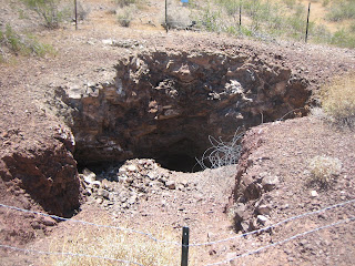
"Sundad", some old foundations, and a number of mine shafts.
Not much is known about the ghosttown at Sundad...except that at one time, it
was under consideration to be the location for the State's sanitorium
(santitorium meaning tuberculosis hospital). The girls found it to be
very boring (of course), and were getting frustrated with Randy and I's
attempts to find SOMETHING to explore. Well, in all honesty, Randy and I
were getting frustrated too...but we forged onward!
 |
| Dixie Mine |
We
drove on and on and on...the road was well graded, and we felt certain we would
find something interesting. We saw the 4th of July Butte (named by a
group who picnic'd there on Independence Day in the late 1800's). We saw
the Dixie Mine and some foundations there. We drove and drove. On
the most boring trail ever. However, it WAS beautiful, and would be fun
if we had the quads in order to explore some of the side trails.
 |
| Arlington, AZ |
Eventually,
however, we made it back to the Old Highway 80. As we drove up to Old
Highway 80 (considered a scenic route), we passed a large dairy ranch, recently
abandoned. However, it was green and lush in the valley, as the Gila
river was flowing - very full, very wide, and making everything green! As
we turned onto the Old Highway 80, I realized we were in Arlington, an old
farming community...there was lots of old, neat farming equipment, mills, and
plants. We enjoyed driving around the small community looking at the
farms and old buildings. It reminded me of driving around Wyoming.
Two story farm houses, barns, out buildings - it was lovely.
 |
| Bailey at the Gillespie Dam |
I
have, however, saved the best for last. Even the girls would agree with
me on this. I had read somewhere about the breached Gillespie Dam...it
was roughly 3 miles South of where we came off the Agua Caliente trail, so we
decided to go see it. As we rounded the corner, the huge Gila river
loomed before us, with a gorgeous gravity fed spill dam strung across it, with
a 150 foot break on the West side. We went around the hill on the East
side of the river, and as we came through the turn, a lovely old bridge
appeared before us! It was the Gillespie Dam Bridge.
 |
| Steel Truss Bridge |
The
dam was built in 1921 by a local rancher to replace another structure. It
was built primarily for irrigation purposes. Because the river crossing
was also a major crossing over the Gila river, the predecessor to the Arizona
Department of Transportation built a concrete "apron" on the South
side of the dam (part of which can still be seen today) for vehicles to go
across the river bed. Then, in 1926 the Highway Department built a steel
truss bridge over the river bed in anticipation of the US Highway System
formation. Upon completion, it became part of US 80, and at the time, was
the longest highway bridge in the state of Arizona. The highway was decommissioned
in 1956, and then the bridge became a county bridge. In 1981, the bridge
was added to the National Register of Historic Places. In 2007, it was
named by the Arizona Preservation Foundation as one of the top 10 endangered
historic places in Arizona. Due to the deterioration of the bridge, and
because it is still basically standing as it was built in 1926, it is in
serious need of repair, and in danger of being destroyed in a flood.
 |
| Gillespie Dam |
In
1993, a 65-year flood rushed through the Gila River bottom, and for unknown
reasons, the Gillespie Dam broke - a 120 foot part of the dam fell into the
river. Due to this breach in the dam, and the resulting flood waters, 3
natural gas lines were exposed, and later were severed. The bridge,
however, survived, and was deemed safe for travel after. There are dirt
berms throughout the South portion of the river below the dam in order to
assist in the diversion of waters to the canals. It is possible to walk
out there, although it is posted as belonging to a local ranch. Fishing
is discouraged due to the all the chemicals in the water that have washed down
from all the farms.
From across the concrete apron, we
could see the mud-swallow nests, and watched the birds flying in and out of
their nests that were hanging from the arches of the dam.
We had a lovely time at the dam, walking around,
watching the fish jumping (there are bass, trout and sunfish in the Gila River
at this juncture). The girls enjoyed it, the clouds were overhead keeping
it cool, and it was a nice finish to what started out as a mostly boring day!
 |
| Mud-swallow nests at the Gillespie Dam |


