Sunday, May 3, 2020

Cabin on the Agua Fria, North of Table Mesa Road

The Cabin - Photo Credit to Paul F.
So today's little jaunt required Paul's driving abilities - and his FJ.  The VooDoo beast - the one that makes Calamity Jane look like a mall hopper (shhhh - don't tell her I said that). We have seen both on Google Earth and on Facebook a cabin on the other side of the Agua Fria River, north of Table Mesa Road, and we wanted to explore.  So we did!  With a cooler full of snacks, a full tank of gas, and armed with cameras, we decided to head up to Table Mesa Road just North of Phoenix for some off-roading fun!

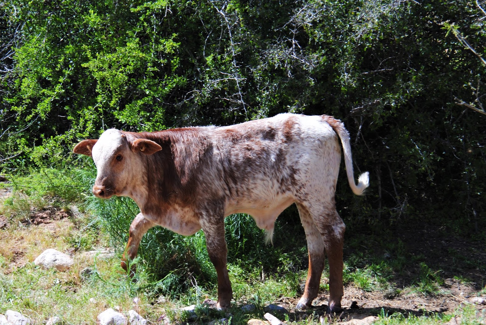
Obligatory Ninja Cow
The Agua Fria River off of Table Mesa Road is the play ground of many off-road enthusiasts.  There's water, there's sand, there's mud, there's rock crawling.  You name it - it's there.  And on Table Mesa Road itself there are tons and tons of places to go shooting (people - really - clean up your mess - it looks terrible out there), and some fun side trails to explore.  

Years ago - before they built the new Waddell Dam at Lake Pleasant, you could cross the Agua Fria River at Table Mesa Road, and jump to the other side and head to Indian Mesa, and many other fun exploration areas such as Tip Top and Gillett, just to name a few.  But since the new Waddell Dam was put in place, the reach of Lake Pleasant has backed up into the Agua Fria making it unsafe for crossing and it is frequently gated off at the crossing (I haven't seen the gate open in probably 20 years).  So people have gone North to other crossings - other places to get across the river and into the Bradshaw foothills (yep, here we are again - in the Bradshaw foothills!).  

As Paul's VooDoo FJ championed the trails by the Agua Fria, and I navigated (successfully this time!), we headed up to this cabin.  Lots of steep hill climbs and some tight turns, but Paul and the FJ handle them, and I don't even so much as squeak.  Of course, the up side of the mountain is on my side - but whatever.  Let's not talk about that right now...  Paul has been on part of this trail already - he pulled his little camping trailer up part of this.  Then we got to the part he hadn't been on.  A very steep incline, with an equally steep climb on the other side of the little gulley.  Paul walks it because we can't see over the top of the other side, and comes back and puts the truck in Go - and we're off!  

In all fairness - this picture doesn't do this justice.  It was MUCH steeper than this appears, altho there was no hesitation on Paul's part - or on the part of the FJ.  And again - I didn't even squeak.  At least I don't think I did.  Let's pretend I didn't...

As we navigate several back road trails with our Gaia App, we come to the stopping point.  We knew we would likely have to hike in a bit - and we did - we bushwhacked it a tad.  There was a very faint trail, but mostly it was stepping over cactus, watching for snakes and being careful not to get shanked by the multitude of mesquite trees everywhere.  Paul took off first to see if we were in the right place while I waited with the FJ - in the air conditioning.  Haha.  I look over, and Paul is telling me something about a Jeep.  I think he's telling me there's a Jeep trail.  But then he tells me to turn off the truck, bring his phone, and come on.  I'm like "if there's a Jeep trail, why in the heck are we bushwhacking in the desert?"  

The Cabin - Note the Jeep Recovery going on below...
Not sure how jumping on the front of the
Jeep is going to get it out...
Photo Credit to Paul F.
So I make my way over to Paul, and I realize it's not a Jeep trail he's talking about.  There's a Jeep stuck in the river below - with another Jeep and a side by side trying to get him out as he buries his tires deeper and deeper...

Cabin - photo credit to Paul F.


We finish hiking to the cabin.  Paul goes down and checks out the cabin - while I stand there watching the attempted Jeep recovery (I literally cannot stop watching this...).  Paul is reporting on what is in the cabin, and I'm reporting all the things that they are doing at the recovery - which is now burying the Jeep deeper and deeper in the silt/mud.  

Jeep buried past the axles...
Paul finishes his exploration - I'm still standing at the top of the hill with my jaw on the ground watching the recovery - I'm fairly certain that this tow strap they are using is just tied to the purple Jeep bumper - and they have the side by side winch hooked up, but they apparently aren't of much use (they don't need to be - the side by sides don't weigh anything near a truck).  Paul joins me while we watch probably 10 people jumping on one Jeep, then the other, as the recovery Jeep gets stuck a couple of times.  We are so engrossed in this recovery that Paul whacks his hand on a barrel cactus, and literally minutes later I hit the same cactus with my hand (prickles in my pinky - ooowwweee).  We move (we're smart like that).  And we continue to stand watching this for probably 30 minutes.  They make some progress, the recovery jeep gets stuck, so they switch to working on it, then the actual stuck jeep - it's slow going.  I find it terribly amusing that we are standing above these folks and by this cabin and they never even notice us.  But eventually we got bored.  And it's hot.  We're standing directly in the sun, and even though the breeze felt nice - there is NO shade up there. So we hiked back (I say hike, but it wasn't very long, nor was it difficult - except for avoiding the stickers and cactus).  

As we head back out, the bumpy trail is fun - I know what to expect, and I'm comfortable with my driver and with his truck...I even took a video of the steep incline/crawl...


The only squeaks to be had today were coming up the road from the crossing by Gillette (we didn't go to Gillette today - just down to the river to have lunch).  I was on the "down" side of the mountain - and Paul told me to just keep talking - keep talking, just look at him and keep talking.  And next thing you know, I'm not looking into the Jaws of Death anymore (okay, I'm exaggerating - the Jaws of Horrific Mangling).  Hats off to Paul - learning my little fears, and rolling with it like a champ!  

It was a short day - and we didn't go far, but it was fun - fun to find something that we had found months ago on Google Earth, and fun to watch a recovery (which I hope was ultimately successful, but who knows right now), and fun to just bounce around the desert for awhile.

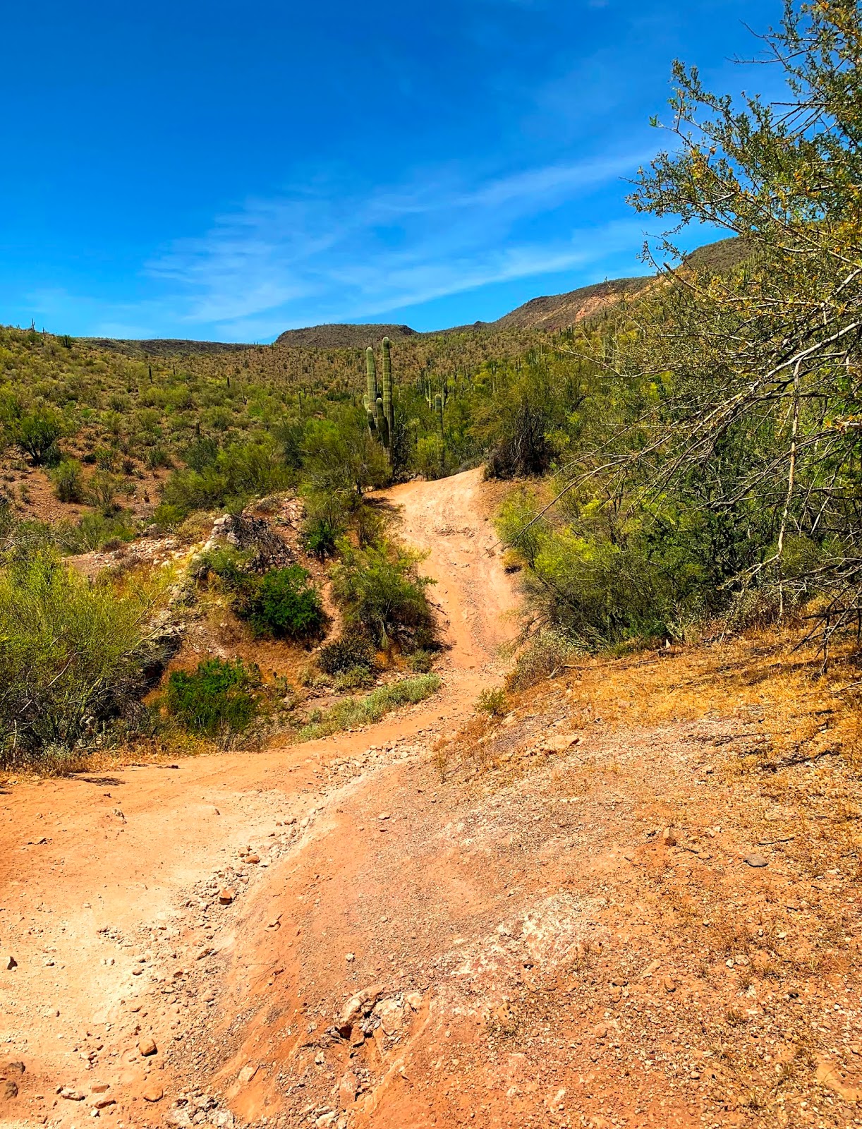
Baby Saguaros off the Agua Fria River

Sunday, April 26, 2020

Adamsville, Arizona and the Gila River Memorial Airport

The FJ Cruiser (now named Calamity Jane) at the Gila River Memorial Airpark
So before I begin this blog - I want to post loud and clear - we were inadvertently trespassing at the Gila River Memorial Airport.  We did not know we were on the reservation - we did not see the sign on the way in (but saw it on the way out after it was pointed out to us - by the Tribal Police).  However, THE GILA RIVER MEMORIAL AIRPORT IS ON THE GRIC ("GILA RIVER INDIAN COMMUNITY") RESERVATION AND THIS IS TRESPASSING.  It is a criminal activity, and you can be arrested and your vehicle impounded by Tribal Police.  DO NOT GO HERE WITHOUT APPROPRIATE PERMITS AND/OR PERMISSION.  The fines range from $150.00 to $4,000.00 and that does NOT include the price to get your vehicle out of impound.  Be careful, be smart.  

Old Watertower at Adamsville


So Saturday morning was an exciting morning for me and my FJ.  First, I need to mention that my baby has a name now - we're calling her Calamity Jane.  I LOVE this name for her.  Well - Calamity Jane got new underwear!  Haha!!  My BudBuilt skid plates came in and Paul and I installed them on Saturday morning (okay, well, mostly it was Paul, but I DID tighten down one bolt on the front plate so I could say I helped - and I fetched tools and ice water!!).  So now I'm feeling like Calamity Jane and I are growing up!!  


Remnants of one of two adobe buildings
in Adamsville - look at the lush farmland behind it!
It was the first day of 2020 to reach 100 degrees.  We were dying, so we spent a bit of time at my brothers cooling down, then we decided to go take a trek down to Adamsville, AZ by Coolidge and Florence.  

Adamsville A.O.U.W. Cemetery Sign
Adamsville was one of the first two towns formed in Pinal County, Arizona.    There is evidence that shows that Adamsville was established along the Gila River as early as 1866.  It was officially established in 1871.  But in 1866, Charles Adams, for whom the town is named, dug some ditches from the Gila River and started watering a quarter section of land that became quite prosperous for farming, and the village/town of Adamsville was born!  In the early part of 1871 they got a post office.  The first flour mill in the "valley" was here in Adamsville.  But it burned down.  Then, in 1900, the Gila River flooded and swept most of Adamsville away...and numerous floods then continued to wreak havoc on the adobe town of Adamsville.  The roadside marker for Adamsville states "In the 1870's, a flour mill and a few stores formed the hub of life in Adamsville, where shootings and knifings were commonplace, and life was one of the cheapest commodities."  

While there wasn't a great deal left of Adamville the town, the Adamsville A.O.U.W. Cemetery was a true delight to walk through, and is clearly being lovingly maintained and restored.  

Adamsville Cemetery
As is normal in pioneer cemeteries, Paul and I found lots of children's graves.  Someone has placed teddy bears and toys at many of them, and out of respect, Paul would turn them right side up and put them with the headstones again.  It's always sad to see so many children buried in one place.  

There are a number of "famous" pioneers buried here in Adamsville - Captain Granville H. Oury - a District Court Judge of New Mexico, Territorial Legislator, Pioneer, Confederate Soldier and hero (with a lovely Confederate memorial); Judge Hiram Bell Summers - first Judge appointed in Pinal County - and was rumored to have sentenced the first man to hang in Pinal County - and when the sentencing came through, the man tried to shoot the Judge!  

Butte View Cemetery

There are some 69 known burials in this cemetery - however it is clear there are many, many more.  The headstones are few and far between.  But it's a lovely little spot with trees lining the North side of the cemetery and thick covering of what looked to me like crested wheatgrass, but who knows.  What I do know is it took my brother's air compressor and tape to get it all off my hiking boots.  


Paul and I wandered slowly around the cemetery - reading all the headstones, thinking about the different people buried their and their lives back then.  We then hopped back Calamity Jane and went over to the other cemetery - the Butte View Cemetery.  

Interesting Grave - Butte View Cemetery
Now - I had read somewhere that the Butte View Cemetery had some "witches" graves.  I knew right where they were, and as we walked through the lovely trails that have been carefully created by a restoration group, we headed to the "witches" graves.  Three concrete covered graves surrounded by a white metal fence and white crosses at the top of each concrete cover.  Well - two of them have been identified.  They are Benjamin Morrell and Franklin Morrell II.  I think local lore has gotten into the heads of some people on the internet.  I know that the markings/identifications are recent as the Butte View Cemetery is currently being researched.  

We did find a weird grave tho - with no identification.  I've never seen a grave that is stacked up with bricks like the grave on the left.  The only signage is one asking people not to desecrate the grave (seriously - people - we shouldn't need these kinds of signs - leave the bricks alone - geez).  

Also odd in this cemetery - little white plastic balls nailed into things on the path way.  Paul finally figured out that they are nailed to stumps or other things that one might trip over.  Of course, I tripped over a little branch or something firmly embedded in the trail.  Figures.  There was no ball on it.  

1942 Douglas DC-4 and the 2007 Calamity Jane
At this point, Paul and I figured we were done for the day, so we walked back to Calamity Jane and on the walk back, we discussed if we had time to go to the Memorial Airport.  We decided to do it as it was on our way home and we really wanted to see these planes.  

So after a very long drive into the West side of Chandler, we got to the Airport.  Now, I'd like to mention again that we did NOT see the No Trespassing/Indian Reservation sign on the way in - it IS posted - but we were looking at the GPS and we were looking to the South at the planes that were just starting to appear.  The No Trespassing sign is on the North side of the road.  Ignorance is no excuse for breaking the law - I, of all people, know that.  But it is my excuse for why we were there.  

A 1942 Douglas DC-4
Paul and I went past the old hangar and started out at the grouping of four 1942 Douglas DC-4 (known as C-54 Skymasters in WWII) that have been retrofitted as crop sprayers.  They were beautiful, although I've seen pictures of them years ago when they were pristine - they were SO much prettier when they were shiny and clean.  But unfortunately, when the GRIC took over the airport land, the airplanes sat abandoned.   A few of them still have their engines, but not one has its props.  They are picked clean of everything, and from what we were told, up until a few years ago, this wasn't the case.  
1945 Lockheed PV-2D Harpoon

After taking some photos with the DC-4's, we then went over to the 1945 Lockheed PV-2D Harpoon (also known as a Lockheed Ventura - a twin engine patrol bomber of WWII - the PV-2 was a redesign used for anti-submarine work).  Now I particularly liked this plane - it sat all by itself, and while it was decorated like all the rest with a ton of graffiti, it has absolutely beautiful lines.  But someone has (recently) been shooting at the engine and it appears they busted through the crankcase (thanks to Paul for that information - I literally have no idea what I'm typing - I'm just regurgitating what he told me - LOL).  
Burned remains of the DC-7

After leaving the Lockheed - we went over to the hangar.  We parked outside of the fence, and there were no "No Trespassing" signs, so we went in the open gate to look for the 1957 Douglas DC-7 that I had seen pictures of.  Unfortunately, it was clearly in a massive fire.  It was just a mass of twisted metal, cables and one wing still holding on. I was really sad to see it so destroyed as this was the big plane - the one that still had an interior, and was so much larger than all the others.  Now its barely recognizable - ash and dust over everything.  

In the back of the fenced Hangar area is what appears to be another Lockheed PV-2D Harpoon/Ventura (also burned up inside) and a Howard 500.  

The Howard 500 is the only plane that still has its props - which made for a wonderful picture taking opportunity!  


Paul at the Howard 500
I'm going to take a minute here again to say this is Gila River Indian Community Reservation land.  You cannot be here without permission or permits.  We should not have been here.  

We did have an exchange with a Tribal Police officer, who was very kind and gave us a warning, but said that they have been having a lot of problems with people vandalizing the airplanes, and in fact, the DC-7 had gone up in flames 2 weeks earlier.  He spoke with us about how beautiful the planes were not so many years ago, and I've since read that the Tribe cites tons and tons of people every weekend going out there.  We were lucky this time - and now we will pay more attention.  Who would have thought an Airport in the middle of West Chandler would be on the Reservation?


The Howard 500
So a little history on the airport itself - In 1942, the airport was built as Williams Auxiliary Army Airfield #5.  After the war, it was renamed the Goodyear Air Force Auxiliary Airfield.  In the 1960's, the airport passed on to civilian control as Goodyear Airport, and then as the Memorial Airfield.  There were no hangars there until 1970.  By 1990, the airport was a boneyard - but oh what a boneyard!  If you look at the Google Earth time images - you will see all the planes and Sikorsky helicopters that were being stored there. In 2007, the GRIC regained control of the property, and all tenants were evicted, planes were moved, sold or scrapped, and this is what remains.  

If you are interested in this kind of thing, click HERE for more detailed information and TONS of historical photos of the airport and the planes that were there.  

As Paul and I left the Airport, we felt we had been given an opportunity to glimpse something that most don't know about - and it's practically in our back yard.  I got some great pictures, and all in all felt we had had a great day.

BUT - that's not all!  On Sunday morning I got up and sent a copy of this photo to my mother.  

My 2007 FJ Cruiser - 2020
My mother sent me back this photo:

Mom's 1951 MG-TD Roadster - 1996
I couldn't believe it!  There was my truck in front of what appears to be the exact same plane from 1996 (before the airport was controlled by the GRIC).  Look at that beautiful airplane - and look at the destruction done by human hands.  

I liked how Paul put it - "I kind of feel sorry for the plane and its former glory and how its now a vandalized shell of itself with its life blood spilled out all over the ground."  I don't think it can be said better than that...

Calamity Jane through a mass of twisted wings and tail pieces...

Monday, April 20, 2020

Constellation Road to the Hassayampa River

Monte Cristo Mine - Headframe and Hoist Shed
Southwest Prickly Poppy
One of the last days of the season to comfortably head out before the heat hits - we are supposed to be at 100 degrees next Sunday - so Paul and I took full advantage of our available Sunday late morning/afternoon to go explore a trail we've both been on - but both had missed things in the past.  We decided to head out to Constellation Road, which heads Northeast out of Wickenburg, towards some sites that need to be seen - Sayer Springs Mercantile, the Monte Cristo, Black Rock Mine, the Gold Bar Mine and the Williams Family Ranch.  While this doesn't probably require 4 wheel drive - it will require clearance and towards the end it can get a bit rough - particularly heading up from O'Brien Gulch past the Gold Bar Mine on the return trip.  If you chose to drive to the Black Rock Mine and Cemetery - you will need 4 wheel drive or you will need to hike it - but it's a short trek up Slim Jim Wash - about 1.25 miles from the Constellation Road.  

So we make the turn off by the McDonalds to begin our trek at the very beginning of the Constellation Road. We have on my old 70's playlist and we're singing along to King Harvest's Dancing in the Moonlight as we cruise down the road.  Its a paved road up and past the rodeo grounds and then becomes a very easy, graded dirt road.  It passes the Buckhorn Road turn off (which will dump you out back by Castle Hot Springs - and is a future trek!)

Sayer Spring Mercantile Ruins 2020
"Rick" the dog's headstone - 2009
Just past the Buckhorn Road turnoff (which has a sign), you will turn right into King Solomon Gulch - a wide river bottom very clearly frequented by ATV's and other off road vehicles.  There is a windmill and a corral up against the rocky ridge, and then - barely visible to someone who doesn't know - is the Sayer Spring (also known as Sayer Station) Mercantile ruins.  George Sayers set up his mercantile sometime prior to 1900 as best we can tell.  George Sayers moved his mercantile here from a site closer to Constellation due to the natural spring located half way up the ridge behind the mercantile ruins.  There are two "spring" locations up the ridge - one higher than the other.  One has a small "headstone" rock with a cross and the name "Rick" engraved on it.  There has been some debate amongst the cemetery research groups, but there has been confirmation from the owner of the nearby JV Ranch that the "Rick" headstone is for that of a dog that died.  

Sayer Spring Mercantile Ruins - 2009
I was surprised by the amount of vegetation that was growing up and around Sayer Springs.  If you look at the picture above from April 2020, and then the one to the right from February 2009 (taken, surprisingly, at almost the exact same angle - go figure my eye goes to the exact same photo opportunity every time), you'll note the heavy vegetation overgrowth that has occurred.  Both Paul and I felt that the trees, bushes and flowers/plant were taking it back over.  We used to be able to clearly see the ruins from the "road" in King Solomon Gulch wash, but now you have to poke around looking for the stairs and the door frame.  For as often as this area is visited, I'm surprised by the vegetation.  But the flowers are in bloom right now, and there are purple New Mexico Thistles everywhere, along with California Poppies, Mexican Poppies, and several different prickly pears.  The desert is a shock of color right now!
One of the two springs at Sayer Springs
New Mexico Thistles

On August 11, 1909, George Sayers died from a gunshot wound - a gunshot wound he caused himself  while loading supplies - by accident.  Mr. Sayers is buried somewhere down by Sayer Springs.


A bee in a California Poppy - he's covered in pollen!
After poking around Sayer Springs for a few minutes, we decided to begin the climb out of the King Solomon Gulch and start heading up to the Monte Cristo - the crowning glory of the Constellation Road.  The road is steep, and as we drove along, I told Paul about my first time heading up to the Monte Cristo in the mid-90's.  I took my Saturn SC2 sports coupe - and taking that road today, I can't believe it made it.  Clearance is necessary just coming out of the Kind Solomon Gulch.  The road must have been in MUCH better condition back in the 90's - my Saturn had no clearance at all.  I laugh now because driving up that road, I kept explaining to Paul how I always end up riding on the side nearest the drop off, and why is that, and can't he scoot closer to the mountain and the trail is so narrow, blah, blah, blah.  Paul tells me the trail is wide enough for two vehicles.  I laugh and tell him it isn't.  But if you stop and look - it is.  I just don't like looking out the window into a canyon.  But Paul has WAY more experience driving an FJ than I do - his comfort level is ten times what mine is - and he makes my truck go places I would never dream of taking her.  Maybe someday...but until then, Paul can get his manual transmission fix driving my FJ (lucky me!).

We pop up over the pass, and now the drop off is on Paul's side (yay me!), and we can see the Unida Mining Group mines below us - there are lots of old foundations, and "big ass holes" in the ground.  This is my phrase for mine shafts I can see clearly on Google Earth.  Big Ass Holes.  We decide not to go down to the Unida Mining Group claims as we've both been there, and both of us want to get to the Monte Cristo.

Monte Cristo Hoist
As we round the bend, the Monte Cristo headframe pops into view (see the picture at the top).  Both Paul and I remember driving up to the headframe - in fact, I have pictures of the quads up there.  But the road has been gated and locked, so we park down by the shed overhang and walk up there.  The headframe is abuzz with wood-cutter bees - the black bees that generally leave you alone but are kinda dumb - they dive bomb things.  But they eat wood...and most of the headframe is wood - I wonder in how many years it will be gone...

The shaft itself has a fence around it, as does the hoist shed.  But other than the fence (and the bees - although last time I was up here, I believe the hoist shed had some graffiti on it that says "BEES!!"), absolutely nothing has changed in the eleven years since I've been there.   See the below photos - one from 2009, one from 2020.  Again with taking the same photos - I'm starting to laugh - I have about 20 of these photos right now from 2009 and 2020 that match.

Monte Cristo Headframe - 2020
Monte Cristo Headframe - 2009


There is some debate on when the Monte Cristo was officially first found, so we're going to just start with the facts I do have - the first owner I'm aware of was Frank Crampton in the very early 1900's.  By 1909, per a letter I found from the former superintendent of the mine, Chas. B. Broan, Ezra Thayer owned the mine, and the shaft was 160 feet deep.  Under Superintendent Broan's direction, the shaft ended up at 1100 feet, with thousands and thousands feet of drifts, intermediates and upraises constructed under ground.  A great deal of high grade ore was discovered, but was rarely removed from the mine as Ezra Thayer is famous for saying that he considered his money safer in the ground than it would be in a bank.  Superintendent Broan left the mine after 12 years of work - and in 1926, Ezra Thayer sold the Monte Cristo mine.  There isn't much information until a brochure regarding the Monte Cristo was written by Mining Engineer Francis E. Agnew on November 7, 1932.  In this brochure, he reviewed the geology, the ore reserves, the metallurgy, and recommended that the Monte Cristo would return a large and consistent profit for many years with a very modest investment.  There are stock certificates in existence from the Monte Christo Gold Silver Co from 1935, and there are letters and other filings at the Arizona Geological Survey office.  Note that sometimes it is spelled Monte Cristo, and sometimes it is spelled Monte Christo.  There has been mining occurring at the Monte Cristo on and off since then - almost always with a recommendation that there could be a great deal of silver, copper and gold in the mine.
Looking down the mine shaft - there is water at 150 feet.
Looking up at the headframe from the
mine shaft


Big thanks to Paul for both of these photos - No way was I walking up to the edge of the mine shaft!

Monte Cristo workshed - 2009


We poked around for a bit - we found some old stairs that led to a flat area - likely an office or home, the old workshed is still standing, although there is a great deal of erosion under the concrete pad and I think in another year or two, it may collapse.  

Monte Cristo Workshed - 2020


A jeep pulled up with a mom and her two daughters, and they hiked around looking at all the ruins, then headed back towards Wickenburg (they had no idea what they were missing!!).  Paul and I got back in the FJ, and decided NOT to go down one of the side routes I had plotted.  The road looked better suited for an ATV or some sort.  Not my FJ.  But there's stuff I want to see.  So we'll be back - because THERE'S STUFF IN THEM THAR HILLS!!!


Gold Bar Mine from the North side - 2009
So off we go - towards Slim Jim creek where the former town of Constellation once was - although there is absolutely nothing left of Constellation any longer.  We decided to leave the Black Rock mine for the way back if we have time.  Now we start the climb up the mountain before the Gold Bar Mine.  I've been so excited to take Paul here.  He's seen it from a distance, but never up close, and I told him all about the hoist and other equipment in the shed, and about walking all over the Gold Bar Mine properties - how large and amazing it was.  

It was locked off with No Trespassing signs.  And there was an RV parked down by the work shed.  In a rare moment of insanity on my part, I was wanting to go anyway - but I was talked out of it by my voice of reason (aka Paul).  So I don't have any current close up pictures.   
Gold Bar Mine from the South side - 2020


The Gold Bar Mine was found in 1888 by James Mahoney and F.X. O'Brien with production declining in 1934 - it has been worked on and off since that time.  It was originally known as the O'Brien Mine.  In 1901, the Saginaw Lumber Company put up a 10-stamp mill and reportedly treated some 4000 tons of ore (valued at $60,000).  F.X. O'Brien, one of the original owners, spent time in Wickenburg, but generally lived in Leadville CO and was an associate of Horace Tabor (a famed miner up in Colorado).  He married the daughter of an engineer at the Vulture Mine, and purchased Henry Wickenburg's home.  Mr. O'Brien died in 1926, and his wife turned their home into Wickenburg's first dude ranch.  The mine was being worked as late as 1980 when a Canadian Company took it over, although it doesn't appear much was done.  The buildings down in O'Brien gulch (the stone and adobe buildings) were part of the O'Brien camp - the largest building - a two story stone building - was a stage depot and then was a school house according to the watchman in 1974.  

Gold Bar 10-Stamp Mill - 1930 - Note the little
Concentrate Shed in the lower left corner
(Picture from the Arizona Geological Survey)

Gold Bar 10-Stamp Mill - 2020 - Note the little
Concentrate Shed in the lower left corner!!
The main shaft is 700 feet deep, and there are a number of adits around the area as well.  Pictures exist of the old Mill at the Gold Bar (see left), as well as that of the "Glory Hole" pit.  I have photos of the Mill remains from 2009 and from 2020 - standing in the same place, as usual.  But this time, I'm going to show the difference between 1930 and 2020.  

Now - I'm going to tell a little tale on Paul here.  He parked the FJ so I could take some of these pictures.  And he hopped out.  When I went to hop out, he had parked the passenger side right over a gulley.  I literally had to jump down a foot to get out of my truck.

In addition - this is where we finally put the truck in 4L - because I walked down the road, and listened to Paul spinning the tires backing it out.  I kept looking back at him like "what are you doing to my baby" - but he popped it in 4L, and he took right off.  I guess I'm lucky he picked me up on the way down after the looks I gave him!

We stopped several times to look at different things on the road down to O'Brien gulch.  At the bottom, the old stone house that I had previously been in before was now fenced off.  Although I have a 2009 and a 2020 picture of the house, the tree, and the outhouse.  Standing in exactly the same place!  According to the Arizona Geological Survey, these buildings used to be part of the O'Brien camp - but in 2009, one of them was full of ore samples in manila envelopes.  Hundreds of them.  No idea if they are still there...
Blooming Hedgehog Cactus

At the turnoff to O'Brien Gulch, we start heading North towards the Hassayampa.  We are now in territory I've never been in.  I've heard for years that there was a ranch for wayward teens at the confluence of O'Brien Gulch and the Hassayampa.  As it turns out, there was a ranch there - and one for kids at that.  I've found information confirming it was a ranch for wayward teens, and then I found something even sadder...

The Williams Family  Ranch has changed hands a number of times through the decades.  From 1930 to 1952 it was the Goodwin Ranch, then until 1961, It was the Jenney Ranch.  From '61 to '72, it was the Davis Ranch, sometime in there it was a Ranch Challenge Hallelujah House (possibly '72 to '83), and then it became the current Williams Family Ranch.  The road through the wash and down to the Ranch (which sits just off the Hassayampa) is absolutely beautiful!  

Ninja Cow Baby on the way
up to the Williams Family Ranch
At some point during the ownership of this ranch, a gentleman named Jack Oliphant (yes, THAT Jack Oliphant - if you don't know who he is - he was supposedly a white supremacist and was an early organizer of the paramilitary movement - he was convicted of plotting a robbery of an armored truck, and he attracted much attention due to statements he made regarding the Oklahoma City bombing and McVeigh being a hero)  - operated the ranch for wayward children (the Ranch Challenge).  It operated for several years until the State shut it down.  During the time Mr. Oliphant ran this ranch, there was a dormitory fire that killed three young girls that were sleeping in it.  Adriah Robertson, Esther Voner and Amanda White died in this fire on October 7, 1978.  The following information was posted in The Wickenburg Sun on October 12, 1978.  

Three Young Girls Die
In Ranch Challenge Fire
Three young girls died in a fire Saturday night at Ranch Challenge, northeast of Wickenburg on Constellation Road. They were in a girls dorm, one of the buildings maintained by the Hallelujah People who formerly had their own settlement in Stanton. Dead in the blaze were Esther Voner and Adarah Robertson, both two years old, and Amanda White, 8. A fourth girl was burned in the fire, which broke out while adults in the group were in a meeting in a nearby building. Some of the adults were able to rescue some of the children in the dorm. It was reported the group has no electricity in use yet, and light is by lanterns and candles.
The Wickenburg SunWickenburg, AZOctober 12, 1978, p. 1


Cactus above the BLM Parking area at
the Williams Family Ranch - they are holding on
for dear life!
It's terribly sad to see the lost lives of these little girls due to simple carelessness by the adults.  The little girls are buried on the ridge above the ranch.  But now, the ranch is a pretty little place which clearly occasionally floods - and the BLM has a map and visitors log in the parking area outside of the ranch.  

That being said, Paul signed the log book for us while I went to investigate the map - and then we decided to head up to Black Rock, because Paul remembered a cemetery up there that I had absolutely no knowledge about!  

We jumped back in the FJ, and headed back out, slowly crawling up the mountain - me shouting every couple of minutes to STOP!  Look over there.  Pretty flowers!  STOP!  I want to take a picture of that.  STOP!  Back up.  No pull forward.  A little more.  Now the tree is in the way.  Back up.  

...Poor Paul... 

Orange Prickly Pear Blossom
We made it out, and headed down to Slim Jim Gulch - where we were going to pull off to go up the Black Rock Mine (well, that's what I thought - there wasn't anything there except a tailings pile and old wood from the chute).  We bumped down the pretty little gulch - opened and closed the gate as instructed - and then it got a little rocky.  Then a nasty little incline showed up.  I assumed we were hiking it in from there.  NOPE!  Paul takes my prissy little FJ up this incline - I can't see anything except the sky and the top of the mountain, and we didn't roll or anything!  I was rather impressed with my truck.  Well, and Paul of course.  But really with my truck!!  She was amazing!
Black Rock Pioneer Cemetery

Up at the top, we parked, and Paul showed me the cemetery.  It's a pretty little place - and was restored by the APCRP in 2007.  It was much bigger than I would have expected, and after doing some reading on the APCRP's website, they too think it was much bigger than the Black Rock Mine would have warranted.  Perhaps the Monte Cristo or some of the Constellation folks were buried here as well?  

There were terraced areas that looked to have been buildings - with upright slabs of rock much like at Sayer Springs, and tons of old wood buildings that had collapsed all over.  

We decided to have some lunch here, and hang out for a bit before heading out for the long drive home.  

Black Rock Mine


The Black Rock Mine was discovered by Sam Powell sometime around 1902, and was in operation until 1941 or 1942 when it closed down due to the War.  There isn't much else out there on the Black Rock Mine - and any standing buildings and the ore chute are collapsed.  So there isn't much to see, except the cemetery (and I understand there are more down the "road"), and just mining ruin/trash everywhere.  


And now the time has come to leave - our wonderful and exciting time out discovering things in the Arizona desert was over, and we started heading back to civilization.  We go back over what I think is the nasty little drop - and my FJ is on 3 wheels.  And Paul stops to tell me all about how she's on 3 wheels.  I'm like - go.  Damn it go (I thought we were going to roll).  Then I wanted him to go back up it and let me video tape it coming back down, but I was nice and didn't make him do it.  

The Monte Cristo Mine is one of the first "ghosttowns" I ever visited in Arizona.  There are pictures on Ghosttowns.com from the '90's that I took of the area.  Buildings at the Monte Cristo which aren't even there any more...time changes all, I guess.  

Monte Cristo HeadFrame