Showing posts with label Verde River. Show all posts

Thursday, April 14, 2022

Red Creek, the Red Creek Backcountry Airstrip, and the Verde River...

The Verde River at the start of the Red Creek Rapids
Its starting to get hot in Arizona.  Paul and I haven't been camping since January when we did the Mohave Trail.  We both ended up sick part way through that trip, and we just haven't been camping since.  I mentioned to Paul earlier in the week that we should go camping - and that I didn't care where.  He suggested the Red Creek airstrip and I immediately agreed.  The Red Creek airstrip is a backcountry airstrip that is maintained solely by the pilots who periodically land there.  The airstrip itself is only 1200 feet long, and has a long history of causing small aircraft crashes (6 that I can find info on in the past 15-20 years) due to the unevenness of the terrain, as well as the potential downdrafts and crosswinds of the several canyons coming together.  The Forest Service does not encourage the use of this airstrip, but people use it regularly despite this.  The Forest Service has a brochure on the Red Creek airstrip due to the safety issues.  
Cooking breakfast at Camp 7 Springs - I'm freezing and Paul gave up his jacket!  
We decided to head out on Friday afternoon, not to get to the airstrip, but to get up to Camp 7 Springs in the Tonto National Forest for our first night of camping.  We stopped and grabbed some In-N-Out on the way out of town, and headed down the long FR24 (Camp 7 Springs) road.  We pulled into the dispersed camping area before the sun went down, and although neither of us are fond of dispersed camping areas, we decided to stay put and set up so we would be set up by dark.  We hurriedly set up the tent and got it all closed up because there were mosquitoes everywhere.  Because Friday is an early day for me as well as Paul, by the time the sun had gone down around 8 or so, we were ready to turn in for the night.  The camp area was not crowded, which surprised me.  A nice family with two younger kids and a 9 month old baby showed up shortly before we crawled into our tent, and their kids were thrilled to be camping, obviously!  
Red Creek - absolutely stunning views!
Paul and I watched the stars through the top of our awesome Marmot 6P tent and slowly drifted off to sleep - I vaguely recall asking Paul to turn off the moon because it was so incredibly bright...  Around 10:30 I woke up to the sound of something sniffing around outside our tent.  I assumed it was the family across the way's dog - but no - there was more than one animal, and I could hear their dog whining.  And whatever they were, they sounded BIG.  I tried to get Paul's attention, but he was sleeping the sleep of a man who had never slept, so I slowly put on my glasses and lifted my head to look out the back of the tent, worried we were going to have javelinas or some other large but unpleasant animal.  But there was a herd of horses just standing around, occasionally eating leaves or grass shoots around our tent.  They were avoiding the tent, but they were aware I was sitting there looking at them.  The horses hung around the campsite area most of the night.  Early in the morning when Paul and I first woke up, we were freezing cold (the temperature was 37 degrees outside) and the horses were still around.  We pulled the quilt over us both and we snuggled down and went back to sleep for another couple of hours.  
A grumpy little cow I named "No Face" after the Ghibli Spirited Away character - my kiddo loves Studio Ghibli
We woke up as the sun was just cresting over the ridge behind us - me insisting that I wasn't getting out of bed until the sun was up because I was freezing.  Paul got up, got a jacket, and made me my hot tea and I finally crawled myself out of the tent to make us some breakfast.  Paul bundled me up and he and I set up our camp kitchen so we could make our usual camp breakfast - eggs with onions, tomatoes, mushrooms and avocado (well, avocado on mine anyway - Paul isn't a fan - I know, he is weird) with a side of cherry wood smoked, thick-cut bacon.  By the time we were done with breakfast, the sun was warming us both up and we tore down camp, packed the truck, said goodbye to the family across the way, and headed out for Red Creek.  
More gorgeous views of Red Creek...I mean, you can't take a bad picture here!
The trip up FR24 to FR269 (aka Bloody Basin Road) was uneventful.  We then traversed Bloody Basin for a few miles before turning off onto FR18 towards Red Creek.  The road was easy and not at all difficult.  Until we dropped into Red Creek.  Then things got fun.  Lots of big rocks to crawl over, huge trees with root systems sticking out everywhere, more rocks to crawl on, and lots of sand and water.  Red Creek flows along a stunning green canyon and the road through it to the Verde is full of stunning views!  So much green in a red dirt canyon.  Absolutely gorgeous!
The rock obstacle on the way to the Verde
Another beautiful view - until you see the dead cow on the left and all the turkey vultures.  It smelled terrible...
As we came to the first obstacle (a big gnarly tree with a huge root system you had to maneuver around), we saw a young man with a canoe and a kayak.  He seemed to be by himself, and there were no vehicles around (there had been a few up at the top before we dropped into the creek).  We asked the young man if he was okay, and he indicated he was, so we proceeded on.  After the first obstacle, we then dropped into Middle Red Creek (which Red Creek flows in to).  At the confluence of the two creeks, we saw another man with a kayak.  He waved, so we stopped and rolled down the window and he asked if he was headed towards the Verde, and we said yes, but that it was 3.1 miles away.  He said okay and went back to walking...with the kayak.  
Getting ready to do some rock crawling to the right there...
On we went, over the obstacles, through some fun tippy spots, and then we finally came out of the creek at the Verde River - right at the Red Creek Rapids.  We were so excited to be the only ones there, and we were able to set up right by the river so we got the rustling of the cottonwoods, the sound of the rapids and the cool breeze that runs up the canyon.  We set up camp, then decided to drive up to the air strip.  The trail from the Verde to the airstrip up on top of the mesa is sketchy and has been washed out and repaired, but there are a few spots where we were dangerously close to the edge.  Like if I had opened the passenger door to step out I would have fallen 50+ feet straight down.  I held my breath and Paul, as he always does, navigated the Lewis & Clark right up and over everything safely.  
While this sign states that this is part of the Matazal Wilderness, that is actually across the Verde...
The fire pit, picnic tables and horseshoe pits.  Behind the bush to the right are the tools to maintain the airstrip.
Looking east down the airstrip.  All takeoffs happen this direction.  
The windsock, which I was shocked was up and flying.  Everything I've read stated it may or, more likely, may not, be flying.
We were surprised at the airstrip.  You cannot see it until you are right on it due to the brush being so tall out there.  On Google Earth, the mesa looks like a giant flat surface without much on it, but in reality, it is heavily covered in desert brush and the airstrip is even rougher than I expected - particularly at the east end where the planes touch down and take off.  Pilots have done an excellent job in keeping it fairly groomed, and there are tools out there to rake and groom the strip with.  There is also a picnic table and a set of horseshoes.  Paul even threw a ringer!  Other than that, this desolate little airstrip is just a red dirt strip in the middle of nowhere.  
Be sure to watch this one all the way through!
The Lewis & Clark at our campsite right next to the Red Creek Rapids on the Verde River.
One of the best campsites we've ever experienced!
We went back down to our camp site just as a group of ATVs and side by sides showed up.  They came down to enjoy the river and we took our chairs down and sat in the river and talked with them for a few hours.  They indicated they too had seen the kayakers/canoers/hikers and had spoken with them for a bit.  They were still headed this way, and were expected at the Verde around 2 or 3.  
The super-impressive group of canoe/kayakers!  These folks have some serious stamina!!!
I decided to take a short nap, and it was short...we had put the fly on the tent this time to help keep us warm, and it was working - a little too well - so out of the tent we went, and back down to the water.  Just as the kayakers and canoers had shown up.  We sat down and chatted with them for a bit.  They indicated that they had thought it was a 1/4 of a mile hike - not 4 miles - from their parked trucks.  I felt so bad for them - they had two full size canoes, and three or four kayaks.  They CARRIED THEM THE ENTIRE 4 MILES THROUGH THE CREEK.    But they were all such good sports about it, and were raring to get on the river.  I took a ton of pictures of their take off - they were heading down to Sheep's Bridge, which is roughly 7 miles as the crow flies from where we were, but is more than 20 "river miles" down the Verde.  They planned to set up camp somewhere along the Verde around 5 or so, then finish up on Sunday.  We wished them well, took pictures as they left, and then we had one last grouping of visitors - three Jeeps and a quad.  
Dragonflies were everywhere...and my new phone takes amazing up-close photos!
After they left (around 4 or so), it was just me and Paul for the rest of the evening.  It hasn't quite cooled down yet (and Saturday was a hot day!  It was in the 90's), so we sat in the truck for a bit having some coffee/tea and listening to the Sirius Radio 1940's old radio programming.  We listened to the Jack Benny show and to Tom Corbett's Space Cadet show - where I learned that for $0.25 and the box top to some Kellogg's Pep cereal I could get some space goggles too!  I made us some steak and stuffed mushrooms and we listened to another weird and creepy show called Lights Out - Sub-Basement.  Paul built a fire as the sun had gone down and the chill was setting in, and it was glorious - the rush of the river, the jostling of the cottonwood leaves, and the crackling of a fire.  
We took a bit of time to cool off in the river...
Apparently just sitting in a chair wasn't enough for Paul - he needed to play king of the rock...in the middle of the river.
We fell asleep warm and cozy in our tent - the fly on, but the two fly doors opened so we had some air flow and could hear the river.  We both slept incredibly well - I'm not sure I woke up at all.  Around 5:30 in the morning Paul was wide awake (and apparently had been for a bit), and as I rolled over, he decided it was time to get up.  I said sure, then promptly waited for him to exit the tent and I sprawled across our sleep mat and tried to get another 15 minutes in while he made tea and coffee and got the fire up and going.  
An extremely healthy and beautiful ocotillo 
Cactus blossoms everywhere - this is a Hedgehog Cactus blossom.
The rock obstacle on the way back from the Verde
I finally got up, and made our breakfast.  We packed up camp, said goodbye to one of the best camp sites we had ever had (and we both agreed on that) and headed back out Red Creek.  We didn't see a single soul coming out of Red Creek, and the drive out on FR269/Bloody Basin Road was uneventful until we were almost at the Horseshoe Ranch, where there were a number of vehicles/dirt bikes stopped and the people were looking over the edge of the road.  As we pulled up, we saw a Prius had gone off and was clinging for dear life to a tree - the only thing holding it from rolling all the way down into the canyon.  It had to have just happened because the windows and body panels were all still intact.  In Arizona, everyone and their brother feels a need to shoot up vehicles left on dirt roads...so we knew this was a recent "accident."  There was nobody inside, and the car was locked, so we left it.  
Someone took a Prius where it shouldn't have gone...
We aired up by I-17, and then went down to Chilleen's on I-17 for our usual bite to eat.  We were home before 3, cleaned out the truck, showered, and spent the rest of the day just relaxing some more.  
Traversing part of the Great Western Trail
It was an amazing weekend.  We saw deer, horses (up and close!), lots of cows, some fish and had a stunning campsite.  We met some people who were truly impressive (who carries canoes and kayaks 4+ miles?  Rich and his gang do...) and all in around just had a truly relaxing and beautiful time.  No phone service means the only thing I used my phone for was pictures - and the setting was so amazing, the pictures don't even do it justice!
Sunrise on the Verde River
Big thanks to Paul for letting the Lewis & Clark get totally AZ Pinstriped, and for having the confidence to crawl over some of the stuff we crawled over.  As always, he got us out safely!  One of the best 4X4 drivers I know.  My Dad, my brother, and my Paul - fearless but not stupidly so.  Just breathe baby, breathe...
Sunrise on the Verde River

Monday, July 6, 2020

100 Miles of Dirt - Verde River Hot Springs and Bloody Basin Road

Verde River Hot Springs Resort Ruins
So it's a rare thing when Paul and I both have a full day off - no working from home, no classes to teach, no trucks to fix...

But Thursday was one of those days.  So we decided to again do a little something that both of us have done SOME of, but neither of us have seen ALL of.  We decided to head up to Dugas Road and off-road in to the Verde River Hot Springs, then head South to Bloody Basin Road, check out a bunch of cabins, and then home.

What a day - a very LONG day...but worth it!

Our day started out at roughly 7:30 a.m. when we left the house in the VooDoo Blue FJ. After a quick stop at Starbucks (because AZBackRoadsGirl loves her green tea in the morning!) we turned on the 50's tunes, and headed North up the I-17 to the musical tunes of Neil Sedaka, Elvis Presley, Pat Boone, and many others!  It was a relatively unremarkable ride up - we stopped at Cordes to get cookies (I know, how does the Girl Scout Cookie Mom forget cookies from the roughly 4 cases she still has at home?) and to top off the tank because we knew we were looking at about 87 miles of dirt road run today and wanted to make sure we were good to go!

Side note - I had to laugh because during this huge COVID-19 mess, I, like a good citizen, wore my mask into the store to use the restroom and then get cookies.  In the bathroom there are signs posted everywhere about washing your hands.  Note you have to hit the button on the toilet to flush it (the auto-flusher wasn't working), the sink was a manual lever you had to pull up and push down to turn on/off.  The soap dispenser required touching, and the paper towel dispenser also required touching.  Lesson learned here?  Always have your hand sanitizer with you!

Paul's Beast - the VooDoo FJ
We settled back into the truck and went the roughly 3 miles up to Dugas Road, and turned off.  As soon as we hit dirt, we stopped and aired down the tires.  Paul told me there were a few rocky spots, but other than that, the trail should be fairly easy and low key.  He forgot about the tight shelf road...that will come in a bit.

We drove across Little Sycamore Creek and through a lovely little ranch area that looked like some kind of old ghosttown - would have been fun to explore if it had been abandoned.  Lots of neat buildings...but we had a long drive ahead of us, so on we went...

There were SO many Golden Agave/Century plants in bloom this weekend.  The blooms were such a bright and shocking yellow...they were everywhere up off Dugas road - but the forest was dry - tons of yellow, dry grass.  We talked about the fire danger, and how many of the National Forests were closing due to fire danger and COVID.  In fact, coming up to Sunset Point, the entire East side of the I-17 was scorched - it was sad.  I know that fire cleanses the forest and rejuvenates the landscape - but these fires are man made and threatened homes and lives.  Be careful people.  It only takes a spark...

Ridge at about 7000 ft elevation
We stopped and took some pictures once we reached a ridge - it was absolutely beautiful - the temperature had dropped 15 degrees or more - there was a slight breeze - the views were stunning!  We continued to climb up into the "mountains" (I say mountains, but to a Colorado/Wyoming girl, these are hills).  And then there it was.  A shelf road.  A tight one - no room to pass, and occasionally required careful tire placement.  In true Paul fashion - before I could even squeak, I heard "Breathe baby, breathe - just look at me - don't look at the edge.  We've got this!"

And he was right.  After a slight hyperventilation moment, I settled in and while I didn't look down, I was able to enjoy the switch backs and some of the fun sights.  The worst part of the trail all day was on the switchbacks - it's a place where Paul has shredded a tire before.  But he navigated the boulders like a champ - and we dropped over the steps like they weren't even there.  Gotta say I'm always impressed with my guy's driving abilities - and his truck.  He makes it look easy.


The old Datsun
And then we came around a switchback and Paul pipes up "there's the old Datsun."  I was like "what are you talking about?"  And there it was, an old Datsun sedan that had gone over the edge, being held up by several trees.  Made me feel better about the switchbacks.  If we roll down the mountain, those trees are pretty strong!  (Note to self - stop with the extreme worst case scenario planning Bobbi - WTH?).  And also in true Paul fashion, he scales down the side and goes poking around the car.  I stayed with the FJ.  You know, in case it decided to drive away on its own...

We continue through the shelf road, and come up to the "T" in the road that we plan to take south AFTER we go to the hot springs.  Right there at the "T" is a newer Chevy truck - we aren't sure why it's there, but we continue on - until we hit the locked gate.

The abandoned Chevy
Now we've been having a lot of bad luck with locked gates lately.  We are less than a mile from the hot springs and we can't get in.  Sign says there is a camera.  So we turn around and head back to the "T" in the road because we figure we will try coming in from the southern route - which has traditionally been gated for the last few years, but we figured we'd give it a try.  This is how we went from 87 miles of dirt to more than 100...

At the "T" we stop to look at the truck because we notice bullet holes in the side mirrors.  The truck has clearly been abandoned.  The Forest Service has put an abandoned notice on the window.  The radio has been stolen, as has the battery.  The truck is a bit of a mess, but has clearly been there for a bit.  But there's nothing of interest, so we take off south towards the big power lines, which is where our turn off to attempt another route to the hot springs is located.

Houston Creek
On the way, we pass this beautiful little area on Houston Creek - it's all lush and green - Houston Creek is running - its quiet and gorgeous.  It would be an absolutely lovely place to camp...and still nobody on the trail.  Not a soul.

We make it to the turn off, and we start heading in towards the Verde River again.  We follow the massive power lines for a ways while Paul explains about the voltage, the insulators, arcing, etc.  Most of it is over my head, but I enjoy listening to the explanation of these enormous power structures that I see all the time but have never much thought about.  A short shelf road and a few rocky spots later, and we get to the gate.  It's open.  Paul gets out to see if it's been forced open or purposely unlocked.  We weren't able to tell, but because it was open, we went in...and in five minutes or so, we are at the Verde River.  We were at a wide portion of the river, but we weren't sure of the depth, so Paul goes out to see how deep it is.  He makes it across with the water only being thigh deep.  But I'm not overly comfortable with crossing the river, then knowing we have to cross it again further up.  So we park the truck on a little trail, eat some light lunch, then start hiking up the trail towards the hot springs.

Now - note at this point - I've not been drinking much water today, and I only ate veggies for lunch - no meat or anything substantial.  It's hot out.  And we are bushwacking our way up to the hot springs on the west side of the river.  We come to a point where we can no longer go up the river and we HAVE to cross.  I'm starting to over heat, and I realize my blood sugar is dropping (thank you hypoglycemia).  I didn't pack any granola bars, and only two bottles of water.  I change from my hiking boots to my Teva's (for water), and tentatively put my toes in the river (which felt nice after the little walk).

View of the Hot Springs Resort from the
former footbridge footing
So Paul coaxes me across the river - with the patience of Job - and makes me sit down and drink one of the bottles of water.  He hikes ahead a bit to see where we are, and comes back like 4 hours later (it was actually only 8 minutes - he timed it - but it felt like forever - and all the animal noises.  I'm certain they were eyeing me as food.  LOL).  I'm feeling better - there's been a nice breeze, and Paul tells me that after a 4 minute hike we will be able to see the old resort across the river.

Paul in the "swim hole" - aka the Verde River


As we hike up what is clearly part of the Verde flood plain, we come upon a couple of cairns, and we take the little trails to what is clearly one side of the old footbridge across the Verde.  We can see the resort!!  Now I'm excited and I can't wait to get over there...so we continue up the east side of the river, and we come upon this HUGE swim hole right next to where we cross the river.  The river crossing, by the way, is ankle deep and maybe 15 feet across.  Total breeze.  But we decide to swim for a bit - cool off and enjoy the solitude of being the only two people up there for miles and miles.


Paul in one of the hot spring pools
After we've both cooled down, we hike over to the hot springs - which smelled - not like sulfur, but something else.  It wasn't pleasant.  We investigate the caves, the two soaking pools, and we hop in for a quick soak - but not for long.  The water is hot, and the weather is hot - not the best combination.  And we are both wanting to go back and swim in the swim hole.  We take our photos - laugh at some of the "art" and sayings painted all around, and head back and jump in the swim hole.  

After a nice, cooling swim, we discuss our route back - and decide to go up to the Childs Power Road  that heads to the old Childs Hydroelectric Power Plant which we saw bits and pieces of as we hiked up to the hot springs.  It's an easy walk up a road and down past the plant - but the plant is fenced off, so we weren't sure if we would be able to get down to the dispersed camping area (where Paul originally crossed the river and where we intended to cross back).  The fence was down at the Childs Plant, so we got to see some of the plant up close, although it is boarded up and you cannot get in.

Childs Hydroelectrical Facility Building
The Childs-Irving Hydroelectrical Facility was named an Historical Mechanical Engineering Landmark in 1971 and was added to the National Register of Historic Places 20 years later.  It was decommissioned in 2005 and no longer produces power.  Much of the complex has been removed in order to allow Fossil Creek and the Verde River to return back to their natural habitat.  Built in 1908 by Arizona Power Company (the precursor to APS), the complex provided power to mining communities in the Bradshaw Mountains and Black Hills.

The Verde River where we crossed (on foot) by the
Childs Dispersed Campground
Paul and I cross the Verde River at the Childs Dispersed Campground (closed) and got back to the truck, realizing that it's 5 p.m. already, and we still have more than 50 miles of off-road trail to complete - with a couple of stops along the way.  We start heading out - still haven't seen a single person since we turned off the highway - and we head South on FR57 towards Bloody Basin Road.

As we make our way down towards Bloody Basin Road, we stop a few times to look at cabins, or another abandoned car complete with some sort of nest in the engine compartment (a Kia Sorento??  How did that even get out here...).  The closer we get to Bloody Basin Road, the faster we can go as the road goes from a two track jeep trail to a well graded and maintained ranch road.  We go through places like "Yellow Jacket Canyon" - which we decided to avoid due to - well - yellow jackets. 

One of the Cabins
And then Bloody Basin Road came in to sight, and we knew any difficult driving was over.  We've both been down Bloody Basin Road numerous times - but there were some cabins we wanted to explore.  Arizona has a number of old ranch cabins that are out in the wilderness that owners, hikers, horseback riders, and the like leave stocked and ready for visitors.  People are welcome to stay there - you take what you need, leave a little for the next person, keep the place clean.  Many of these cabins run in lines along what would be a cattle or sheep herding operation - and are spaced fairly regularly.  Bloody Basin Road has a number of these - and we visited quite a few.  Some are easier to get to than others - some are blocked off and there are no trespassing signs (we stayed away from those).  I'm not giving any additional information as to the whereabouts, but I will post some pictures here of our find.


Another dilapidated cabin


Bloody Basin Road is the only place we saw signs of humans the entire day on the dirt - one side by side, one pick up truck, and one cattle trailer/truck.  It was a perfect day - just how we like it - me, Paul, an FJ and nature.


Final cabin of the night

As we were heading out of the Agua Fria National Monument area, we found Bloody Basin Road blocked off.  We skirted the barriers and read the signs on the other side - Bloody Basin Road/Tonto National Forest is closed due to extreme fire danger and COVID-19.  We came in through Prescott National Forest, and of course had no idea when we had moved into Tonto - but we took only pictures, left only footprints - so we were good.


As soon as we saw pavement, we stopped to air up the tires.  And we were starving for something more than just veggies and cheese - so I started looking for something to eat on the way home.  It was 9:20 on a Thursday.  I suggested RockSprings Cafe - closed.  Then Chileen's - closed.  Denny's in New River?  Closes at 10 p.m.

So we went to In-n-Out, ate in the truck, then scooted on home...we were exhausted.  It was a long day - but it was amazing - Paul, a VooDoo FJ Cruiser, 100+ miles of dirt, a hot spring, and several historic cabins!  No better way to spend the day - gotta love Arizona!

Me and Paul - Verde River Hot Springs Resort Ruins


Saturday, January 4, 2014

Sheep's Bridge - Upper Verde River - January 4, 2014

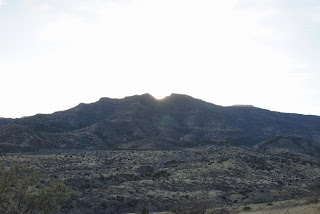
Red Point - Sheep Bridge, Verde River
Been a long time since I've posted a new blog post...life got busy, but I'm back...and with a new vehicle!  I have an awesome Black Cherry Pearl FJ Cruiser - she's my baby, and affectionately called the "Purple Submarine."  Man, Bailey and I are set to go anywhere in this thing...

So this is technically our third off-road experience in the FJ.  The first was our yearly trek to Humbug, and our second was a trip down the Maggie Mine trail - enjoyed both, but this trip was awesome!

We decided to go to Sheep's Bridge via Camp 7 Springs, or FR 24.  It's a long road - 30 miles from pavement to the turn off on FR269, then another 12 miles down what was referred to as a "rough road."  I was told by everyone that my stock FJ could make it no problem, but not to attempt to cross the river (like I would do that without help anyway...).  We also wanted to drive out via Bloody Basin Road, which I had heard was easier than the Camp 7 Springs road.  We wanted Cabot to go, but unfortunately, his pick-up was in the shop, and the "Goes Anywhere Scout" wasn't able to go...We went with a friend in a Jeep so we weren't alone. 

7:30 a.m. sharp we leave for Cave Creek/Carefree - the start of our journey.  I've been down this road many, many times, and always in a 2wd vehicle.  It's always been fairly smooth and easy - and I've been up the road all the way to the County Line.  We had some geocaching to do, so we had some stops planned...

First stop - bathrooms at the Bronco trailhead.  Bailey was playing games in the back seat and got a little car sick because she wasn't looking up...so quick stop to let her stand up for a few, use the last real facilities, and then off we go.

We blow through Camp 7 Springs without stopping - the camp itself is, sadly, still closed.  We went up the road a bit further to our first Geocache - right at the juncture of Table Mesa Road and FR24.  Took a few minutes of bushwhacking to find it, but we did.  Then on to the next stop - a quick find at the County Line.


Refurbished stage coach stop
Now we're on a trail I've never been on.  But it's still graded.  And beautiful.    We stop to look at a refurbished stagecoach stop along the road, but it's on private property and gated off, so we just look and move on. 

Again, several stops for geocaches - having fun, trading items, picked up a travel bug that had been sitting for over 6 months.  And it's still early.  Road is still graded - completely smooth going!


Great Western Trail sign at the Junction
between FR24 and FR269
As we get up to the T-intersection between FR24 and the FR269 (road to Sheep's Bridge - also known as Bloody Basin Road), we stop momentarily to make sure we're all ready to go.  There is a sign there about the Great Western Trail - the 3000+ mile trail from Canada to Mexico.  In Arizona, the trail travels over 800 miles of back roads and trails, and we've just traversed a section of it.  I've been out in the middle of nowhere and come across the trail before...you don't hear much about it anymore, but I find it fascinating (of course, history...).

Now, I've heard the road to the river is decent for the first three miles, but the remaining 9 are supposed to get really bumpy.  There is a brief discussion about airing down our tires, but I'm against it, our Jeep friend is for it.  Ultimately, another pickup says don't do it...so we don't.  On we go into some of the most beautiful country - we hit Tangle Creek and the camping areas are lovely - the smell of pine, and the cool air makes for a delightful drive.  Then we hit the 3-4 mile point.

And...well, I don't think much of it.  It isn't anything more than a well minded Jeep trail.  Plenty of people on it, a bit rocky occasionally, but all in all, fun.  I never even put it in 4 wheel drive. 

And then...we pull off to take a peek at the overlook...and we see it.  The bridge...I can barely contain my excitement.  I've been reading about this bridge for 15+ years...the history, the remote location, the beauty - and it is all of those things!

Red Point Sheep Bridge
The original Red Point Sheep's Bridge was a cable suspension bridge built in 1943 by, I believe, the Flagstaff Sheep Company (I've read differing stories on this) to allow for safe crossing of the sheep that are run from lower Arizona to the Rim each year.  This area was teaming with sheep ranchers, and many sheep were lost each year trying to cross the Verde River, which, until about 5 miles further down river, is one of the last fully uncontrolled rivers left in the state of Arizona.  The original bridge structure was built mainly from salvaged materials, starting with wood and cables, and later reinforced with concrete, and was made entirely by hand - no heavy machinery was used.  The total cost to build the bridge in 1943 was $7,277.  The cabling was more than 1 inch in diameter, and was salvaged from the old Blue Bell mine. 

Concrete buttresses from original bridge

In 1978, the bridge was listed on the National Register of Historic Places as the last of its kind in the southwestern United States.  Unfortunately, in 1988, the old bridge had to be dismantled due to its being weakened from years of service and flooding, and a new bridge, of similar design, which you see in my pictures above, was built.  The only thing left of the original bridge is one of the concrete and wood buttresses.  It's a very imposing structure, and tells of a time when lots of foot traffic was seen on this bridge. 

The current bridge is 598 feet between towers, and 691 feet between anchorages.  The walkway itself is 476 feet long and approximately 3 foot wide.  It crosses high above the Verde River.  High enough that I was unwilling to travel very far out onto the bridge.  My daring daughter and my boyfriend and shotgun rider, Jon, and his girls, went all the way across.


Bailey, Gia and Jon on the bridge
Sheep ranching is no longer carried out in the area, but the bridge is used by hikers, horseback riders and hunters to gain access to the Mazatzal Wilderness. 

After thorough exploration of the bridge and buttress, the girls were anxious to look for the other key point in the area - the Sheeps Bridge Hot Spring.  Down the side of the embankment, and across a short meadow and into the reeds, is a concrete tub which people have built, guiding hot springs water down into the tub, and then it flows out the other side.  The Verde river has many hot springs along it, and in fact, this is just down the river from the famous Verde River Hot springs site, which used to have an old resort at it.  But that is for another trip...
Hot Springs "Tub"


Down to the hot springs we went, slipping and sliding through the mud.  While muddy, it was not "dirty" - it was very nicely kept, and the water was clear and beautiful.  We let the girls get in up to mid-thigh for about 10 minutes, but we still had a long drive out, so we made them get out and head back up.  It would be a lovely site to spend a quite evening if camping, and I understand that frequently one finds people bathing au natural - so if you plan this trip, send an adult in to check the tub first! 

As we left the Verde River, there were several other side trips I wanted to make, but due to time, and lack of experience, I decided to leave those for another time when I have my brother with me.  We had had fun, but still had a 50+ mile drive out via Bloody Basin Road...and we didn't know what was ahead of us. 

Three miles into our trip back towards the T intersection, I get a CB transmission telling me we have a big problem.  I stop, get out, and walk back to the Jeep.  The Jeep owner tells me his clutch just gave out.  My heart sinks a bit, as I'm not sure I can pull a Jeep all the way back to civilization.  The Bloody Basin Road is the shorter route, but we don't know anything about it.  The Camp 7 Springs/FR24 route is longer, but easy...what do we do?  We are all crawling around looking under the Jeep, in the engine compartment, etc.  I ask one of the girls to move the clutch pedal around.  Nothing.  I don't see anything...and then it occurs to me if we're not seeing any movement...maybe the pedal has something wrong.  I get in the truck, and it is clear that the issue is in the pedal itself.  It's just flopping all over the place, with no resistance whatsoever.  I follow the pedal stem up, and find that it has become detached from the master cylinder rod.  Hmmm...how are we going to fix this?  I can put it back on, but it keeps popping off. 

I explain our dilemma to the guys, and explain that it would be nice if we had one of those pins - you know, that looks like a bobby pin, but bigger (I'm referencing a cotter pin, but couldn't remember the words) - you know, the kind you use on your trailer receiver piece - which of course, I don't have with me.  I'm thinking I'll zip tie the stupid thing on there, when the owner of the Jeep says "well, I have one.  He pulls his cotter pin off, I pop it on the clutch pin that went through the master cylinder rod, and voila, we are on our way! 

I'm feeling very full of myself and glad I could fix the Jeep and not tow it out.  Little did I know how glad I was we didn't have to tow it out - on Bloody Basin Road. 

The sun setting on Bloody Basin Road
What a beautiful drive while the sun was setting...stunning views, meadows, mountains, hair pin turns everywhere (again, thanking the Lord above we didn't have to tow the Jeep - we wouldn't have made those turns). 

As we make it off the Tonto National Forest land and onto the BLM land, I realize we have about 12 more miles to go, but I think it will go quickly - the Tonto National Forest land was well graded and a beautiful drive.  Well, let me tell you, the BLM apparently doesn't have the money, nor does it care to grade the road.  Clearly, all the recent rain had made for lots of mudding fun for trucks - there were wheel ruts that were, in some places, a foot deep - lots of rocks and bumpy dried dirt.  Four miles of the roughest road we had been on all day.  I was having a blast, but everyone else on the trip was about done.  Well, except Bailey who was, of course, expecting a much rougher ride all day. 

We cleared out of the BLM property, stopped at the facilities at the Horseshoe Ranch, and drove the rest of the way out to the I-17, then high-tailed it home.

It was a sunrise to sunset drive.  Beautiful back country - the beauty of the desert was never more apparent than today.  A little off-roading, a lot of history, and some hot springs fun...a great day for all!

And let's see - I always like to end with a bit of a moral.  Hmm...always check the pedal first.  It might be an easy fix.  LOL