 |
| The xB at the Gila Bend Pioneer Cemetery |
Well, it's hot. If you live in Arizona, you know that already. If you live elsewhere, well, you likely know that as well. It's almost too hot for camping up north, but even if it wasn't, gas prices are hitting everyone hard in the wallet these days. So we decided to have a "paved road" outing on Father's Day. Just me, my guy Paul, and the cute little xB.
 |
| The beautiful and well kept Guadalupe Cemetery |
So we started out our early morning at Lux on Central for Paul's all time favorite breakfast out - Biscuits and Gravy with scrambled eggs and cheese, and a side of bacon. After filling and fueling up, we headed out to the All Souls Cemetery. I, unfortunately, did not take any pictures of this cemetery, but there wouldn't have been much to take a picture of. The All Souls Cemetery/Asylum Cemetery is the State Hospital/State Insane Asylum cemetery. So for the most part, it looks like a long green lawn. But if you look closely...there are row and section markers. A few headstones. Unfortunately, many of the records were destroyed in a fire, and therefore grave locations are few and far between. It is estimated that some 2400 people are buried here...of which there appears to be about 400 or so that there are records for. We drove around the outside of the fencing, and then decided to head off.
 |
| The first calibration target |
Our next stop was to a unique cemetery - the Guadalupe Cemetery. The Guadalupe Cemetery is, in my opinion, unique in Phoenix as it is a Town/City Cemetery, but it appears to be maintained primarily by the families of the deceased. It was immaculate and colorful, and even at the early hour of 7 or 7:30 a.m., there were families there tidying up graves and wishing their fathers love. This historic cemetery of the Yaqui Indians and descendants of Mexican heritage has been around for over 100 years by all counts, and 130 by several others...the land was officially transferred to the Town of Guadalupe by the Diocese of Phoenix (and prior to them, the Diocese of Tucson in 1969) in 1979. As Sugg Homes (developer) decided to turn the farm lands out there into new developments, they agreed to build an iron fence around the 5 acre cemetery and to pave the access road and parking area.
 |
| Nicer and better kept Satellite Target |
The cemetery is bursting with color - flags and other traditional adornments decorate the resting places of loved ones. As the cemetery was bustling with activity, we opted to be more respectful and not to wander around. It is, after all, Father's Day, and I'm sure many were there to spend time with their fathers. It was a beautiful stop and very endearing to see people out tending to the graves of their loved ones.
 |
| Survey Marker at the above calibration marker. |
Next stop was supposed to be a quick hop down the I-10 to Casa Grande. But as per the usual, it was no quick hop. I-10 was closed all the way down to the 202, so we headed south on side roads until we could jump back on I-10 and head down to Casa Grande. After a quick stop at a Dutch Bros for more tea and coffee, we headed off to our first site down here...the Corona Satellite Calibration Targets.
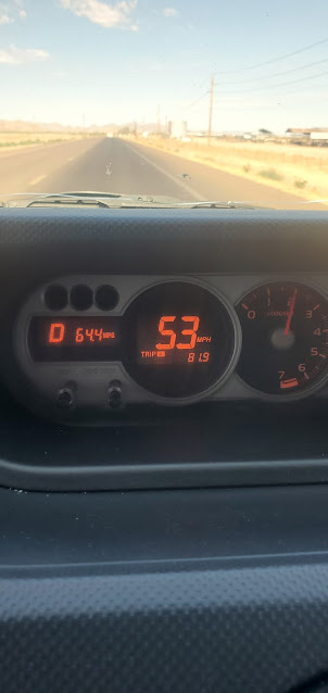 |
| Look at us getting 64.4 mpg in the Scion when we keep the RPM's really low and we drive slow. Hahaha |
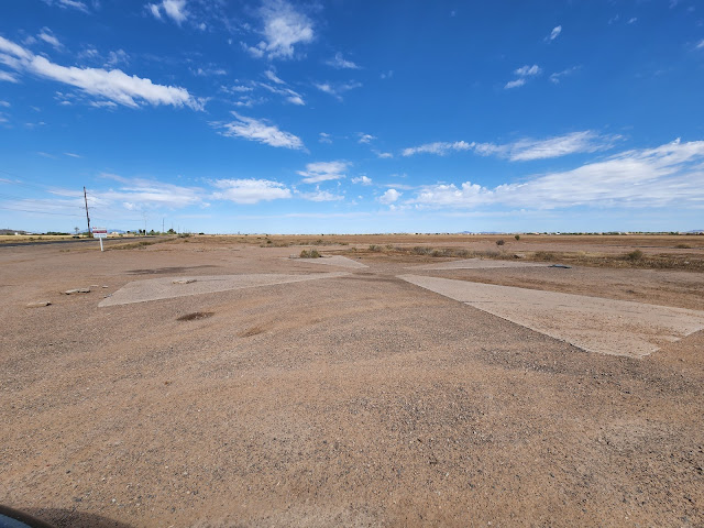
Now, before I start this section of our "tour" - I do want to make mention that I know that the concrete crosses around Casa Grande were NOT used for the Corona project - or any other spacecraft calibration. The were constructed for the calibration of aerial photogrammetry cameras to validate maps. BUT - as is the norm on the inter-webs, there is a TON of false info out there about these. The US Air Force DID use them for aircraft camera calibration, but it wasn't used for space based intelligence camera systems.
 |
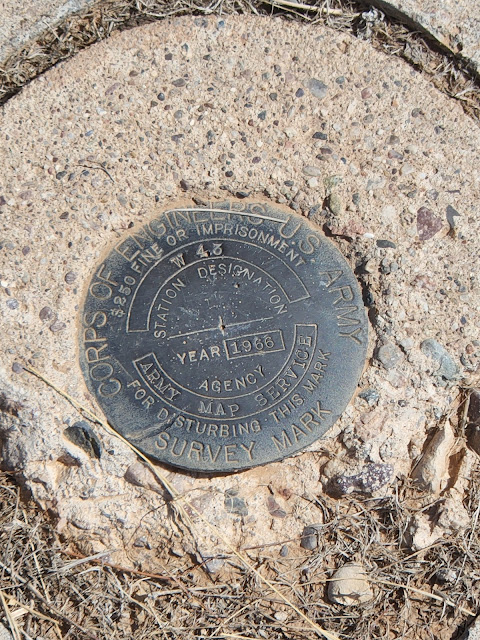
| The best marker we saw on this trip... |
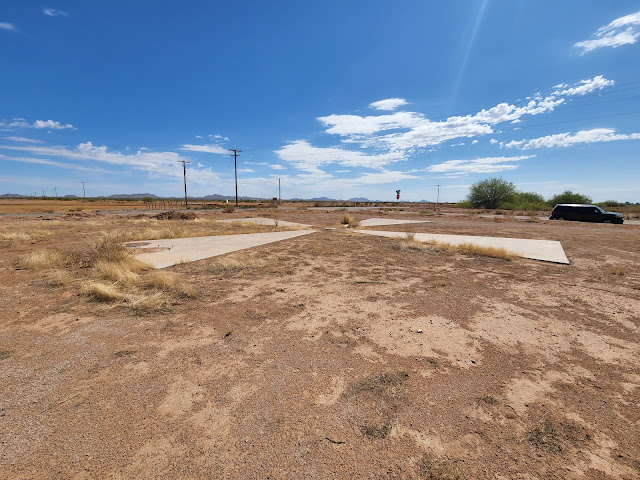
The Casa Grande Photogrammetric Test Range was a 16 x 16 mile grid of 60 foot targets. Each target was spaced approximately 1 mile apart. They provided a fixed spatial grid for photogrammetric calculations for mapping camera calibrations/validation. The targets were maintained from 1959 to 1972, and about half of them are still visible on Google Earth and on the ground.
 |
| A close up of the "manhole" cover |
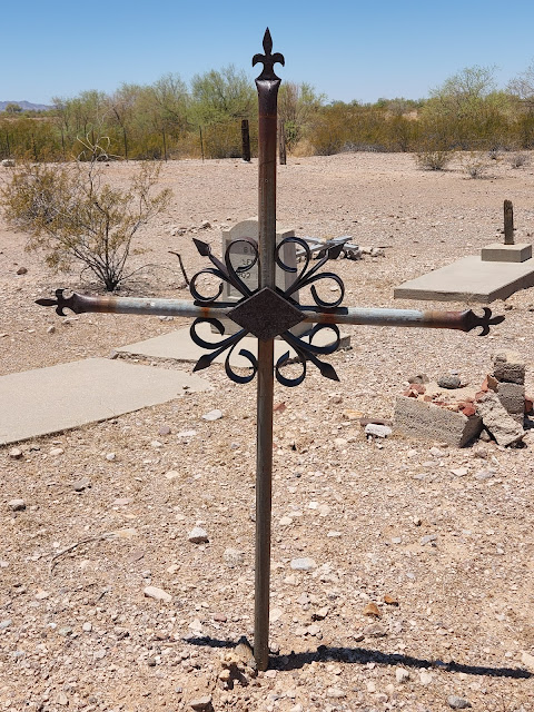
Each of the targets has a manhole on the west arm of the cross and the manhole has a cement cover with still reinforced bars. According to the Cold War Museum, the six pieces of rebar which protrude from the concrete cover were used to hold a laser designator. The targets were abandoned in 1972. I've been to some of these targets many times over the years, but Paul had not seen one up close, so we went to a couple. The first one we went to was not in great condition - but the last one was in great condition! So another check off of Paul's exploration bucket list (and no, we did not visit all 140-something of these targets...but we did visit 4 or 5 on our trip).
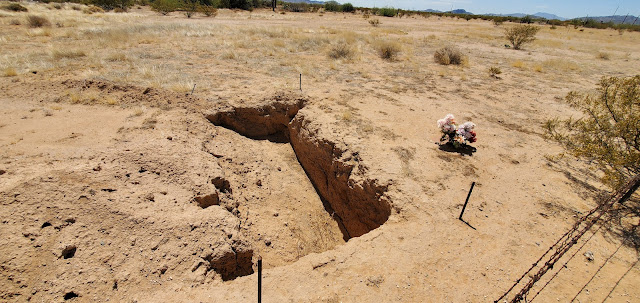 |
| The VERY creepy partially filled grave in the Galilee Baptist Church Cemetery. |
After visiting the targets and the sight of an old slaughterhouse (which was long ago torn down), we headed up to historic Casa Grande, then into Maricopa to catch the Maricopa road out of town and towards Gila Bend. As we wound our way through the southern Estrella Mountains and the southern Sevenmile Mountains, we stopped in a tiny little "town" (town is an overstatement for this town) called Mobile and went to the Galilee Baptist Church Cemetery, also known as the Mobile Cemetery. This Cemetery is a private cemetery, and backs up to an old abandoned hacienda of some kind. It is very remote and appears to have burials back as far as the 1930's. We did not go inside the cemetery, but we did find a grave hole that had been dug and partially filled back in from erosion. Kind of creepy...
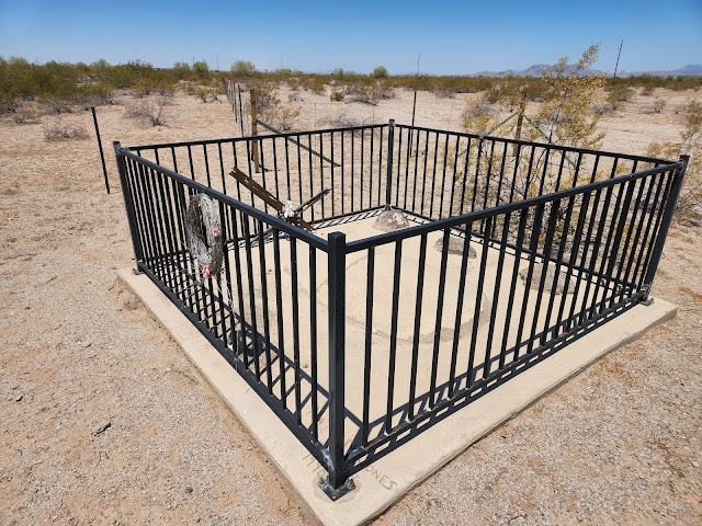 |
| The grave site of little Maria Consorcia Urias at the Bosque Cemetery. |
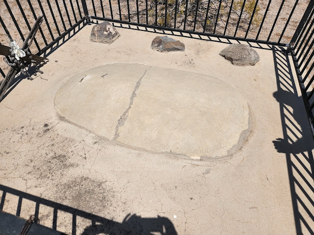 |
| Little Maria Consorcia Urias' grave at the Bosque Cemetery - close up |
We left Mobile and headed to Bosque. Which literally has NOTHING except this grave of a young girl named Maria Consorcia Urias. Maria died on June 24th at 2 days old. A boy scout created the fenced area around Maria's grave, and now it is the only thing you can see of Bosque. There are supposedly two other individuals buried here (per find-a-grave) but where is anyone's guess.
 |
| What appears to be an old schoolhouse in Gila Bend, AZ |
We left the Bosque cemetery and headed into Gila Bend. There were three cemeteries here to see - the first one we went to was the Hee-A-Han Park. We could not find an easy way into the cemetery, so we drove around it and then decided to move on to the more historic/pioneer cemeteries.
 |
| Stout Memorial Park/Stout Cemetery |
Our next stop was the Stout Memorial Park. I have little to no information regarding the Stout Memorial Park, or Stout Cemetery. It is out in the middle of nowhere on the road to Ajo...but it can't be seen from the road. There are graves here dating from the 1920's to the 1980's. There are many concrete tombstones that have been recently updated and placed, along with some of the regularly seen homemade ones. It was a pretty little cemetery in the middle of nowhere - with more tombstones than usual.
 |
| Aquila Guzman's grave at the Stout Cemetery (1891-1920) |
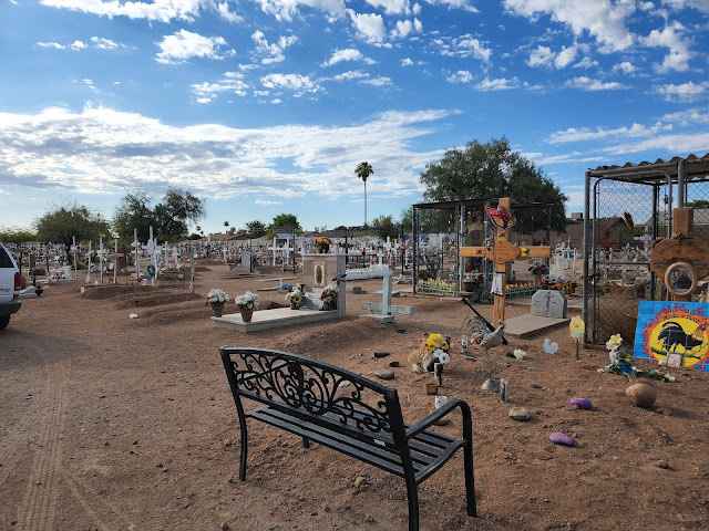
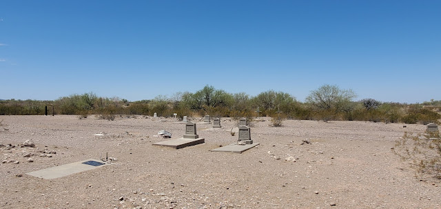
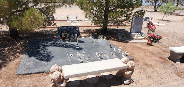
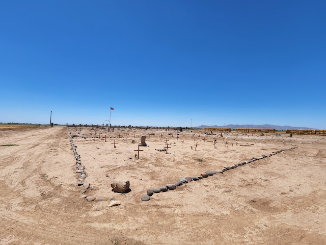
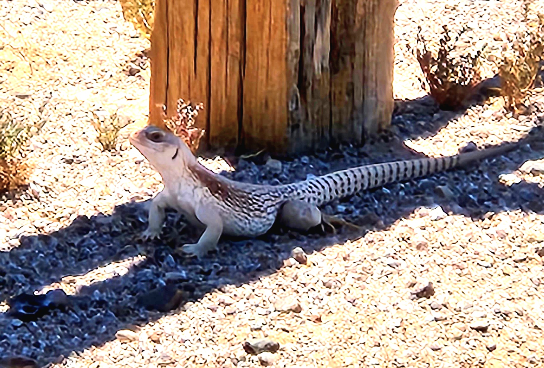
Our last stop in Gila Bend was to the Gila Bend Pioneer Cemetery. The Gila Bend Pioneer Cemetery is still active, and the City is still selling burial plots. It is a lovely and well planned out cemetery, with trees and benches and lots of care taken of each burial site. The oldest grave I could find was 1957, but there may definitely be older ones. We did see a gorgeous Northern Desert Iguana - he was white and brown, and ran SO fast! He was absolutely stunning.
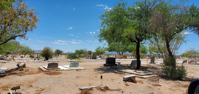 |
| Gila Bend Pioneer Cemetery |
 |
| Gila Bend Pioneer Cemetery |
Our very last stop on our cemetery Sunday was at the Liberty cemetery. The Liberty cemetery is one of the first established cemeteries in Maricopa County. There are over 500 burials according to the records, of which more than 400 have been located and marked. Burials began in this old cemetery prior to 1900, and the last burial was made in 1962. The cemetery is actively being researched and kept up by descendants of the buried and by the City. The founding fathers of Buckeye, AZ are buried in this cemetery...
 |
| Liberty Cemetery |
It was a hot and dusty day, but we managed to get out and learn something! We went to
La Santisima on the way home for gourmet tacos - filled ourselves up, and went home fat and happy - with new knowledge of our state and having seen areas of the state that neither Paul or I had been to.
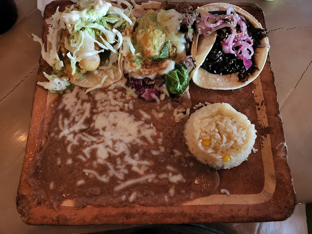 |
| La Santisima taco trio - Shrimp, Carne and Mole - Yum! |
See - there's stuff to do in Arizona - even when it's blistering hot outside.
 |
| Northern Desert Iguana - dipsosaurusdorsalis |


No comments:
Post a Comment