My adventures on the backroads of Arizona - visiting ghosttowns, mines, cemeteries, and any other areas of interest in remote areas of Arizona and the surrounding states. In addition, we are underwater explorers, so you may occasionally see underwater explorations being posted as well! Welcome to my fantastic life! My name is Bobbi Jo Claywell, and exploring is our thing!
Friday, May 7, 2021
The Chiricahuas and the Aravaipa Wilderness Area - Astounding Beauty in the Desert
Chiricahua National Monument
Ahhh - another well planned weekend away exploring areas of Arizona I've never been to...and in Calamity Jane this time! Not much in the way of 4 wheeling, but exploring we did, and new places to further explore were found!
I've always wanted to visit the Chiricahua National Monument inside the Coronado National Forest - I've seen the pictures of the pinnacles/hoodoos and thought they were stunning - and Paul had never been either, so we decided to head down and check out the Chiricahuas and a bunch of other things I had found on Google Earth.
The Historic Gasden Hotel in Douglas, AZ
Friday was a bit hectic - we both worked, and by the time we got home and packed up Calamity Jane, it was already pushing 3:30. We wanted to make Douglas, AZ by dinner time, so off we went. South over the Gila River (note the odd compass thing that Paul had noticed in the past, and we've been watching faithfully for the last few months - the compass on the truck always spins going over that bridge...), through Tucson (stopped for coffee), down into Benson for fuel, down to Tombstone, then we turned off on a road we've never been on on the way to McNeal, and off on an adventure to an area of Arizona neither of us had ventured to.
The opulent marble staircase and stained glass windows
As we pulled in to Douglas, we got excited to see the Gasden Hotel, a historic hotel located in the heart of Douglas. The Gasden Hotel first opened its doors in 1907. It was designed by the famed architect Henry Trost and it was named after the infamous Gasden Purchase - the purchase of 30,000 miles of Mexico by the United States in 1853. In 1928, a fire destroyed most of the hotel, leaving nothing but the elevator car cabin, the marble staircase and the marble columns. The architect immediately rebuilt the hotel, bigger and better!
The light fixture above the marble staircase - very retro and I adored it!
As we entered the Gasden Hotel, the opulence is overwhelming - especially for Douglas - it is a stunning hotel, and I wish we had had the opportunity to stay the night. But we had come for dinner, so we attempted to be seated at the restaurant, and then at the bar, but neither had room. We didn't know that the rest of the town was on take out only, so this was literally the only place at 8:00 p.m. on a Friday night that we could sit. We were disappointed to not be able to eat and explore, and we tried numerous other restaurants, and ended up at Burger King. Which was terribly disappointing, but we wanted to get to a camping spot that night, so off we went - North and East of Douglas into the Coronado National Forest towards Camp Rucker.
First Campsite at Camp Rucker in Coronado National Forest
The road up and into the Coronado National Forest was quiet - we didn't see a soul the entire way in. As we meandered through the low mountains up towards Camp Rucker, we watched for good campsites, but didn't see a single one until we came to the Camp Rucker campground. Which was closed due to COVID. But we drove up the road a short way and found a gorgeous spot tucked back into the trees. It was pitch black and windy, but we got the tent set up, crawled inside and snuggled down in the comforter to go to sleep. Paul slept like a rock. I kept hearing noises. So I was awake half of the night until it quieted down and then I zonked out...typical Bobbi...
Calamity Jane in the Coronado National Forest
As we woke up the following morning to crows cawing VERY loudly - we heard a weird sort of noise - was that a turkey? It was - it was multiple turkeys gobbling all over the place. We laid in the tent listening to them call to one another. We didn't realize it until later, but it is turkey season! And apparently there are quite a few of them. We never saw them - but we sure did hear them. And cows too - we heard cows - nothing shocking there.
Unknown Pioneer Grave at Camp Rucker Campground
It was, of course, chilly - so I made bacon and eggs and we sat in the truck eating while discussing our plan for the day. We decided to head back out the way we came (there was a cabin we wanted to see) and head up to Portal, AZ and then take the back way through Coronado National Forest up to the entrance to Chiricahua National Monument. We packed up camp and decided to go up to the evap ponds and do a little geocaching while it was beautiful and cool out. We went further up the little forest road and easily found the geocache - signed the log and moved on. We stopped at the little camp area to look at the pioneer graves, and then off to Camp Rucker proper to check it out.
Paul in the doorway of the beautiful Camp Rucker barn
Camp Rucker was amazing. It is incredibly well preserved and the signs are very informative. It is maintained by the National Forest Service and interpretive signs are along rock-lined paths so you can read about the history of the area. You can't drive in to Camp Rucker, and it is tucked behind a grove of trees, so unless you know it is there, you don't see it. So we parked Calamity Jane and walked in about 500 feet or so where a gorgeous old barn came into view, with adobe buildings sprinkled across the landscape and a small pond off to one side.
Camp Rucker Side Barn Door
The history of Camp Rucker is well documented. In 1872 the government set aside the southeastern corner of the Arizona Territory as the Chiricahua Indian Reservation. After four years, it closed the reservation and relocated the Chiricahuas to the San Carlos Apache Indian Reservation up north. This, of course, was not appreciated by the natives, and many years of bloody raids occurred because of this. By March of 1978, Camp Supply was established and was maintained by Company C of the 6th Cavalry and several companies of Indian Scouts.
Well preserved adobe house at Camp Rucker
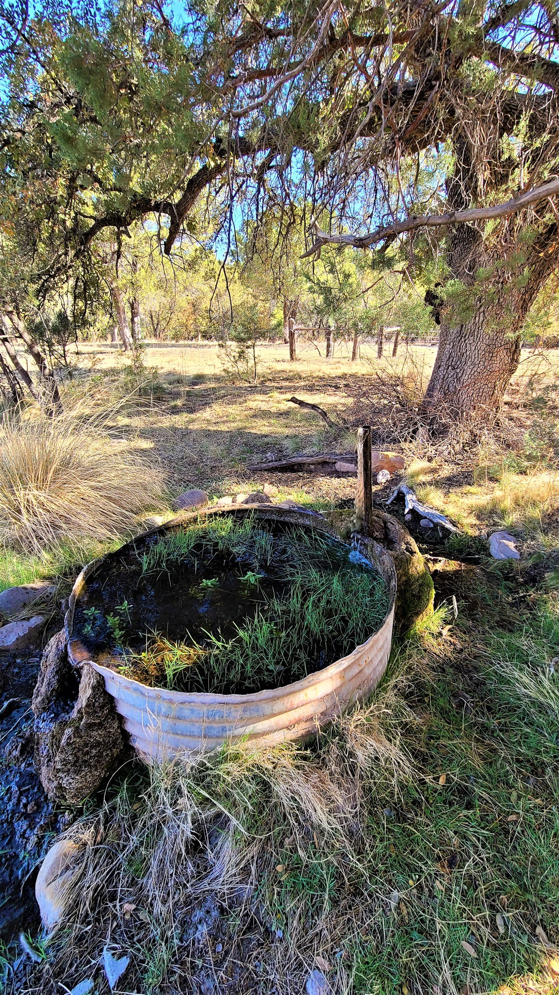
Spring that feeds the ponds - Paul found the valve to turn it on and off
Water tower by the ponds - Camp Rucker
On July 11, 1878, Lieutenants John Rucker and Austin Henely and their Indian Scouts were returning to Camp Supply during a violent summer monsoon. Henely attempted to cross the creek at the White River Canyon and was swept away, as was Rucker who went in to try and save him. The following spring the Army renamed the post Camp Rucker. In September of 1879, Apache Chief Victorio began raiding in the region, and three months later Geronimo and his followers surrendered in the nearby Guadalupe Mountains and stayed four days in Camp Rucker. Chief Victorio continued his attacks...
"Big" house at Camp Rucker - multiple wings - with a gorgeous living room
The living room in the "Big" house - Camp Rucker
Built in corner shelving details in the living room in the "Big" house in Camp Rucker
In 1880, a bakery and commissary were built (portions of both are still standing). The raids began to die down, and in July of 1880, the store closed and most of the troops left Camp Rucker for Fort Apache. Camp Rucker was fully abandoned by the Army in July of 1881.
Random sasquatch sighting...yeah, he's wearing a baseball cap!
The ranch was "claimed" via a squatters claim by Mike Gray, who sold the ranch to artists Theodore and Mathilde Hampe. They improved on the buildings (see the painting on the ceilings in the small adobe in our photos), and then in 1919 sold the ranch to Charlie and Mary Kidder Rak. In 1943, they sold the ranch to Ella Dana, a New York socialite, and in 1970, Ms. Dana deeded the property to the US Forest Service in a land exchange. The US Forest Service has been stabilizing the building remains and they do a marvelous job - the area was absolutely beautiful!
The well preserved adobe home with paintings by the Hampes
We loved Camp Rucker - it was beautiful and well preserved. It appears to still be sometimes used for cattle grazing and round ups. But it was just me and Paul there this day - well, and a few cows and their babies - and it was a beautiful cool morning and an absolutely beautiful little ranch set in the pines.
Small cabin - looks like a ranch hand cabin of some sort
Bear tracks!
But off we went to find another cabin I had seen on Google Earth. We have very little information about this cabin, except for the fact that a gentleman we ran in to that was hunting turkey said he believed it was owned by a gentleman out of Douglas who has been recently killed by illegals. The cabin was lovely, but because it was private property we hurried to get off the property - and on the way we saw a bear paw print! We have black bears in Arizona - but you don't see them much. This print was fresh and the bear had probably been there the night before - and he was big for a black bear. His print was bigger than my hand!
Gorgeous cabin in the middle of nowhere - part adobe part wood frame construction
One of the rooms inside the cabin - the colors were outstanding
But we needed to head out - there was lots to see and lots to do - and next up was a beautiful drive through the southern part of the Coronado National Forest to get to the entrance to the Chiricahua National Monument! So as we head out of the Camp Rucker area and back to Highway 80, we see a weird sign...."Loose Cattle." And our sense of humor get the best of us...
Uh-oh....beware of loose cattle...
"Don't Look Ethel...but it was already too late. She'd already been mooooooooo-ned" Here is a loose cow letting it all hang out - who forgot to teach the cows morals? (Aren't we funny?)
As we drive along old Highway 80, it is quiet and desolate - I'm not sure we even passed a single vehicle. Paul pointed out an odd animal in a field - it was an Arizona pronghorn - but we didn't get a picture. We drive through little one and two building "towns", and head in to Rodeo, New Mexico. Then back in to Arizona towards Portal, AZ. We had no idea the beauty we were about to behold...and I know I've said that there are certain areas in Arizona that I consider to be quite possibly the most beautiful places in Arizona, but this weekend we found more - several of them. One of which is Portal, AZ.
The road in to Portal, Arizona - absolutely stunning.
There isn't much in Portal, AZ - a CCC (Civilian Conservation Corps) cabin for rent, a small campground, and small ranger station that, due to Covid, was essentially closed although volunteers stood outside to talk to people. We stopped to enjoy the stunning beauty of the area, and then headed in to the Eastern Chiricahuas towards Paradise, AZ. Paradise, AZ is a group of cabins and homes built along the canyon walls, but the cemetery was beautiful. Very large, and well disbursed, we spent time walking around, paying our respects as we always do.
Paradise, AZ Cemetery
Wide view of Paradise, AZ Cemetery
As we wound our way through the Southern Chiricahua Mountains on Paradise Road, then FR42, we climbed in elevation and the views were amazing. We stopped for some geocaching, and just took a nice, relaxing drive through an old forest road which really, was good enough for a 2wd car. In fact, because this area is famous for its bird watching, we saw several cars parked in and around hiking trails.
Chiricahua National Monument in the Coronation National Forest
Then we came out on the western side of the Chiricahua Mountains - and into Chiricahua National Monument we went! I've been wanting to visit the Chiricahuas for decades - and I was finally there! It didn't disappoint, although my pictures do not do it justice...the rock pinnacles were weird and beautiful. Such an odd thing in the middle of a forest. But beautiful nonetheless.
Chiricahua National Monument from Massei Point overlooking Sugarloaf Mountain
Paul enjoying the lookout at Massei Point where we hiked
Massei Point Overlook
Pinnacle Up Close
The drive to Massei Point
The Organ Pipes in Bonita Canyon, Chiricahua National Monument
More stunning beauty in the Chiricahua National Monument
We spent a few hours at Chiricahua National Monument, and then realized that we were ahead of our schedule, so we decided to leave and hightail it up to Aravaipa - a ghosttown that Paul and I both wanted to see in the Santa Teresa Mountains north of Wilcox. So after a lengthy drive from the Chiricahuas to Wilcox (via Dos Cabezas) where we gassed up and Bobbi discovered a Starbucks (yay me!!), we headed North towards Bonita, AZ to take a picture of the old store, then up towards Klondyke and Aravaipa. Bonita, by the way, is the site of Billy the Kid's first murder on August 17, 1877 - local blacksmith Frank "Windy" Cahill. I don't know - I've known some "windy" folks myself - don't know if I'd shoot them though!
Wilcox Train Station
Old Bonita Store (note the cool old merry-go-round on the right)
While on our way to Klondyke and Aravaipa, we are in old pioneer country - these towns were established in the mid to late 1800's by homesteaders and miners. Some of the families still live in the area.
Cooking dinner - steak in the pan and stuffed mushrooms in our 1971 Coleman Camp Oven
Stuffed mushroom caps in our 1971 Coleman Camp Oven
But by now, the sun is starting to go down, and we need to find a place to camp. So while we drove higher and higher into the Santa Teresa Mountains we saw smatterings of old mining camps, and finally made it to Aravaipa. But we didn't stop for pictures - we needed to make camp! But we are in some serious mountains here - not a flat place to be found except a corral - and we didn't want to sleep in the cow patties. Finally we found a small flat area by an abandoned water tank, and we made camp. I made dinner (steak with stuffed mushrooms), and we decided to call it an early night. It was dark - and so incredibly quiet. Not even any bug noises...which was weird. But we slept extremely well and woke up to the sun coming up on Sunday.
Paul's breakfast - egg, sausage, bacon and cheese on a bagel thin
Night two camp site - an odd little place - abandoned - but perfect for camping!
As we slowly woke up and made breakfast, we planned out our day - a lengthy visit to Aravaipa, and then we decided to go check out the Salazar church, which I had seen on some abandoned Arizona board I belong to at some point in the past - we had time, so why not? We were a half a day ahead of schedule! Then we had the long drive home...
Aravaipa Townsite from the river bed
Aravaipa big house with smaller stone Firth Residence attached to the right
But Aravaipa! Wow - it lived up to the hype. A beautiful old mining town - Aravaipa was originally known as Dunlap and was a ranch headquarters that was established in 1882. Burt Dunlap was the postmaster from 1883 to 1892. Burt Dunlap also served several terms in the Arizona Territory legislature. The post office was renamed to Aravaipa, after the Aravaipa Apaches, but was then closed in 1893. There were several times the town was revived for mining purposes - buildings were added, buildings disappeared - the old stone building attached to the big house was the original residence of the mining superintendent, Harry Firth. It was built sometime in the very early 1890's. The larger home appears in a photo from 1894, but was not yet attached as it is now. There are lots of remnants, and some standing buildings - although they will likely not be standing for long. I've seen pictures from the last two decades of this place, and the buildings have begun to deteriorate fast as buildings tend to do when they begin to fail. There are buildings that are nothing more than a pile of wood and debris...but the it is so beautiful up here one could see why people might want to live there...even if there wasn't a mine! So here are a ton of photos from Aravaipa townsite...
The Aravaipa Big House with the falling wrap-around porch awning
Aravaipa Big House - West side
Aravaipa Big House bathroom with sailboat decals on the wall and tiles lining the tub
Paul standing in the South doorway of the Big House taking photos of the photographer
Aravaipa Big House linoleum tile details
Aravaipa Big House living room - I wonder who sat here?
Aravaipa Big House - under the awning is an old double stove!
Old stone house - original home of Harry Firth, mining superintendent - now part of the big house
Paul looking out of the wood building - the big house is to the right
Old wooden building - house, shop or storage?
Wooden building - soon to fall down - the North wall is almost separated from the rafters
The wood building from the North looking South
The Panama Mine at Aravaipa - a lead and zinc mine
Always being watched - this big guy flew out of nowhere and startled us. I think he's a barn owl
We spent several hours at Aravaipa exploring and enjoying all the remnants of an old mining town, less disturbed than most. I took several hundred pictures here - so much to see. And we want to go back - there is more that we didn't even make it to on this trip!!
But we decide to head down to Aravaipa Road and head West towards Aravaipa Wilderness Area. No idea what lies ahead, but we know the old Salazar family homesteads, cemetery and church are there. So as we bounce our way back down (we still aren't in 4L nor have we aired down - this trip was a breeze in terms of "off roading") we admire the beautiful view of the Santa Teresa Mountains, and we talk about the power lines strung all the way up from Klondyke. They obviously had power at Aravaipa at some point (I think it was officially abandoned in the 1950's), but the power possibility is still there - Paul checked!
View from the Aravaipa Town road looking out over the Santa Teresa Mountains towards Mt. Graham
We didn't know what to expect when we got back down to the road heading to the Wilderness. We stopped at a Forest Service kiosk and discovered we were heading into the Aravaipa Wilderness and Turkey Creek Wilderness areas. Lots of abandoned homesteads (many belonging to the pioneering Salazar family), six or seven creek crossings, and one of the few rivers that runs year around in Arizona - the Aravaipa Creek. Water as clear as a bell and creating a beautiful setting in canyons. The Aravaipa Canyon Wilderness area is accessible by foot only - much of it spent in water that could be knee deep - and you must have permits - but we also discovered that we could drive down Turkey Creek (dry) and there were tons of camp sites and even some cliff dwellings! We explored a bit, but then decided to come back another time and do a loop from Mammoth Arizona through Turkey Creek and over to Klondyke - it's too beautiful not to come back! We both wanted to keep going, but we knew we had a three hours drive home once we got out of the wilderness areas...and it was a 50 mile drive out of the wilderness areas!
Salazar Family Church along Aravaipa Creek - this adobe church is over 100 years old!
Salazar Pioneer Cemetery
Aravaipa Creek heading in to the wilderness area
Abandoned homestead - private property along Aravaipa Road/Creek
Lupe Salazar Abandoned Homestead - private property along Aravaipa Road/Creek
Paul at the Turkey Creek Cliff Dwelling
Turkey Creek with the Arizona White Oak Trees - they looked like they could come to life and walk around!
As we drove out of the stunning wilderness areas that we had had no idea existed, Paul and I planned our return trip. We did a little geocaching, and then headed through the San Carlos Indian Reservation towards home, through Eden and Geronimo. We were tired, but we had an awesome dinner awaiting us at my mom's (scallops!!) so home we went, and we looked forward to our next trip into the Arizona wilderness to see what awaits!
Calamity Jane has new friends! Tumbleweeds outside the McEuen Cemetery - Eden, AZ
Calamity Jane in the abandoned townsite of Geronimo


No comments:
Post a Comment